MyTopo
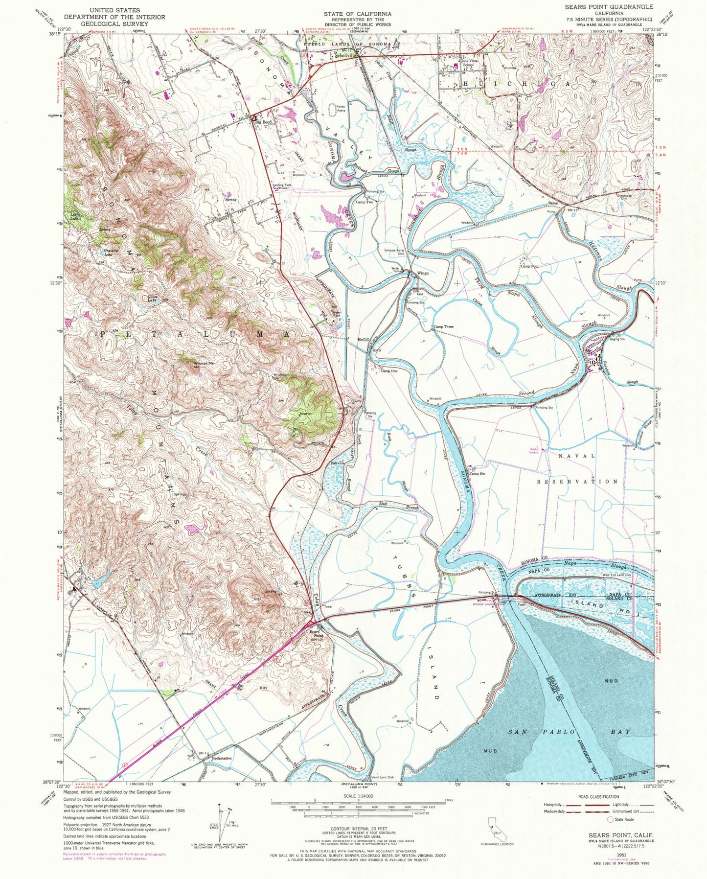
Classic USGS Sears Point California 7.5'x7.5' Topo Map
Couldn't load pickup availability
Historical USGS topographic quad map of Sears Point in the state of California. Map scale may vary for some years, but is generally around 1:24,000. Print size is approximately 24" x 27"
This quadrangle is in the following counties: Napa, Solano, Sonoma.
The map contains contour lines, roads, rivers, towns, and lakes. Printed on high-quality waterproof paper with UV fade-resistant inks, and shipped rolled.
Contains the following named places: Arroyo Seco, Big Bend, Bush Slough, Camp Four, Camp One, Camp Six, Camp Three, Camp Two, China Slough, Cline Cellars Winery, East Branch, Embarcadero, Fairville, Fairville Quarry, Fowler Creek, Gloria Ferrer Winery, Goose Lake, Gravelly Lake, Greenwood, Homewood Winery, Infineon Raceway, Island Land Club, Lee Lake, McGill, Naval Supply Detachment Monterey, North Branch, Railroad Slough, Rainbow Slough, Ramal, Reclamation, Roche Winery, Rodgers Creek, Rose School, San Pablo Bay National Wildlife Refuge, Schell - Vista Fire Protection District Station 1 Headquarters, Schell Creek, Schell Slough, Schellville, Sears Point, Second Napa Slough, Shellville Colony, Skaggs Island, Sleepy Hollow 2 426 Dam, Sleepy Hollow Ranch, Sonoma Creek, Sonoma Creek Winery, Sonoma Valley, Sonoma Valley Airport, Sonoma Valley Club, Steamboat Slough, Sweetwater Club, Third Napa Slough, Tubbs Island, Tule Vista School, Viansa Winery, West End Land Club, Wildcat Mountain, Wingo, ZIP Code: 95476