MyTopo
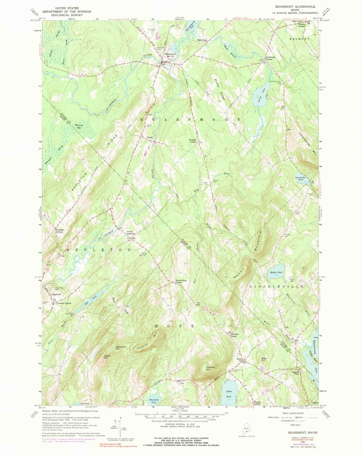
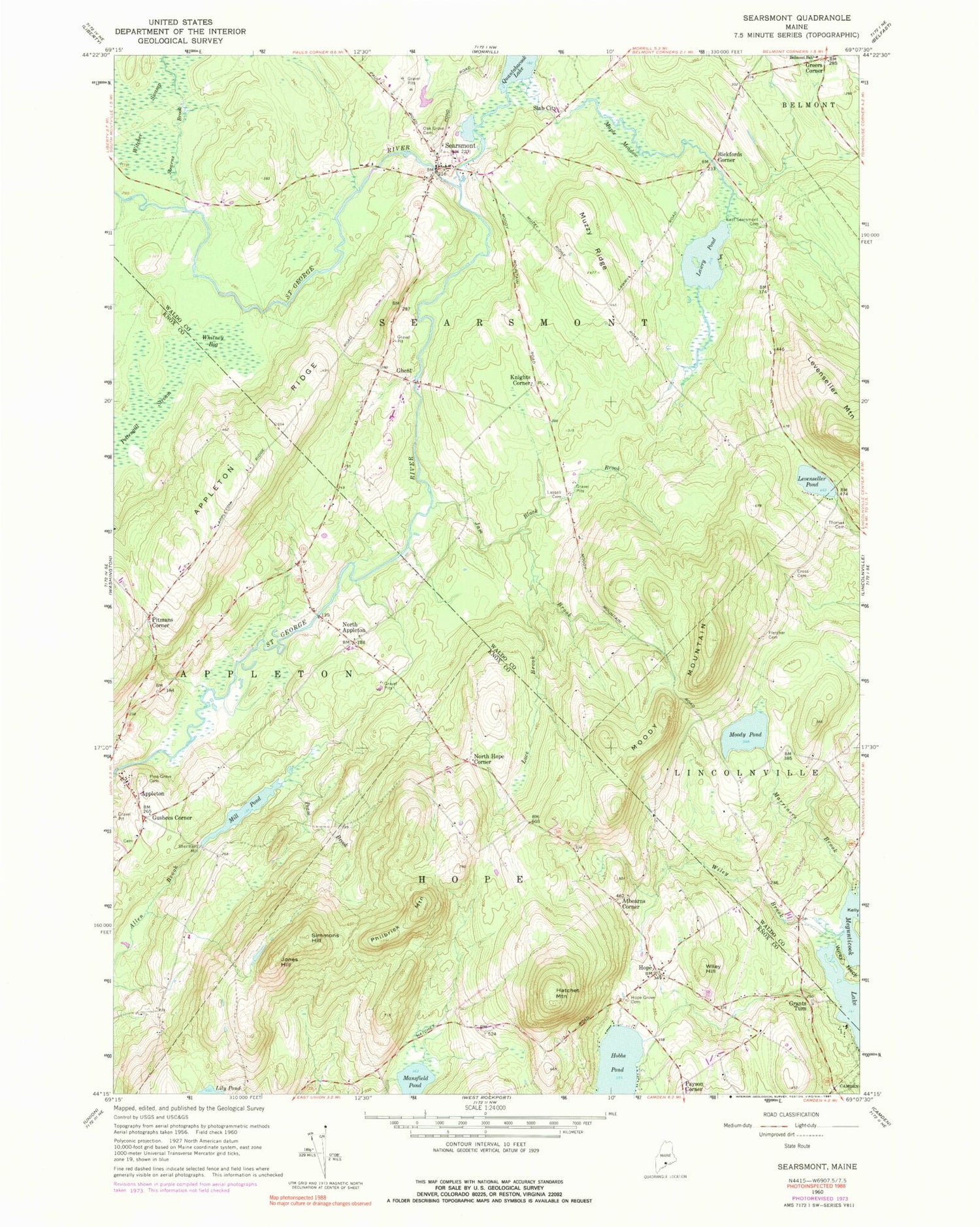
Classic USGS Searsmont Maine 7.5'x7.5' Topo Map
Couldn't load pickup availability
Historical USGS topographic quad map of Searsmont in the state of Maine. Typical map scale is 1:24,000, but may vary for certain years, if available. Print size: 24" x 27"
This quadrangle is in the following counties: Knox, Waldo.
The map contains contour lines, roads, rivers, towns, and lakes. Printed on high-quality waterproof paper with UV fade-resistant inks, and shipped rolled.
Contains the following named places: Appleton Ridge, Black Brook, Cross Cemetery, East Searsmont Cemetery, Fletcher Cemetery, Hatchet Mountain, Hope, Hope Grove Cemetery, Jam Brook, Jones Hill, Lassell Cemetery, Lawry Pond, Levenseller Pond, Luce Brook, Mansfield Pond, Maple Meadow, Marriners Brook, Mill Pond, Moody Mountain, Moody Pond, Muzzy Ridge, Oak Grove Cemetery, Pease Brook, Philbrick Mountain, Pine Grove Cemetery, Searsmont, Simmons Hill, Stearns Brook, Thomas Cemetery, Whitney Bog, Wiley Brook, Wiley Hill, Athearns Corner, Bickfords Corner, Ghent, Grants Turn, Greers Corner, Gushees Corner, Knights Corner, North Appleton, North Hope Corner, Payson Corner, Pitmans Corner, Shermans Mill, Slab City, Ben Hur Heliport, Town of Hope, Town of Searsmont, Mill Pond Dam, Robbins Mill Dam, Saint George River Reservoir, Quantabacook Lake Dam, Church of the Nazarene, Hope Community Bible Church, Highland View Field, Ridgeview Airport, Searsmont Volunteer Fire Department, Hope Volunteer Fire Department, Quaker Cemetery, Ames Elementary School, Hope Library, Searsmont Town Library, Mildred Stevens Williams Memorial Library, Searsmont Post Office