MyTopo
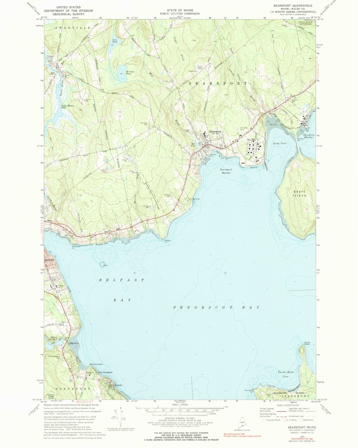
Classic USGS Searsport Maine 7.5'x7.5' Topo Map
Couldn't load pickup availability
Historical USGS topographic quad map of Searsport in the state of Maine. Typical map scale is 1:24,000, but may vary for certain years, if available. Print size: 24" x 27"
This quadrangle is in the following counties: Waldo.
The map contains contour lines, roads, rivers, towns, and lakes. Printed on high-quality waterproof paper with UV fade-resistant inks, and shipped rolled.
Contains the following named places: Bayside, Belfast Bay, Belfast Reservoir Number One, Bowditch Cemetery, Browns Head, Cain Pond, Edna Drinkwater School, East Belfast Cemetery, East Northport Cemetery, Elmwood Cemetery, Ford Chapel, Goose River, Gordon Cemetery, Kidder Point, Little River, Long Cove, Long Cove Brook, Mack Point, McClure Pond, Mill Brook, Mill Pond, Moose Point, Moose Point State Park, Morrow Brook, Mosman Park, Mount Hope Cemetery, Patterson Point, Piper Brook, Searsport, Searsport Harbor, Smart Cemetery, Spragues Beach, Turtle Head, Turtle Head Cove, Upper Mason Pond, Sears Island Ledge, East Northport, Village Cemetery, Marshall Point, Sears Island, Long Cove Ledge, Sears Island Ledge, Steels Ledge, Town of Searsport, Behind the Mill Dam, Mason Pond Dam, Little River Lower Dam, Mill Brook Dam, Mill Brook, Bud Youngs Dam, Goose River Reservoir, Central Maine Dam, Searsport Census Designated Place, Searsport Fire Department South Station, Northport Volunteer Fire Department Bluff Station, Waldo County General Hospital, Searsport Police Department, Searsport Elementary School, Searsport District Middle School and High School, Searsport District Middle School and High School, Waldo County General Hospital Marx Library, Penobscot Marine Museum Stephen Phillips Research Library, Carver Memorial Library, Searsport Post Office