MyTopo
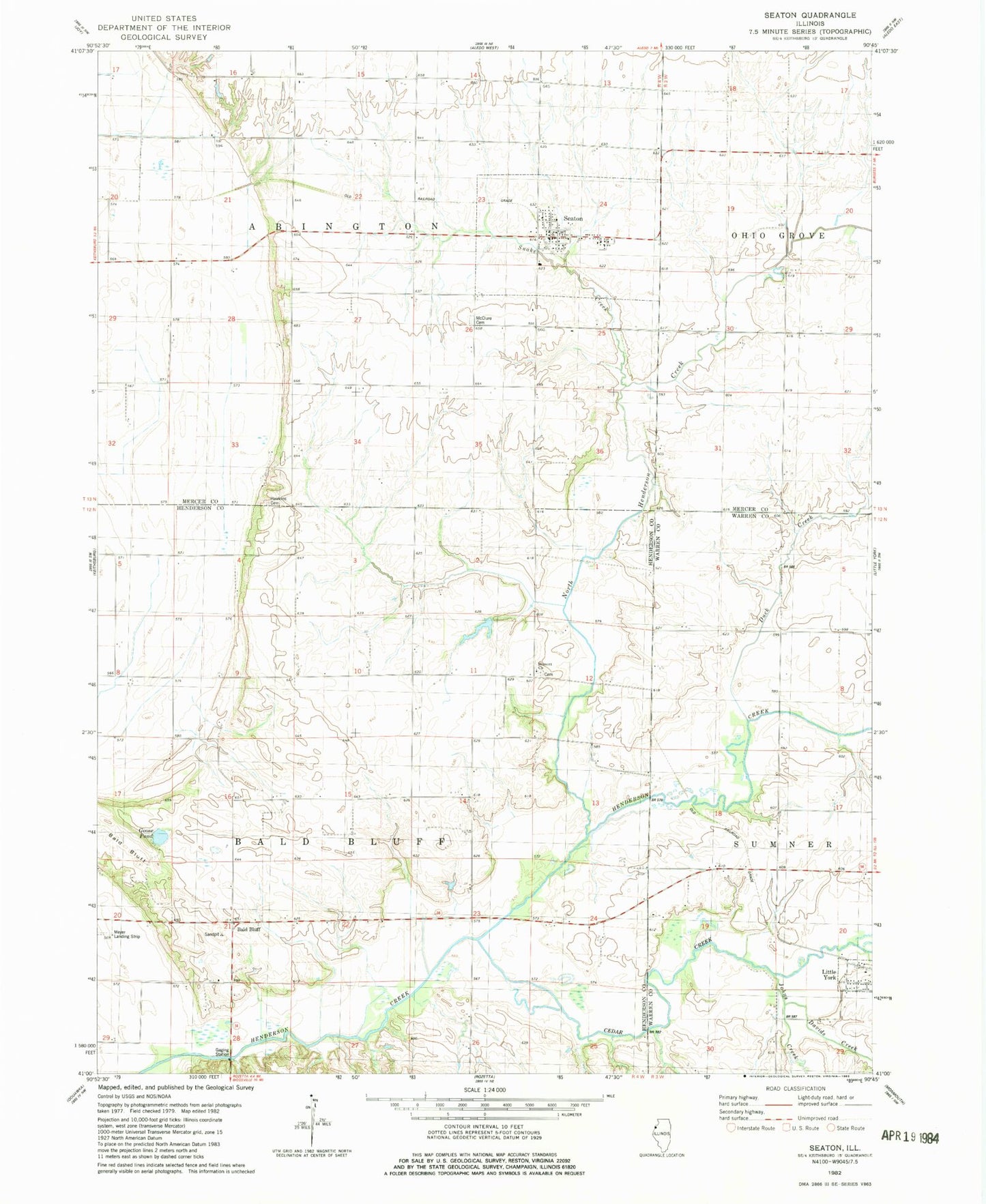
Classic USGS Seaton Illinois 7.5'x7.5' Topo Map
Couldn't load pickup availability
Historical USGS topographic quad map of Seaton in the state of Illinois. Map scale may vary for some years, but is generally around 1:24,000. Print size is approximately 24" x 27"
This quadrangle is in the following counties: Henderson, Mercer, Warren.
The map contains contour lines, roads, rivers, towns, and lakes. Printed on high-quality waterproof paper with UV fade-resistant inks, and shipped rolled.
Contains the following named places: Abington Center School, Bald Bluff, Bald Bluff School, Belmont Cemetery, Belmont Church, Belmont School, Cedar Creek, Davids Creek, Douglas School, Duck Creek, Goose Pond, Hawkins Cemetery, Johns Creek, Kissinger Lake, Kissinger Lake Dam, Mcclure Cemetery, North Henderson Creek, Scaly Point School, Seaton, Seaton Community Fire Station, Seaton Post Office, Snake Creek, Township of Abington, Township of Bald Bluff, Village of Seaton, Walnut Grove School, ZIP Codes: 61453, 61476