MyTopo
Classic USGS Sebastopol Mississippi 7.5'x7.5' Topo Map
Couldn't load pickup availability
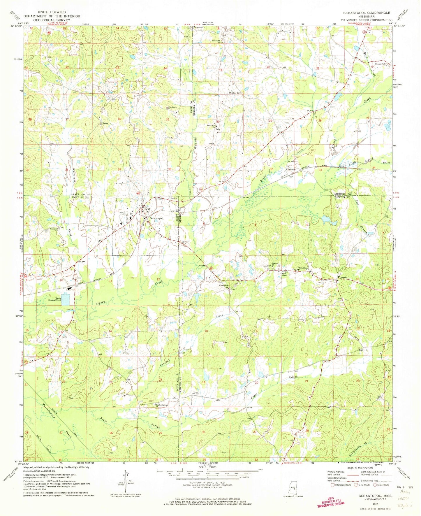
Historical USGS topographic quad map of Sebastopol in the state of Mississippi. Map scale may vary for some years, but is generally around 1:24,000. Print size is approximately 24" x 27"
This quadrangle is in the following counties: Leake, Neshoba, Newton, Scott.
The map contains contour lines, roads, rivers, towns, and lakes. Printed on high-quality waterproof paper with UV fade-resistant inks, and shipped rolled.
Contains the following named places: Bethelehem Church, Bogue Faliah, Chestnut Ridge School, Crossroad Church, Dollars Store, Don Landrum Lake Dam, Gilmers Church, Green Acre Farm Sewage Pond Dam, Greenfield, Hays, High Hill, High Hill Cemetery, High Hill Church, Hurricane Creek, Kitchener, Little Sipsey Creek, Milldale Cemetery, Moores Mill, Pine Grove Church, Pinter Creek, Pleasant Valley Church, Prospect, Prospect Church, R C Camp Lake Dam, Race Creek, Reids Chapel, Rocky Hill Church, Salem, Salem Cemetery, Salem School, Sebastopol, Sebastopol Attendance Center, Sebastopol Baptist Church, Sebastopol Post Office, Simmons Creek, Steam Mill Church, Stribbings Store, Sulphur Spring, Sulphur Springs Church, Tom Branch, Town of Sebastopol, Vance Mill, Vanzant Creek, White Plains Church, ZIP Code: 39359