MyTopo
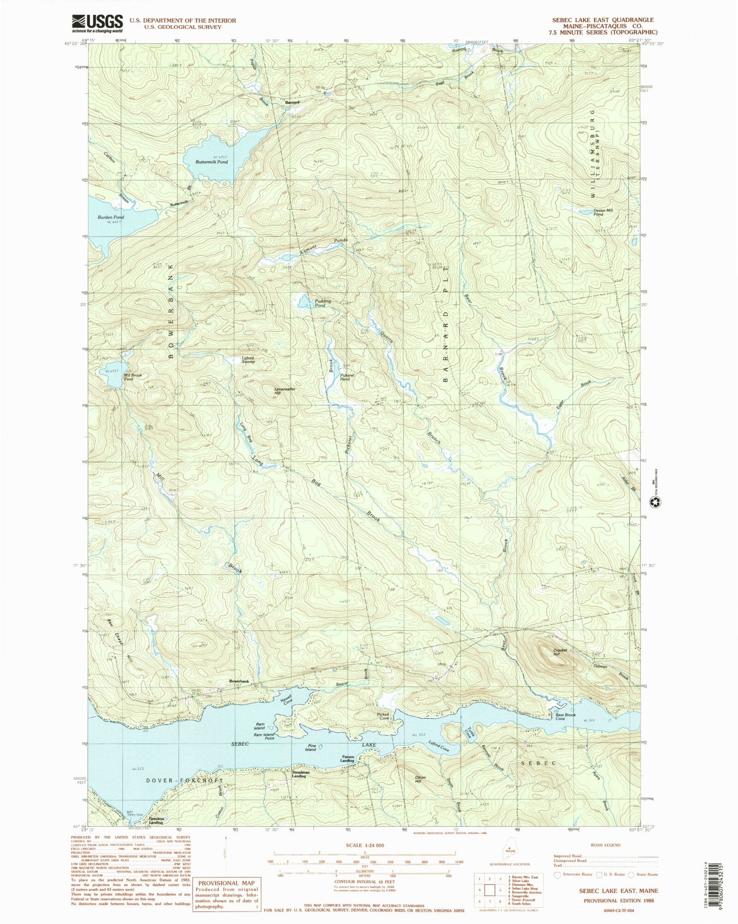
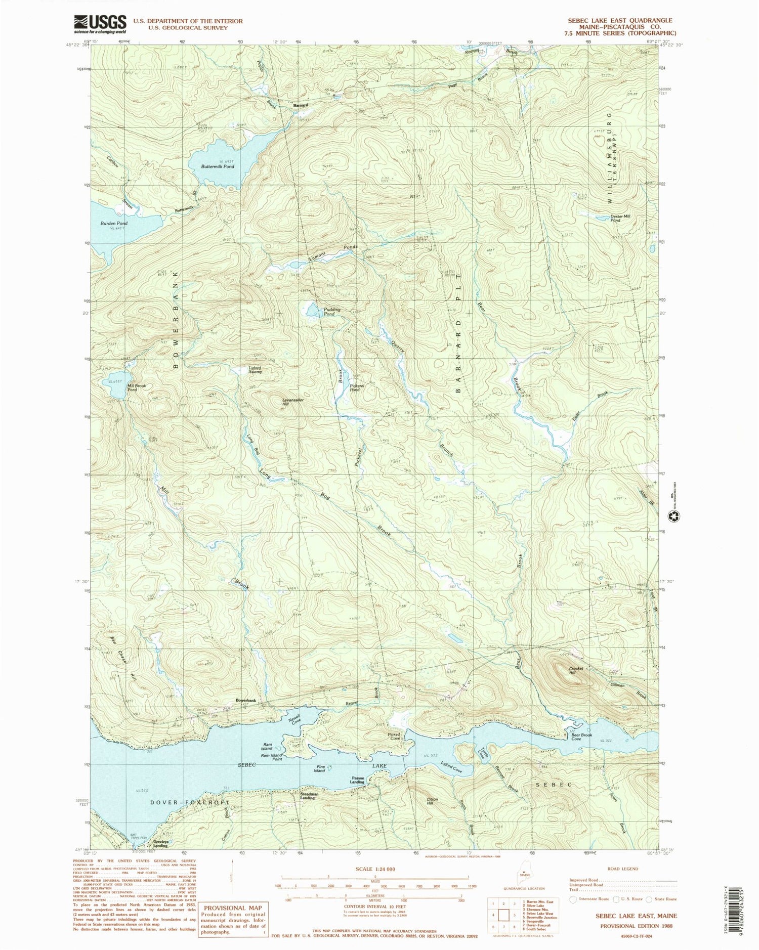
Classic USGS Sebec Lake East Maine 7.5'x7.5' Topo Map
Couldn't load pickup availability
Historical USGS topographic quad map of Sebec Lake East in the state of Maine. Typical map scale is 1:24,000, but may vary for certain years, if available. Print size: 24" x 27"
This quadrangle is in the following counties: Piscataquis.
The map contains contour lines, roads, rivers, towns, and lakes. Printed on high-quality waterproof paper with UV fade-resistant inks, and shipped rolled.
Contains the following named places: Ayers Brook, Bear Brook, Bear Brook Cove, Beaver Brook, Bennett Brook, Bog Brook, Burden Pond, Buttermilk Pond, Caribou Stream, Citron Hill, Cotton Brook, Crocket Hill, Dexter Mill Pond, Essler Brook, Lamont Ponds, Levansaller Hill, Long Bog, Long Bog Brook, Lyford Cove, Lyford Swamp, Mill Brook, Mill Brook Pond, Newell Cove, Northwest Ridge Road, Picked Cove, Pickerel Brook, Pickerel Pond, Pine Island, Poplar Brook, Pudding Pond, Quarry Brook, Ram Island, Ram Island Point, Smith Brook, Turtle Cove, Barnard, Bowerbank, Greeleys Landing, Parson Landing, Steadman Landing, State of Maine, Plantation of Barnard, Bowerbank Community Cemetery, Bowerbank Fire Department