
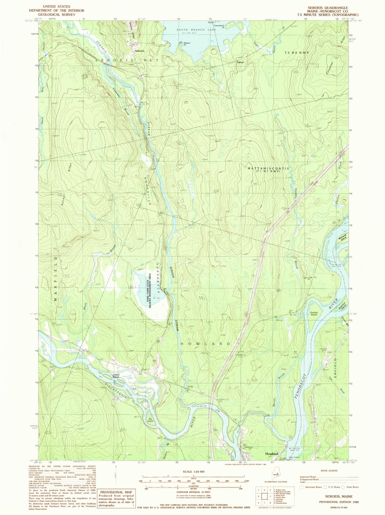
MyTopo
Classic USGS Seboeis Maine 7.5'x7.5' Topo Map
Couldn't load pickup availability
Historical USGS topographic quad map of Seboeis in the state of Maine. Typical map scale is 1:24,000, but may vary for certain years, if available. Print size: 24" x 27"
This quadrangle is in the following counties: Penobscot.
The map contains contour lines, roads, rivers, towns, and lakes. Printed on high-quality waterproof paper with UV fade-resistant inks, and shipped rolled.
Contains the following named places: Barnes Brook, Beatham Island, Carpenter Ridge, Chesley Brook, Contrary Brook, Doe Island, Gordon Brook, Gordon Island, Hoytville Horseback, Lowell Island, Maxy Brook, Meadow Brook, Merrill Brook, Mohawk Island, Nason Point, Randall Ridge, Seboeis, Seboeis Stream, Tate Brook, Townsend Point, West Enfield Dam, Big Island, Pond Farm State Wildlife Management Area, Gilford, Town of Howland, Penobscot River Reservoir, Pond Farm Pond Dam, Pond Farm Pond, Mattamiscontis Township, Howland Census Designated Place, Seboeis Plantation Volunteer Fire Department


