MyTopo
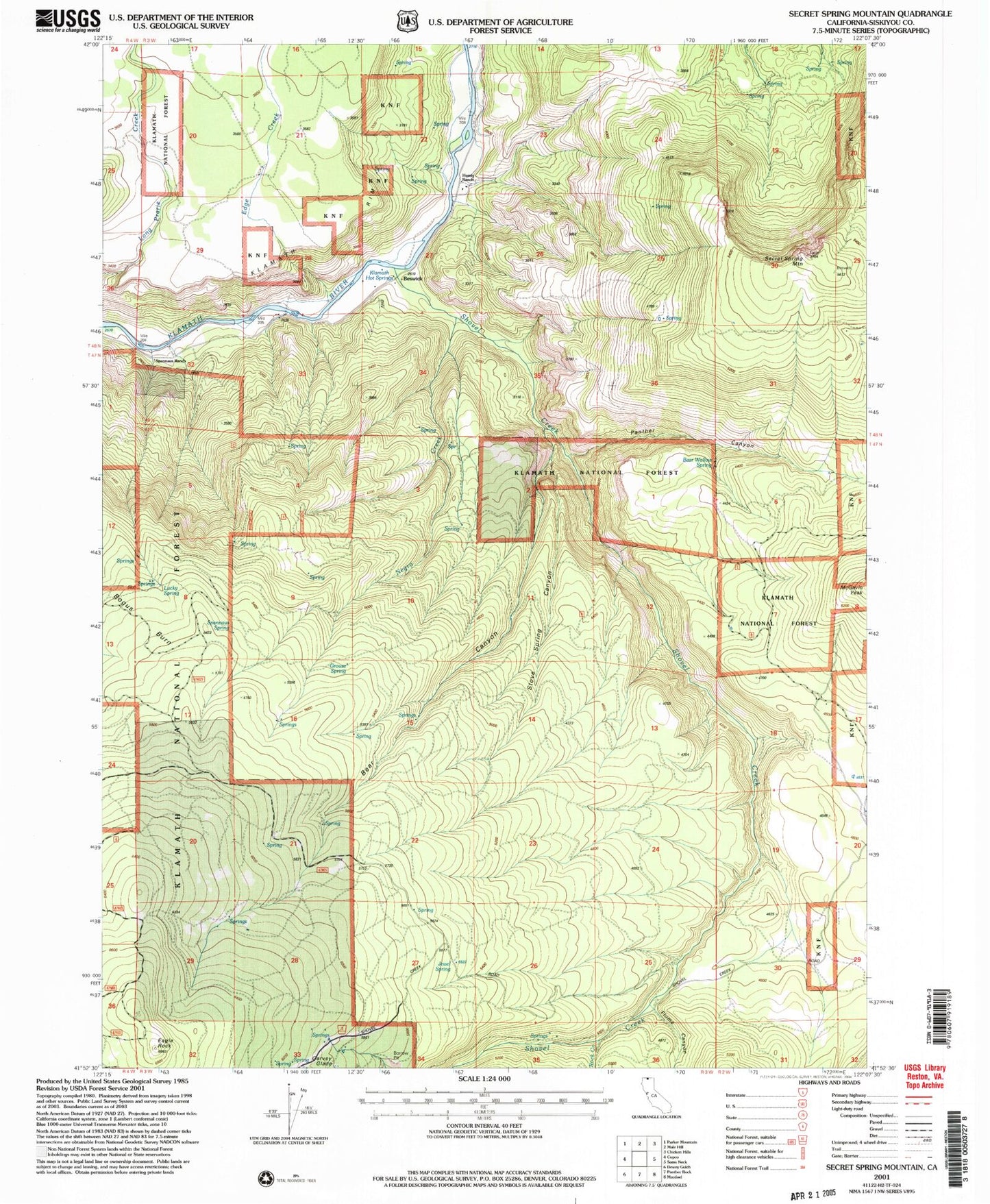
Classic USGS Secret Spring Mountain California 7.5'x7.5' Topo Map
Couldn't load pickup availability
Historical USGS topographic quad map of Secret Spring Mountain in the state of California. Map scale may vary for some years, but is generally around 1:24,000. Print size is approximately 24" x 27"
This quadrangle is in the following counties: Siskiyou.
The map contains contour lines, roads, rivers, towns, and lakes. Printed on high-quality waterproof paper with UV fade-resistant inks, and shipped rolled.
Contains the following named places: Bear Canyon, Bear Canyon Campground, Bear Canyon Ranger Station, Bear Wallow Spring, Beswick, Eagle Rock, Edge Creek, Flume Canyon, Grouse Spring, Hessig Ranch, Jewel Spring, Klamath Hot Springs, Lower Crossing, Lucky Spring, McGavin Peak, Negro Creek Canyon, Oak Grove School, Panther Canyon, Rock Creek, Secret Spring Mountain, Shovel Creek, Shovel Creek Guard Station, Spannaus Ranch, Spannaus Spring, Stove Spring Canyon, Upper Crossing