MyTopo
Classic USGS Sedalia West Missouri 7.5'x7.5' Topo Map
Couldn't load pickup availability
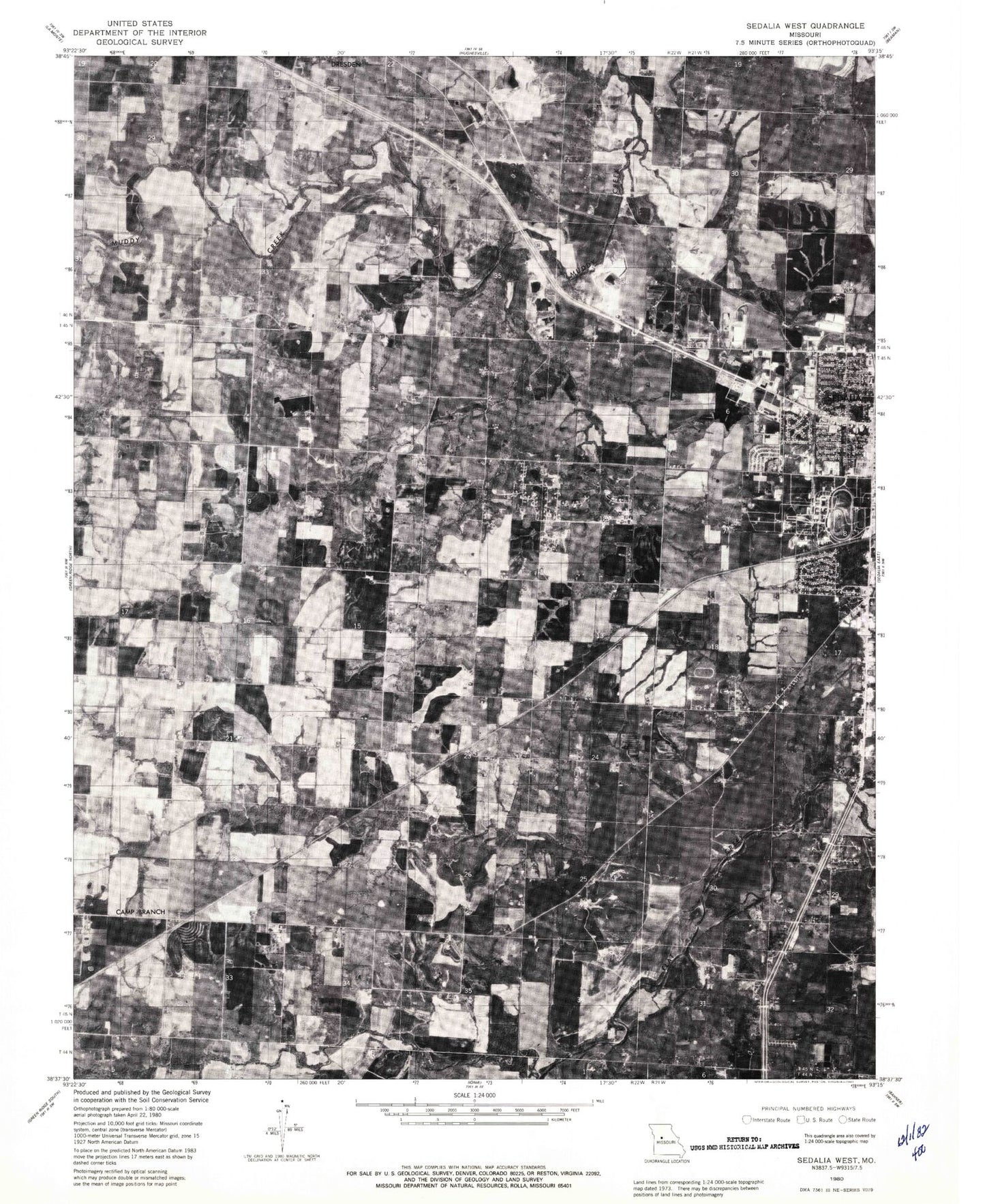
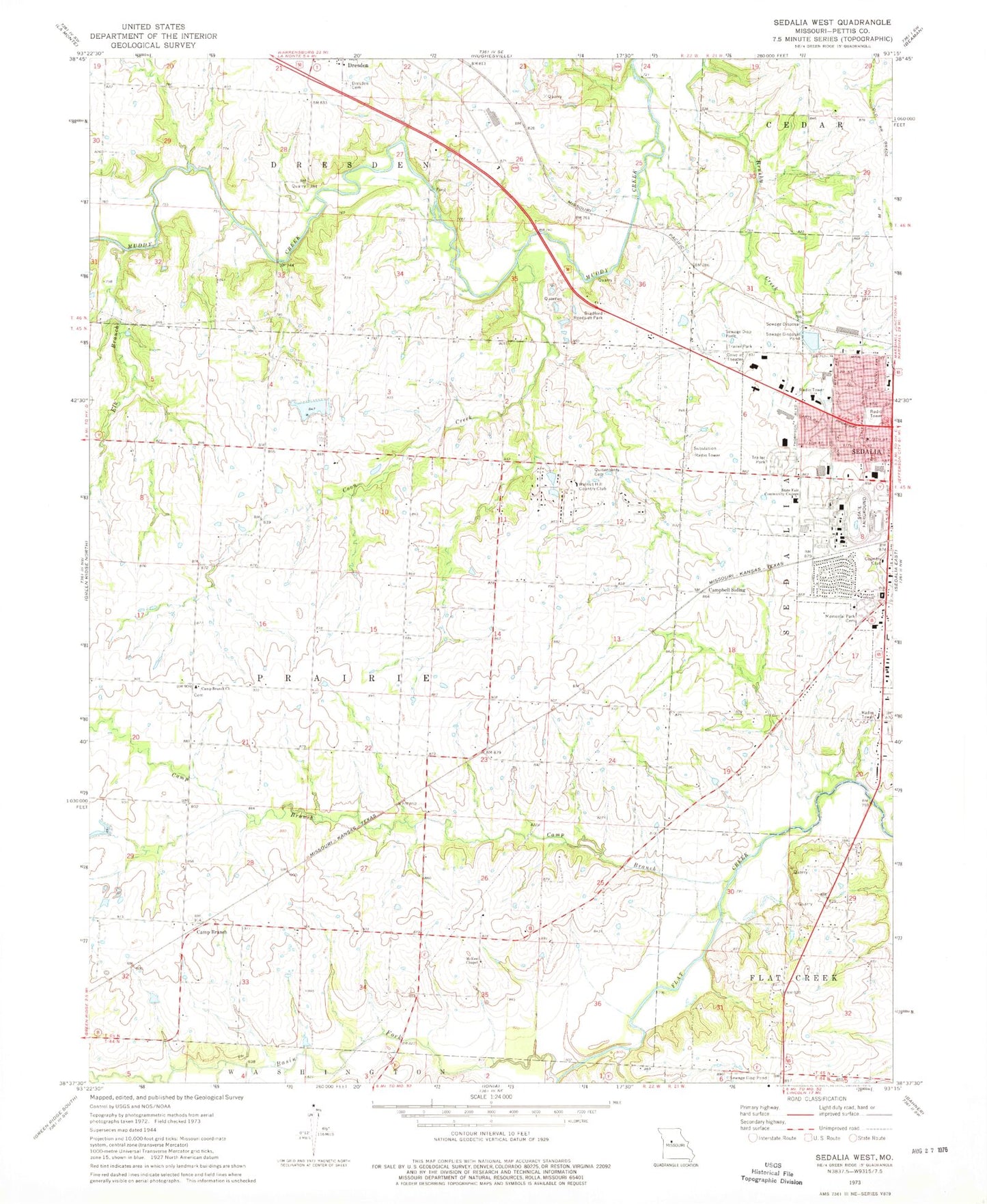
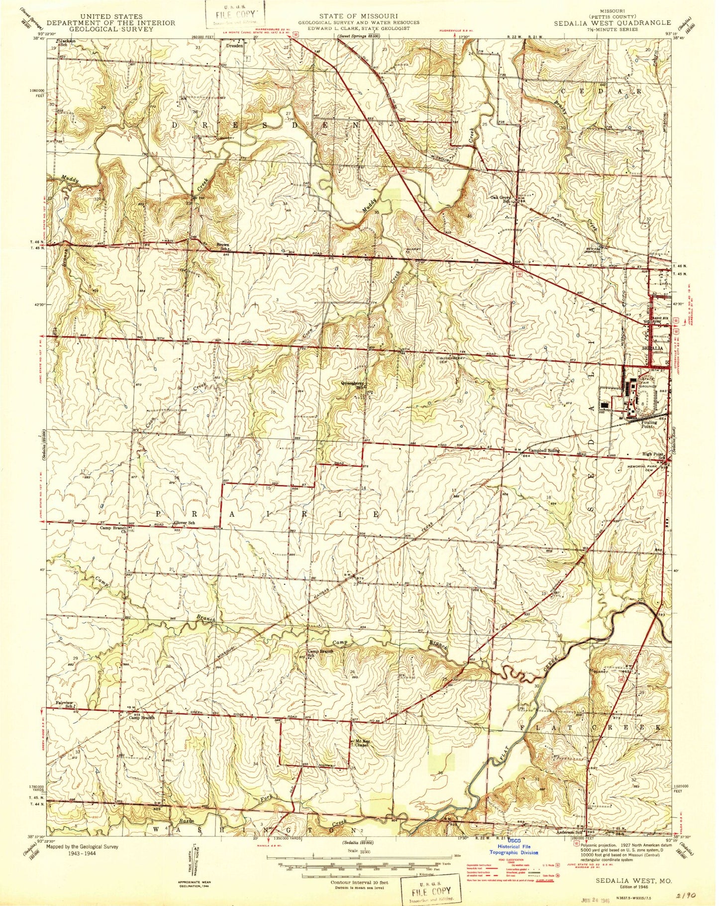
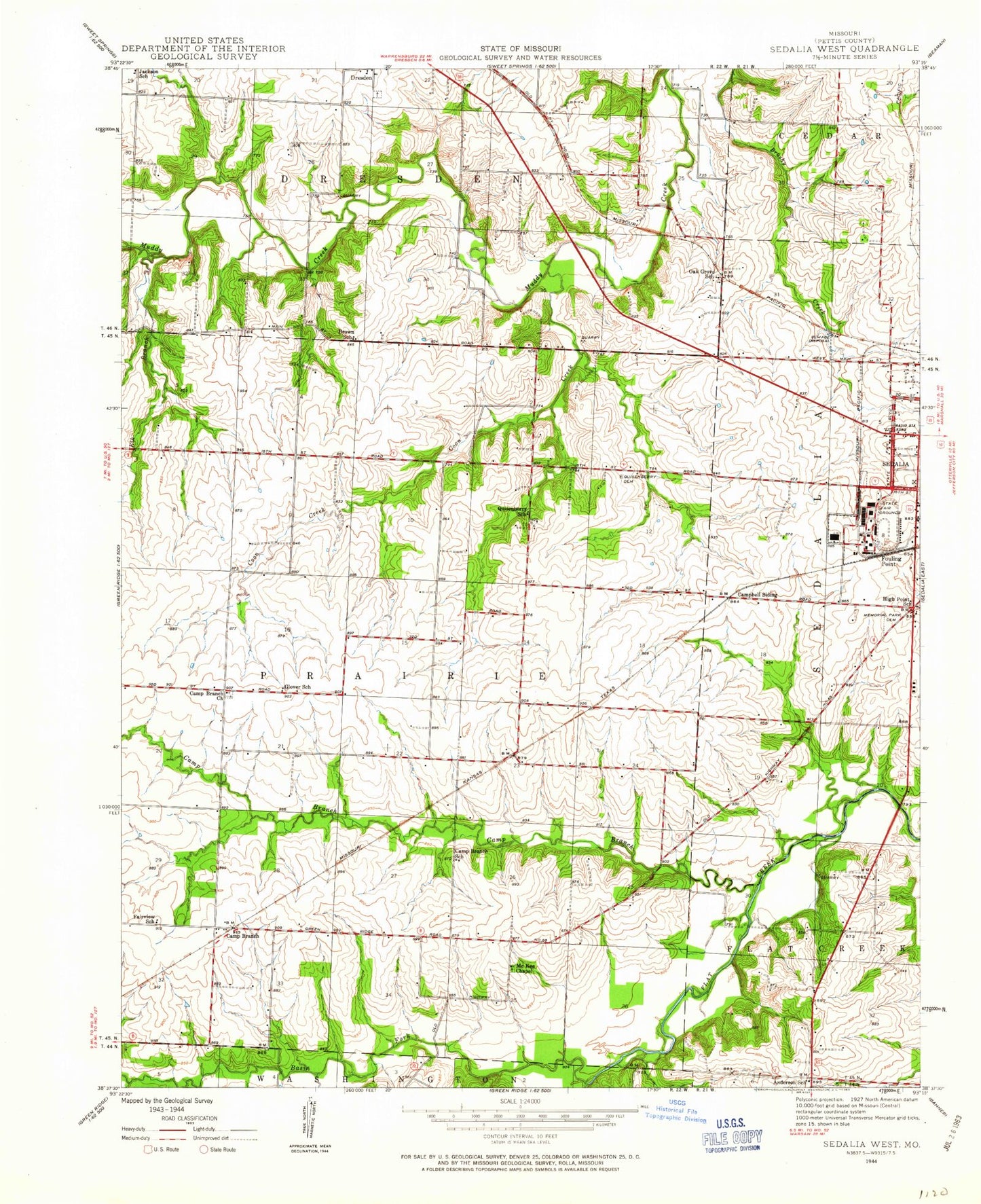
Historical USGS topographic quad map of Sedalia West in the state of Missouri. Map scale may vary for some years, but is generally around 1:24,000. Print size is approximately 24" x 27"
This quadrangle is in the following counties: Pettis.
The map contains contour lines, roads, rivers, towns, and lakes. Printed on high-quality waterproof paper with UV fade-resistant inks, and shipped rolled.
Contains the following named places: Anderson School, Basin Fork, Bradford Roadside Park, Brown School, Camp Branch, Camp Branch Church, Camp Branch School, Campbell Siding, Coon Creek, Department of Conservation Kansas City Regional Field Fire Office Sedalia, Dresden Cemetery, E W Thompson School for the Handicapped, Elk Branch, Glover School, High Point School, Homan Field, KDRO-AM (Sedalia), KMOS-TV (Sedalia), Lake Lucille, McKee Chapel, Memorial Park Cemetery, Oak Grove School, Parkhurst Lake Dam, Pettis County, Pettis County Elementary School, Pettis County Fire Protection District Station 1, Quisenberry Cemetery, Quisenberry School, Sedalia Fire Department Headquarters Station, Skyline Elementary School, State Fair Community College, State Fair Shopping Center, State Fairground Racetrack, Thompson Hills Shopping Center, Township of Prairie, Van Natta School, Walnut Hill Country Club