MyTopo
Classic USGS Sedgwick Kansas 7.5'x7.5' Topo Map
Couldn't load pickup availability
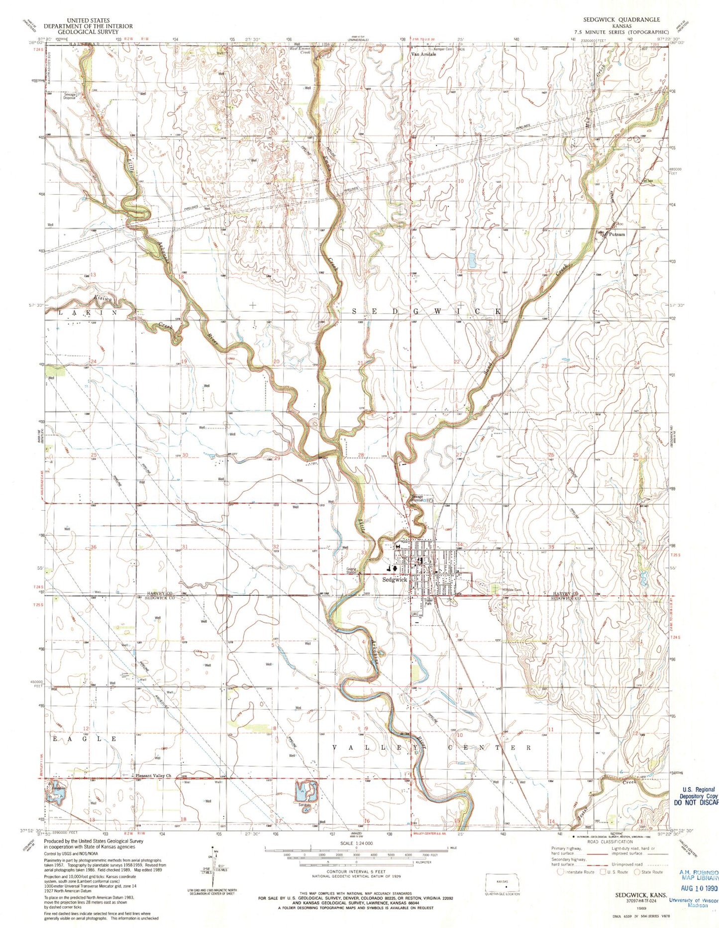
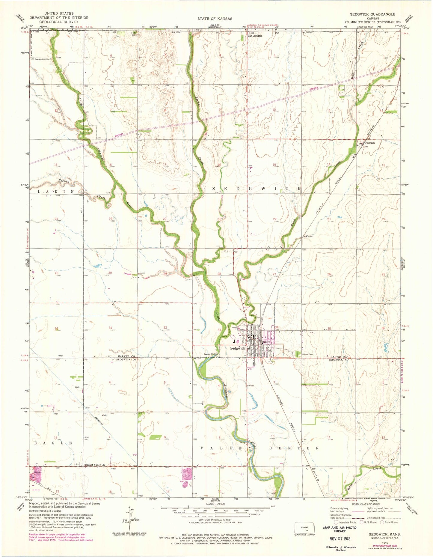
Historical USGS topographic quad map of Sedgwick in the state of Kansas. Map scale may vary for some years, but is generally around 1:24,000. Print size is approximately 24" x 27"
This quadrangle is in the following counties: Harvey, Sedgwick.
The map contains contour lines, roads, rivers, towns, and lakes. Printed on high-quality waterproof paper with UV fade-resistant inks, and shipped rolled.
Contains the following named places: City of Sedgwick, City of Sedgwick Volunteer Ambulance Department, East Emma Creek, Emma Creek, First Christian Church, Halstead Wastewater Treatment Facility, Hillside Cemetery, Kisiwa Creek, Lillian Tear Library, McKinley Mobile Home Park, Mud Creek, Pleasant Valley Cemetery, Pleasant Valley Church, Plymouth Congregational Church, Putnam, R L Wright Elementary School, Sand Creek, Sedgwick, Sedgwick City Hall, Sedgwick Community Center, Sedgwick Elementary School, Sedgwick High School, Sedgwick Industrial Park, Sedgwick Police Department, Sedgwick Post Office, Sedgwick Recreation Center, Sedgwick Senior Center, Sedgwick United Methodist Church, Sedgwick Volunteer Fire Department, Sedgwick Wastewater Treatment Plant, Sooter Airport, Township of Sedgwick, Van Arsdale, West Emma Creek, ZIP Code: 67135