MyTopo
Classic USGS Seekseequa Junction Oregon 7.5'x7.5' Topo Map
Regular price
$16.95
Regular price
Sale price
$16.95
Unit price
per
Couldn't load pickup availability
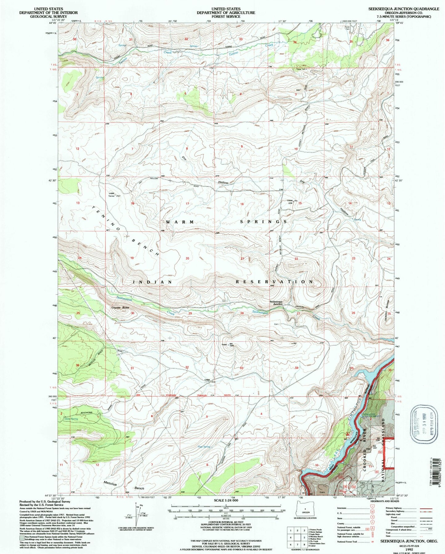
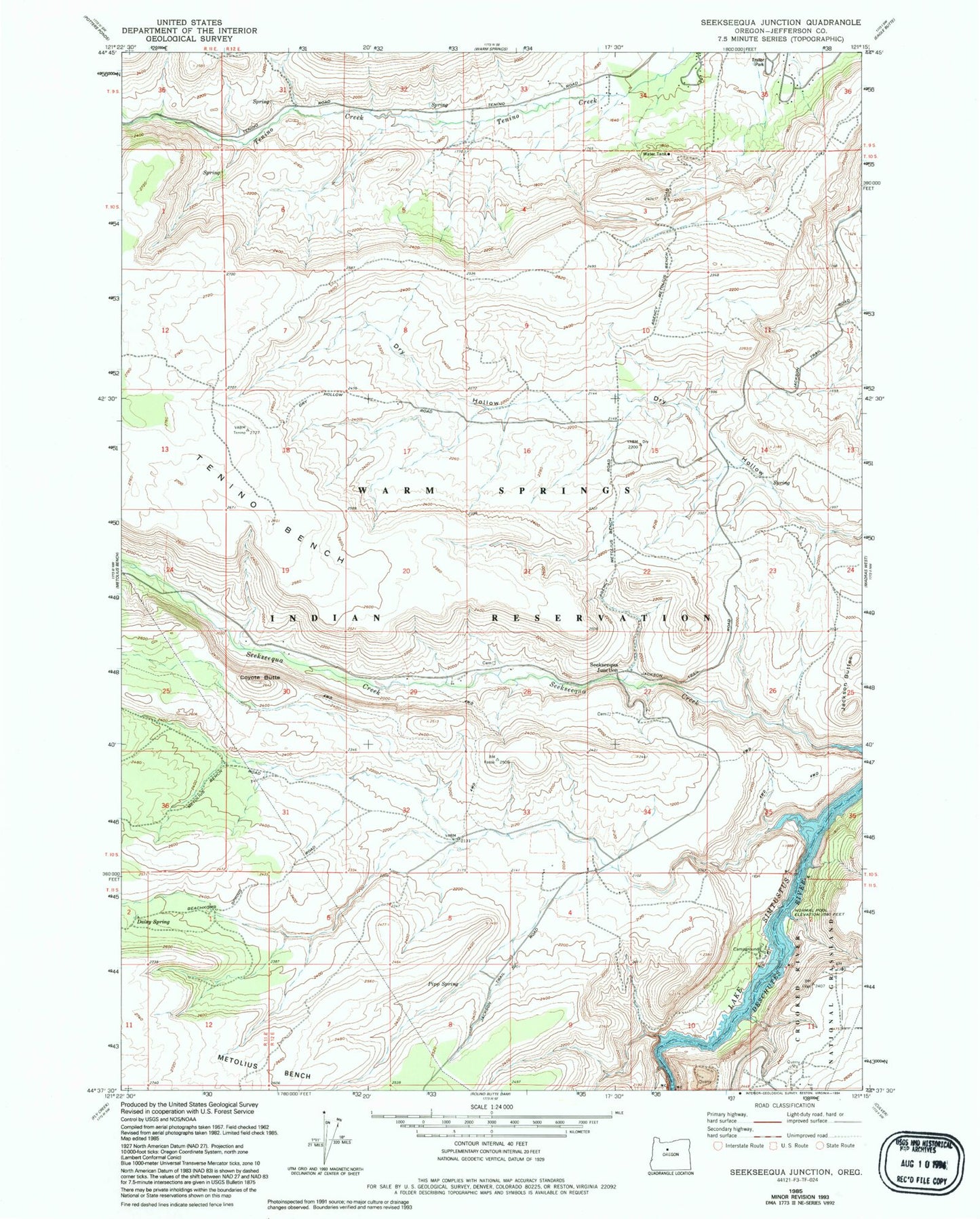
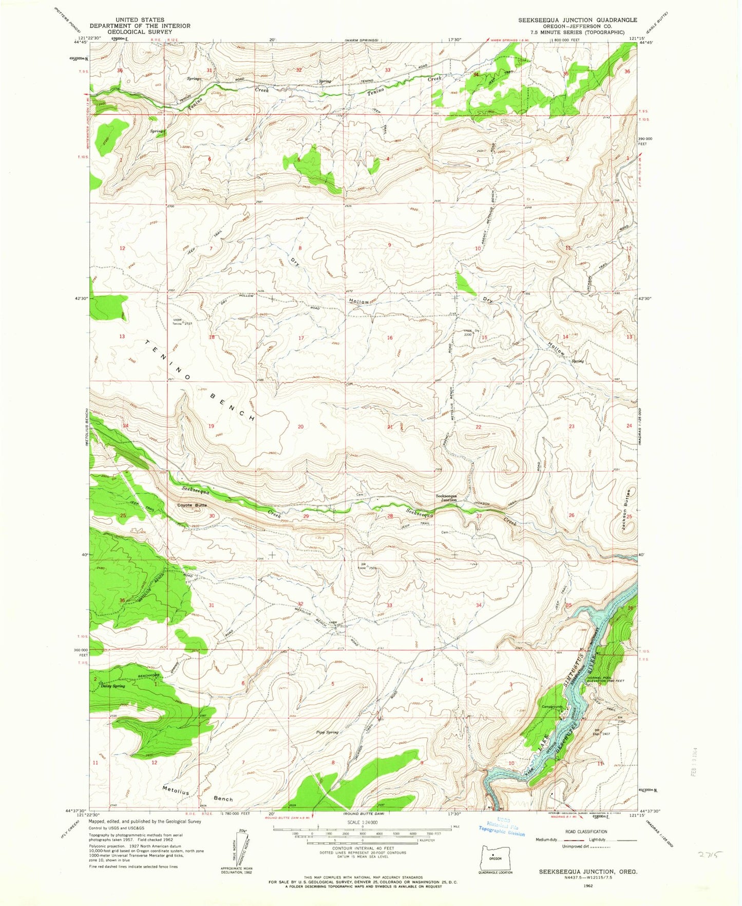
Historical USGS topographic quad map of Seekseequa Junction in the state of Oregon. Map scale may vary for some years, but is generally around 1:24,000. Print size is approximately 24" x 27"
This quadrangle is in the following counties: Jefferson.
The map contains contour lines, roads, rivers, towns, and lakes. Printed on high-quality waterproof paper with UV fade-resistant inks, and shipped rolled.
Contains the following named places: Box Canyon, Coyote Butte, Daisy Spring, Indian Park Boat Launch, Jackson Buttes, Pipp Spring, Seekseequa Cemetery - 1, Seekseequa Cemetery - 2, Seekseequa Junction, South Fork Seekseequa Creek, Tenino Bench