MyTopo
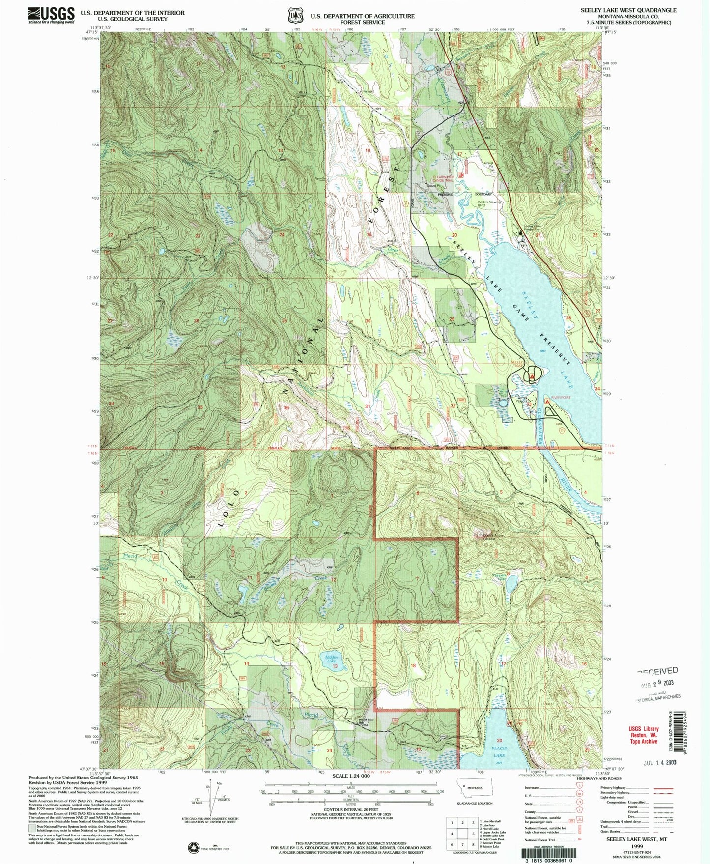
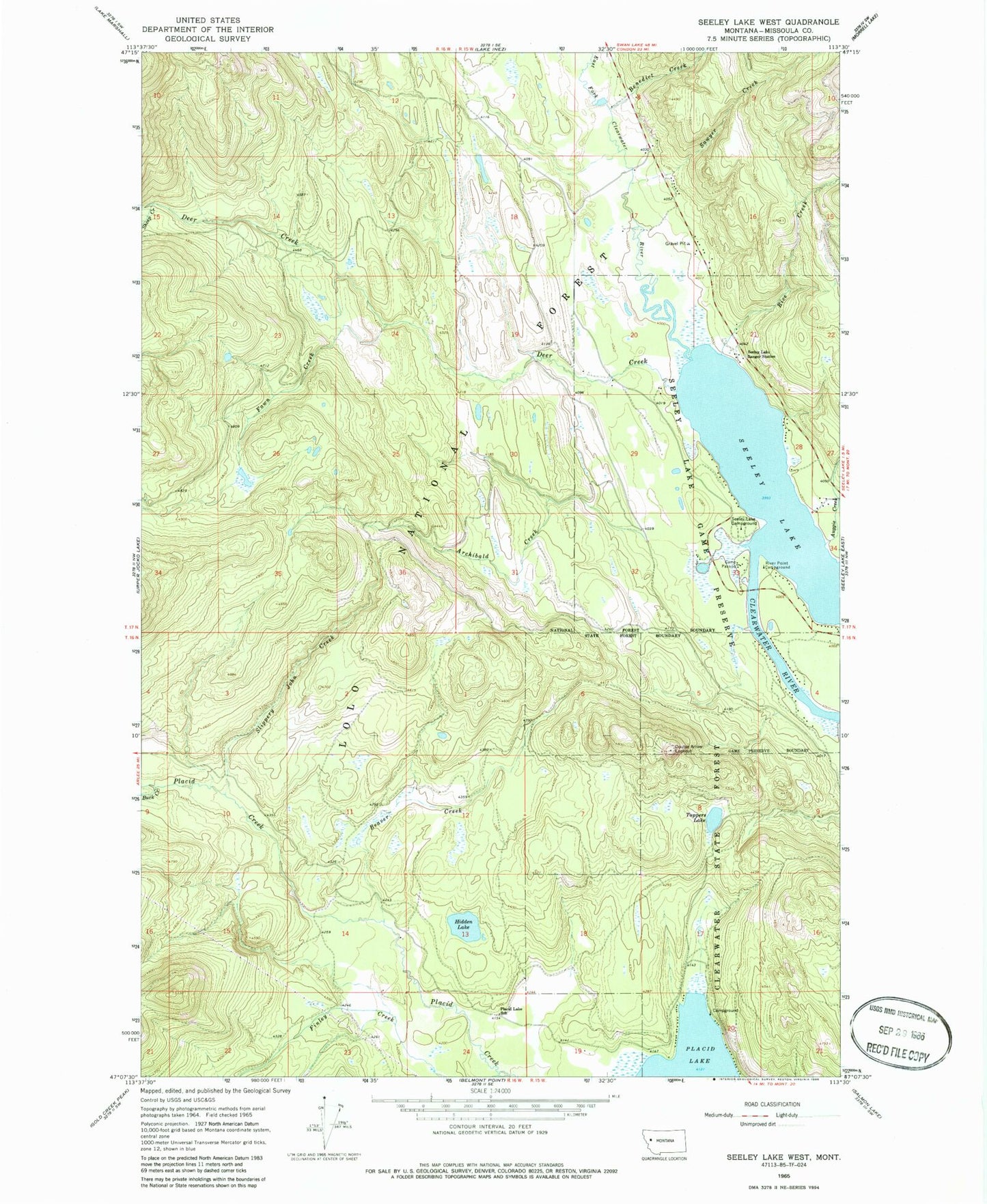
Classic USGS Seeley Lake West Montana 7.5'x7.5' Topo Map
Couldn't load pickup availability
Historical USGS topographic quad map of Seeley Lake West in the state of Montana. Map scale may vary for some years, but is generally around 1:24,000. Print size is approximately 24" x 27"
This quadrangle is in the following counties: Missoula.
The map contains contour lines, roads, rivers, towns, and lakes. Printed on high-quality waterproof paper with UV fade-resistant inks, and shipped rolled.
Contains the following named places: 16N16W14DDCC01 Well, 16N16W24AABA01 Well, 16N19W11BACB01 Well, 17N15W08DBDB01 Well, 17N15W16CCBB01 Well, 17N15W17ABBC01 Well, 17N15W17ADCC01 Well, 17N15W17BBCD01 Well, 17N15W17BCAC01 Well, 17N15W17BDBA01 Well, 17N15W20BBAD01 Well, 17N15W28BACA01 Well, 17N15W33BABA01 Well, 17N15W34CCCC01 Well, 59868, Archibald Creek, Auggie Creek, Beaver Creek, Benedict Creek, Buck Creek, Camp Paxson, Deer Creek, Double Arrow Lookout, Fawn Creek, Finley Creek, Hidden Lake, Placid Lake Campground, Placid Lake Recreation Site, Placid Lake School, Placid Lake State Park, Rice Creek, River Point Campground, Sawyer Creek, Seeley Lake, Seeley Lake Campground, Seeley Lake Game Preserve, Seeley Lake Ranger Station, Seeley Lake-Blackfoot Valley Division, Sheep Creek, Slippery John Creek, Tamaracks Resort, Tuppers Lake