MyTopo
Classic USGS Seepage Mountain Arizona 7.5'x7.5' Topo Map
Couldn't load pickup availability
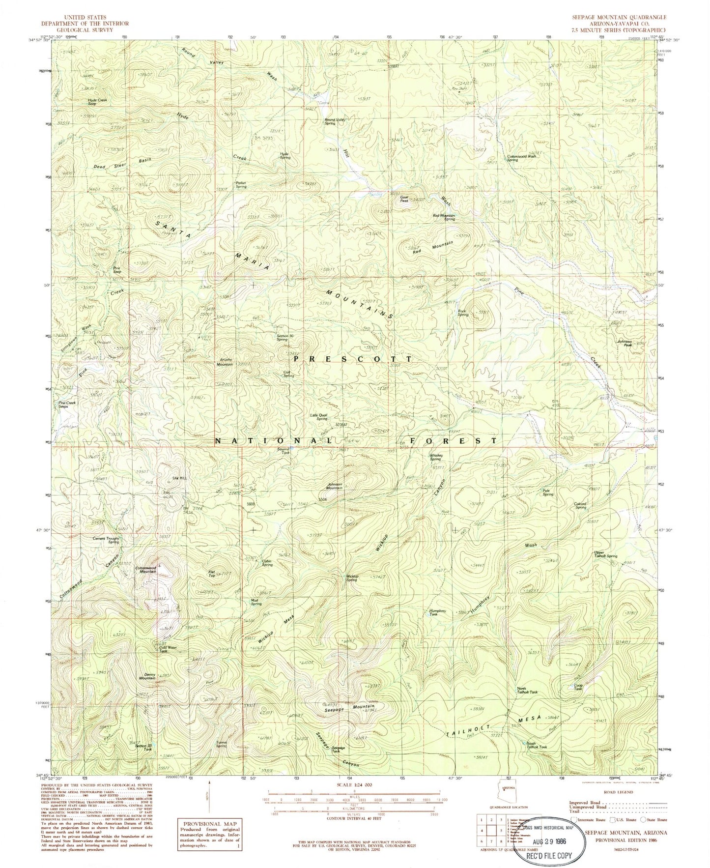
Historical USGS topographic quad map of Seepage Mountain in the state of Arizona. Map scale may vary for some years, but is generally around 1:24,000. Print size is approximately 24" x 27"
This quadrangle is in the following counties: Yavapai.
The map contains contour lines, roads, rivers, towns, and lakes. Printed on high-quality waterproof paper with UV fade-resistant inks, and shipped rolled.
Contains the following named places: Brushy Mountain, Brushy Tank, Cabin Spring, Cement Trough Spring, Colcord Spring, Cold Water Tank, Coop Tank, Cottonwood Mountain, Cottonwood Wash Spring, Cross U Ranch, Dead Steer Basin, Denny Mountain, Flat Top, Goat Peak, Hitt Wash Well, Humphrey Tank, Hyde Creek, Hyde Creek Seep, Hyde Spring, Johnson Mountain, Johnson Peak, Kckel Spring, Little Pine Creek Well, Little Quail Spring, Mud Spring, North Tailholt Tank, Oak Spring, Parker Spring, Pine Creek Seeps, Pine Seep, Pole Spring, Prescott National Forest, Red Mountain, Red Mountain Spring, Rock Spring, Round Valley Spring, Round Valley Wash, Sawmill Tank, Section Thirty Spring, Section Twenty-three Tank, Seepage Mountain, Seepage Tank, South Tailholt Tank, Stringtown Wash, Tailholt Mesa, Tunnel Spring, Upper Tailholt Spring, West Sedona Elementary School, Whiskey Spring, Wickiup Canyon, Wickiup Mesa, Wickiup Pit Tank, Wickiup Spring, Williamson Valley Tank, Windy Ridge Spring