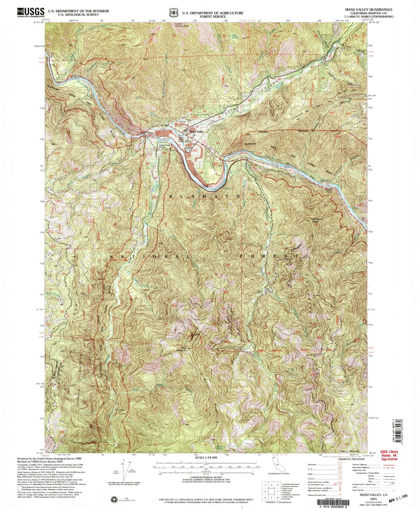
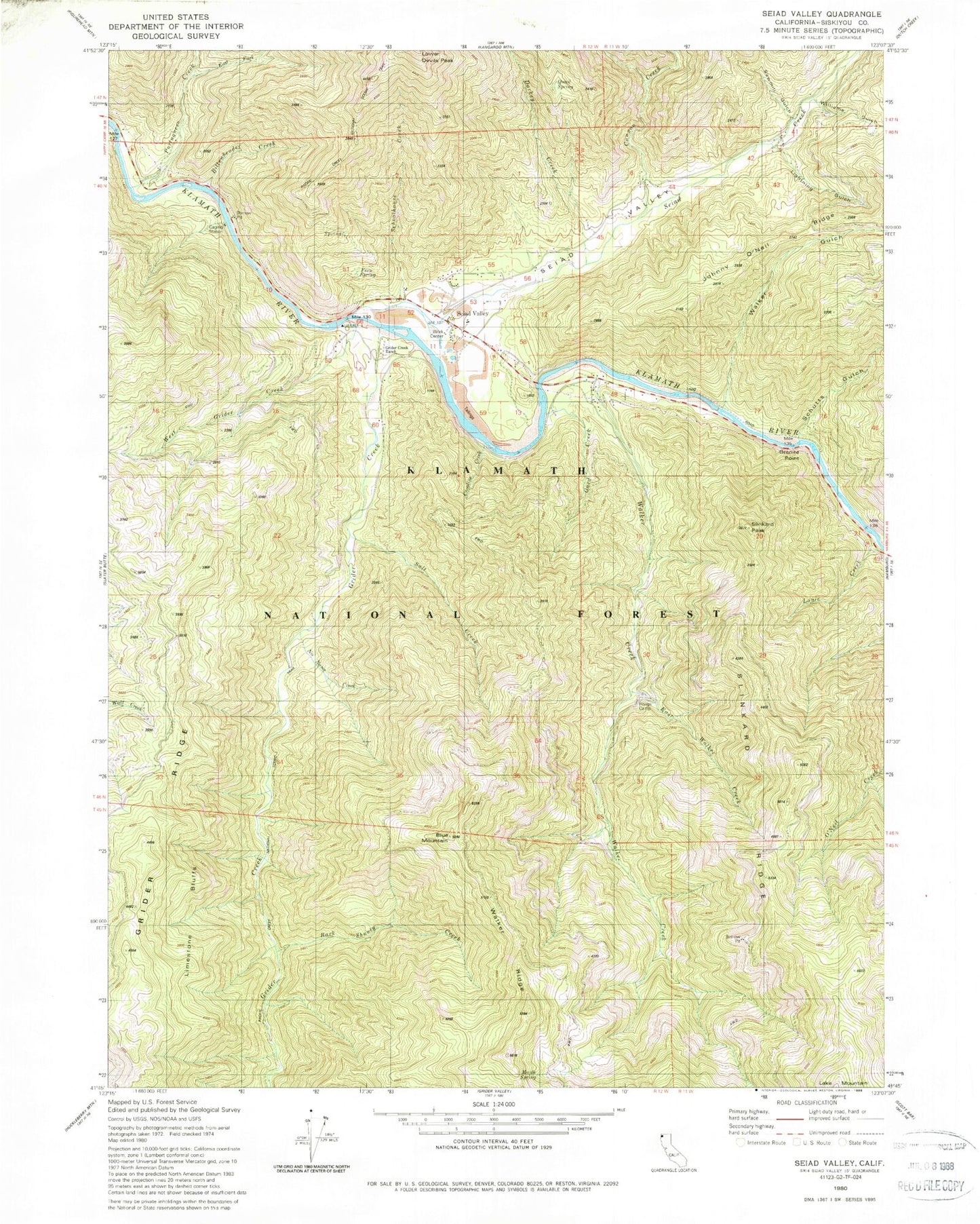
MyTopo
Classic USGS Seiad Valley California 7.5'x7.5' Topo Map
Couldn't load pickup availability
Historical USGS topographic quad map of Seiad Valley in the state of California. Map scale may vary for some years, but is generally around 1:24,000. Print size is approximately 24" x 27"
This quadrangle is in the following counties: Siskiyou.
The map contains contour lines, roads, rivers, towns, and lakes. Printed on high-quality waterproof paper with UV fade-resistant inks, and shipped rolled.
Contains the following named places: Bark Shanty Creek, Bittenbender Creek, Blue Mountain, Canyon Creek, Caroline Creek, Darkey Creek, East Fork Portuguese Creek, East Walker Creek, Fern Spring, Gard Creek, Granite Point, Grider Creek, Grider Creek Ranch, Grider Ridge, Hoags Camp, Lightning Gulch, Limestone Bluffs, Louie Creek, Lowden School, Maple Spring, Maple Spring Camp, No Name Creek, Portuguese Creek, Quail Spring, Rocky Bar Campground, Salt Creek, Sawmill Gulch, Schoolhouse Creek, Schutts Gulch, Seiad Creek, Seiad Elementary School, Seiad Oaks Administration Site, Seiad Valley, Seiad Valley Post Office, Seiad Valley Volunteer Fire Department, Seiad Work Center, Slinkard Peak, Slinkard Ridge, Walker Creek, Walker Gulch, Walker Ridge, West Grider Creek, Williams Gulch