MyTopo
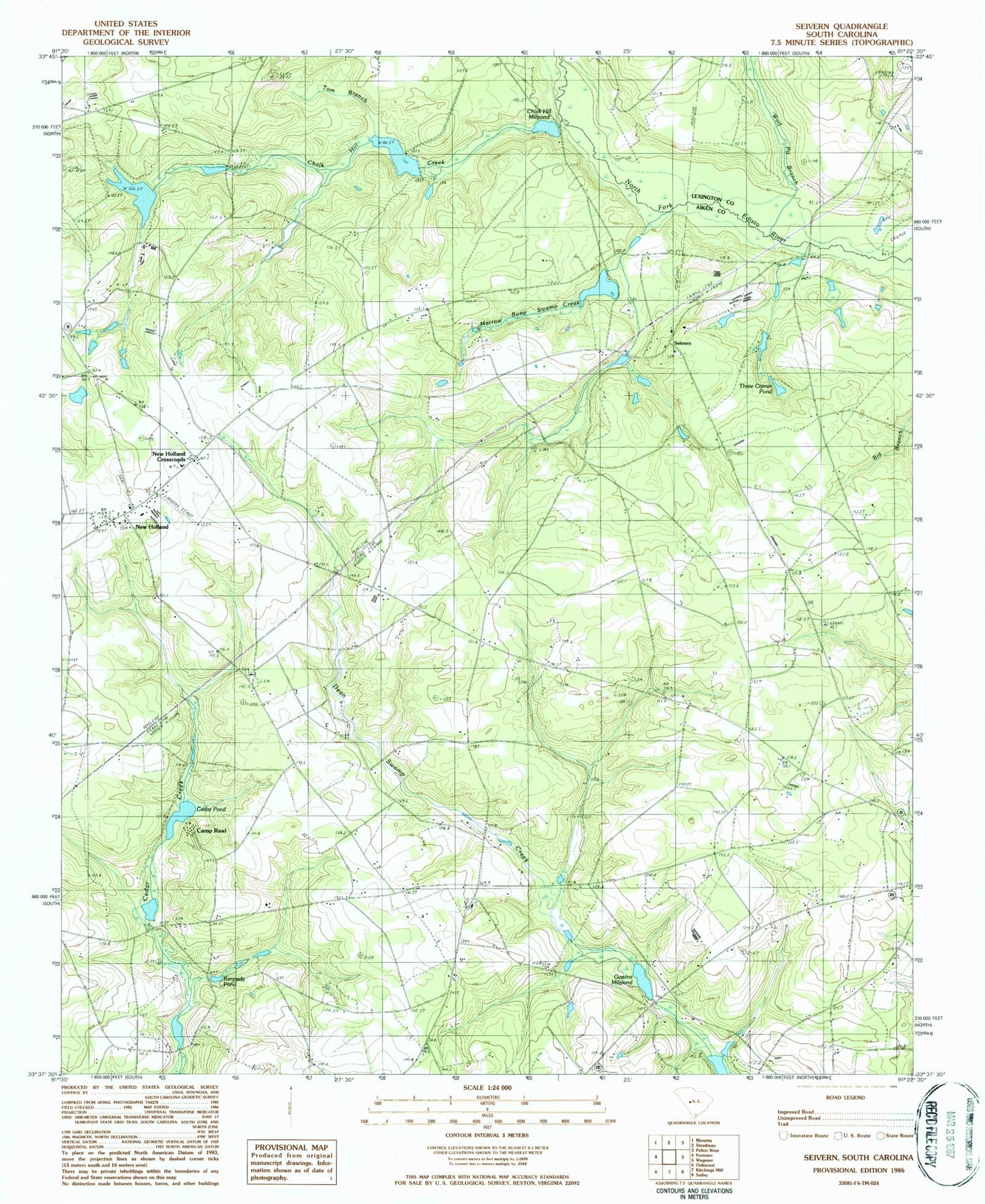
Classic USGS Seivern South Carolina 7.5'x7.5' Topo Map
Couldn't load pickup availability
Historical USGS topographic quad map of Seivern in the state of South Carolina. Map scale may vary for some years, but is generally around 1:24,000. Print size is approximately 24" x 27"
This quadrangle is in the following counties: Aiken, Lexington.
The map contains contour lines, roads, rivers, towns, and lakes. Printed on high-quality waterproof paper with UV fade-resistant inks, and shipped rolled.
Contains the following named places: Altman Pond, Barefoot, Baughmanville Church, Bethcar Church, Bethcar School, Bonnie Lake, Brogdens Pond, Camp Rawls, Cedar Creek Church, Cedar Grove School, Cedar Pond, Chaffee, Chalk Hill Church, Chalk Hill Creek, Chalk Hill Millpond, Cofer Pond, Gantts Pond, Garvin Lower Pond, Garvins Millpond, Gum Pond School, Gunters Millpond, Juniper Creek, Kennedy Pond, Marrow Bone Swamp Creek, Merritts Bridge, New Holland, New Holland Church, New Holland Crossroads, New Holland Volunteer Fire Department, Pentecostal Holiness Church, Rawls Millpond, Red Hill School, Seivern, Seivern Church, Seivern Lake, Seivern School, Snowville School, South Carolina Noname 02072 D-2130 Dam, South Carolina Noname 02097 D-2029 Dam, South Carolina Noname 02098 D-2140 Dam, South Carolina Noname 02113 D-2142 Dam, South Carolina Noname 02114 D-2135 Dam, South Carolina Noname 02116 D-2136 Dam, South Carolina Noname 02123 D-2141 Dam, South Carolina Noname 02142 D-2145 Dam, Swartz Pond, Three Corner Pond, Toms Branch, Wagener Division, White Bluff Bridge, Wolf Pit Branch, ZIP Code: 29164