
MyTopo
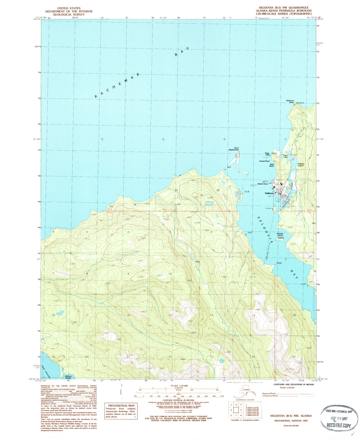
Classic USGS Seldovia B-5 NW Alaska 7.5'x7.5' Topo Map
Couldn't load pickup availability
Historical USGS topographic quad map of Seldovia B-5 NW in the state of Alaska. Map scale may vary for some years, but is generally around 1:24,000. Print size is approximately 24" x 27"
This quadrangle is in the following counties: Kenai Peninsula.
The map contains contour lines, roads, rivers, towns, and lakes. Printed on high-quality waterproof paper with UV fade-resistant inks, and shipped rolled.
Contains the following named places: Camel Rock, City of Seldovia, Gray Cliff, Indian Village, Point Naskowhak, Powder Island, Red Bluff, Seldovia, Seldovia Airport, Seldovia Bay, Seldovia Lagoon, Seldovia Medical Clinic, Seldovia Point, Seldovia Police Department, Seldovia Post Office, Seldovia Reservoir, Seldovia Seaplane Base, Seldovia Slough, Seldovia Upper Dam, Seldovia Village Tribe Health Center, Seldovia Volunteer Fire and Rescue Fire Department, Trena Lake, Watch Point


