MyTopo
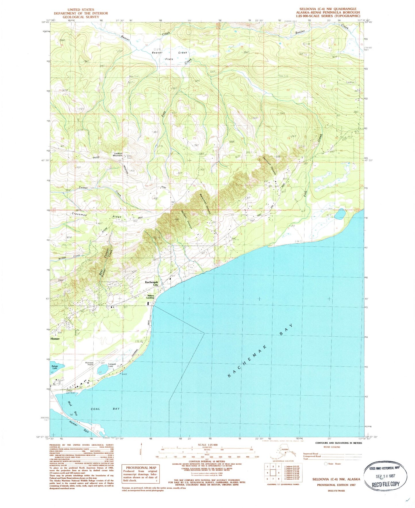
Classic USGS Seldovia C-4 NW Alaska 7.5'x7.5' Topo Map
Couldn't load pickup availability
Historical USGS topographic quad map of Seldovia C-4 NW in the state of Alaska. Map scale may vary for some years, but is generally around 1:24,000. Print size is approximately 24" x 27"
This quadrangle is in the following counties: Kenai Peninsula.
The map contains contour lines, roads, rivers, towns, and lakes. Printed on high-quality waterproof paper with UV fade-resistant inks, and shipped rolled.
Contains the following named places: Bear Canyon, Beaver Creek Flats, Carrie Creek, City of Kachemak, Coal Bay, Crossman Ridge, Fritz Creek, Fritz Creek Post Office, Homer Airport, Homer Airport State Critical Habitat Area, Kachemak City, KBBI-AM (Homer), Lampert Lake, Lookout Mountain, Mariner Park, Millers Landing, Mud Bay, Neilson Canyon, Palmer Creek, Shingle Beach, Thurston Canyon, Waterman Canyon