MyTopo
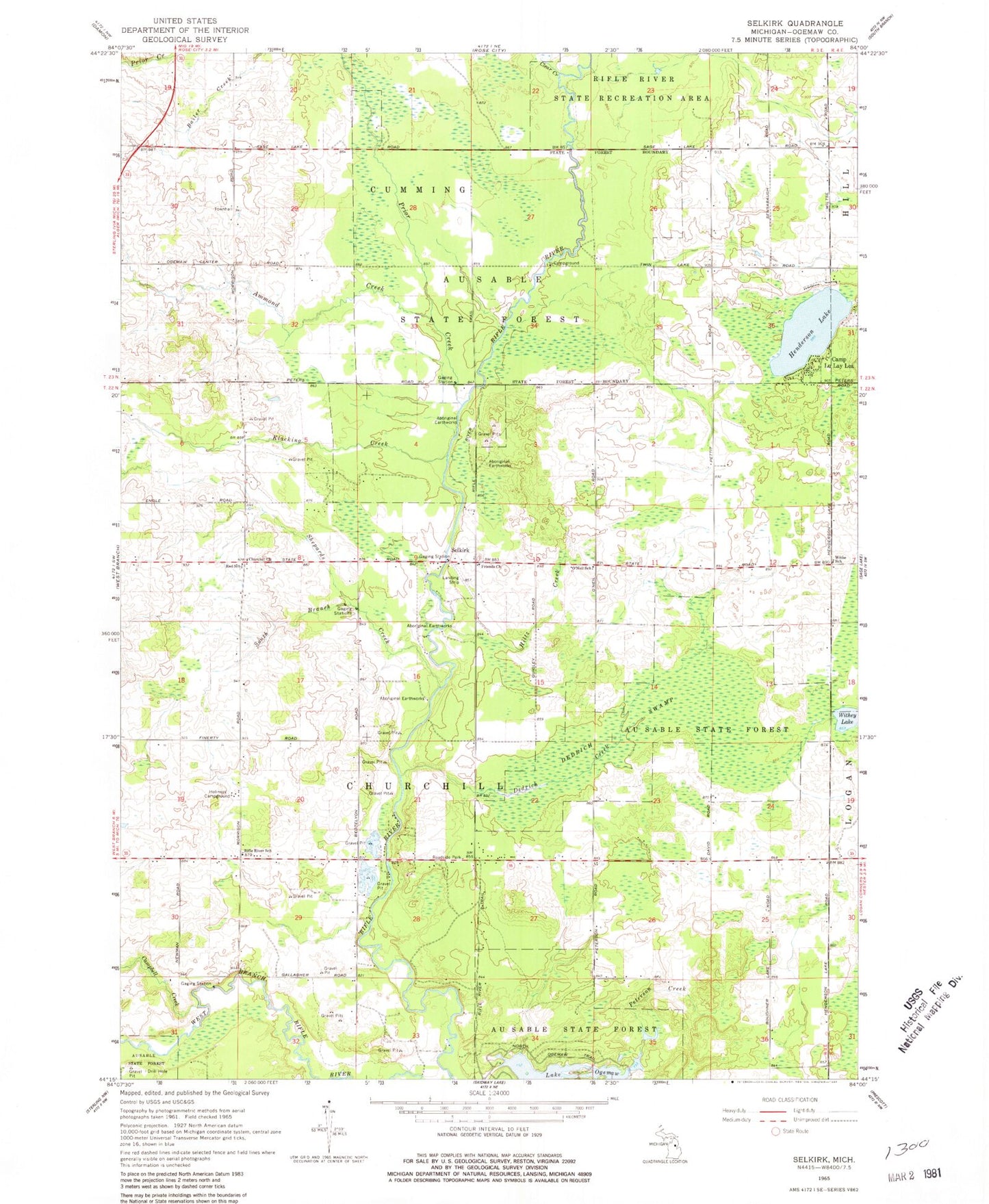
Classic USGS Selkirk Michigan 7.5'x7.5' Topo Map
Couldn't load pickup availability
Historical USGS topographic quad map of Selkirk in the state of Michigan. Map scale may vary for some years, but is generally around 1:24,000. Print size is approximately 24" x 27"
This quadrangle is in the following counties: Ogemaw.
The map contains contour lines, roads, rivers, towns, and lakes. Printed on high-quality waterproof paper with UV fade-resistant inks, and shipped rolled.
Contains the following named places: Ammond Creek, Bo - Te Farms, Camp Lu Lay Lea, Campbell Creek, Churchill Church, Churchill Township Cemetery, Clear Creek, Dedrich Creek, Dedrich Swamp, Emt Farms, Faith Lutheran Church, Henderson Lake, Hiltz Creek, Holiness Campground, Klacking Creek, Ogemaw County Fairgrounds, O'Neil School, Peterson Creek, Prince of Peace Lutheran Church, Prior Creek, Red School, Rifle River School, Rosebrugh Dairy Farm, Sage Post Office, Selkirk, Selkirk Post Office, Shepards Creek, South Branch Shepards Creek, Thompson Airport, Township of Churchill, Troll Landing Campground, Withey Lake, Withey School