MyTopo
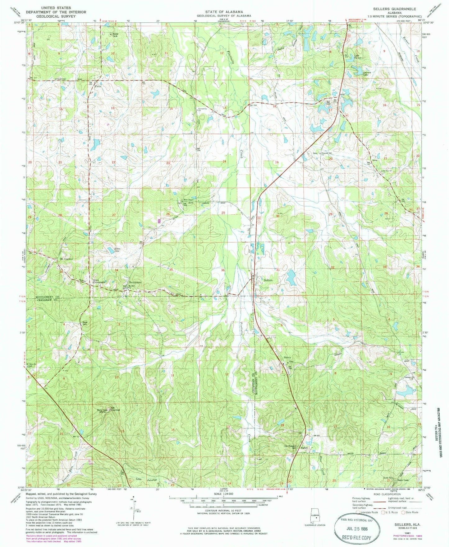
Classic USGS Sellers Alabama 7.5'x7.5' Topo Map
Couldn't load pickup availability
Historical USGS topographic quad map of Sellers in the state of Alabama. Map scale may vary for some years, but is generally around 1:24,000. Print size is approximately 24" x 27"
This quadrangle is in the following counties: Crenshaw, Montgomery.
The map contains contour lines, roads, rivers, towns, and lakes. Printed on high-quality waterproof paper with UV fade-resistant inks, and shipped rolled.
Contains the following named places: Ada, Bedsole Branch, Bedsole Dam, Bedsole Lake, Bell Cemetery, Bethlehem, Bethlehem Church, Browns Ponds, Cauthen Lake Number One, Cauthen Lake Number Two, Cauthen Number 1 Dam, Cauthen Number 2 Dam, Cauthen Pond, Charles Davis Dam, Collins Dam, Davenport Gap Filler Annex, Duncan Lake, Fair Prospect Cemetery, Fleta, Friendship Church, Guys Crossroads, Hill Dam, Lake Ta-lale, Leisure Lake, Little Zion Church, Mead Dam, Mize Dam, Montgomery Hunting Club Lake, Mose Chapel, Mount Carmel, Mount Hill Church, Mount Olive Church, Naftel, Norman Dam, Normans Lake, Nutson Number 1 Dam, Nutson Number 2 Dam, Nutson Number 3 Dam, Oakdale Church, Pine Acres, Pleasant Hill Church, Rutland Pond, Sardis Church, Sellers, Sellers Lake, Skinner Lake, Skywood Lake Number One, Skywood Lake Number Three, Skywood Lake Number Two, Strata, Strata Church, Strata Church of Christ, Strata School, Surles Church, Underwood Number 1 Dam, Underwood Number 2 Dam, Underwood Pond, Warrs Lake, Zion Hill School, ZIP Code: 36046