MyTopo
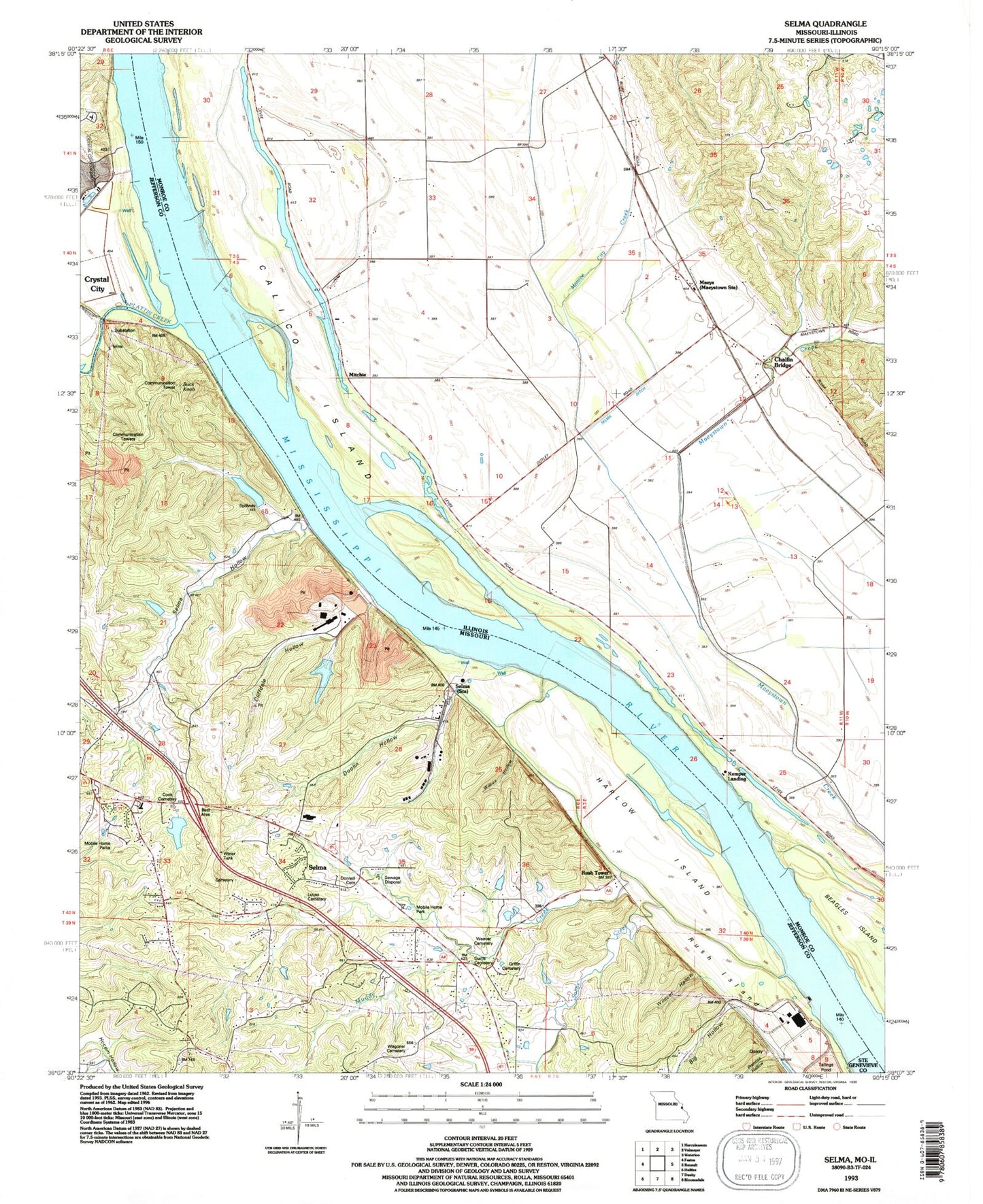
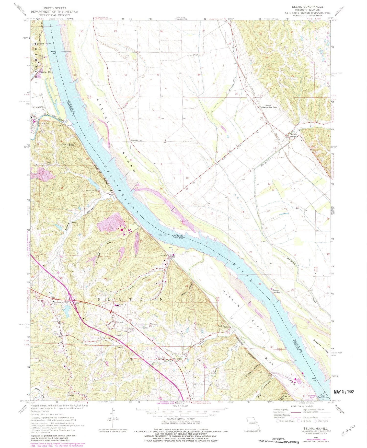
Classic USGS Selma Missouri 7.5'x7.5' Topo Map
Couldn't load pickup availability
Historical USGS topographic quad map of Selma in the states of Missouri, Illinois. Map scale may vary for some years, but is generally around 1:24,000. Print size is approximately 24" x 27"
This quadrangle is in the following counties: Jefferson, Monroe, Ste. Genevieve.
The map contains contour lines, roads, rivers, towns, and lakes. Printed on high-quality waterproof paper with UV fade-resistant inks, and shipped rolled.
Contains the following named places: Arbor Place, Barsotti Cemetery, Big Hollow, Branch Lake, Buck Knob, Calico Chute, Calico Island, Chalfin Bridge, Cliffdale Hollow, Cliffdale Hollow Natural Bridge, Conservation Club Lake, Conservation Club Lake Dam, Cook Cemetery, Curtis Cemetery, Donnell Cemetery, Doolin Hollow, Griffin Cemetery, Harlow Island, Jefferson R - 7 Fire Protection District, Jefferson R-7 School, Kemper Landing, La Platte Mine, Long Lake School, Lucas Cemetery, Maeys, Maeystown Creek, Mitchie, Mitchie School, Monroe City Creek, Muddy Creek, North Lake - Selma, Osborne Chute, Plattin Creek, Porter Lake Dam, Prentiss Hollow, Rainer Lake, River Cement Company Lake, River Cement Company Lake Dam, Rush Island, Rush Tower, Rush Tower School, Saint Joseph Ursuline Novitiate, Saline Creek, Selma, Selma Dam, Selma Ditch, Selma Hollow, Selma School, Varnum School, Wagoner Cemetery, Weaver Cemetery, Wesley Church, Wilcox Hollow, Wildcat Hollow