MyTopo
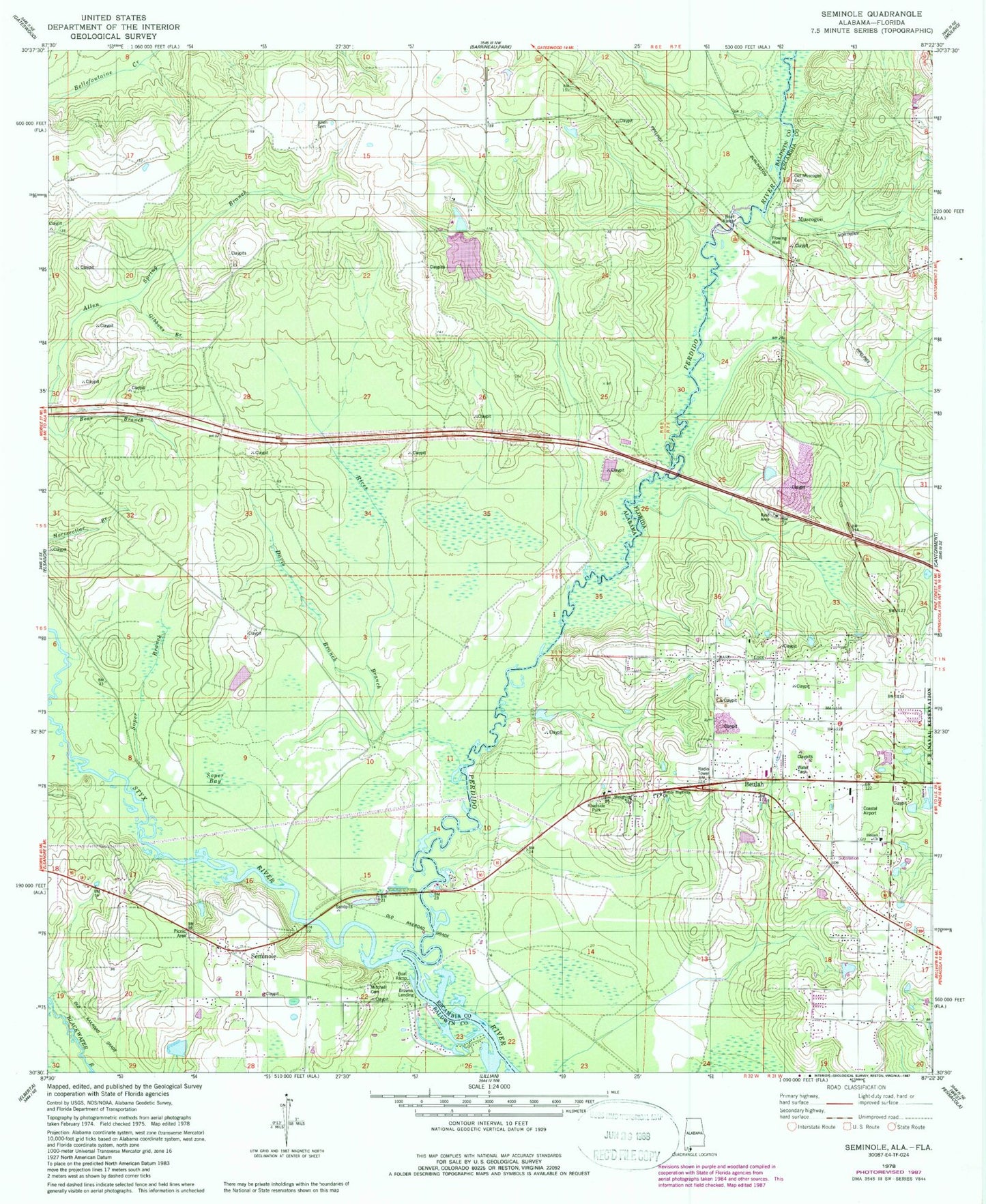
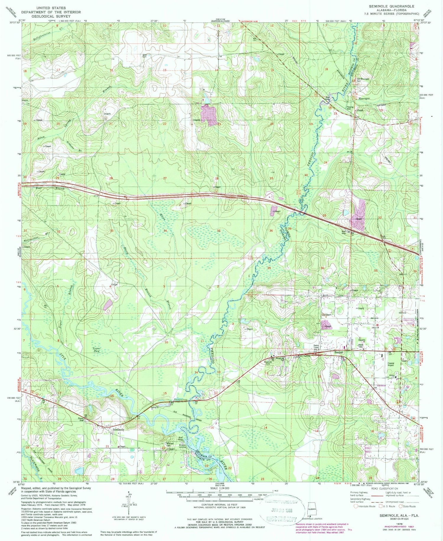
Classic USGS Seminole Alabama 7.5'x7.5' Topo Map
Couldn't load pickup availability
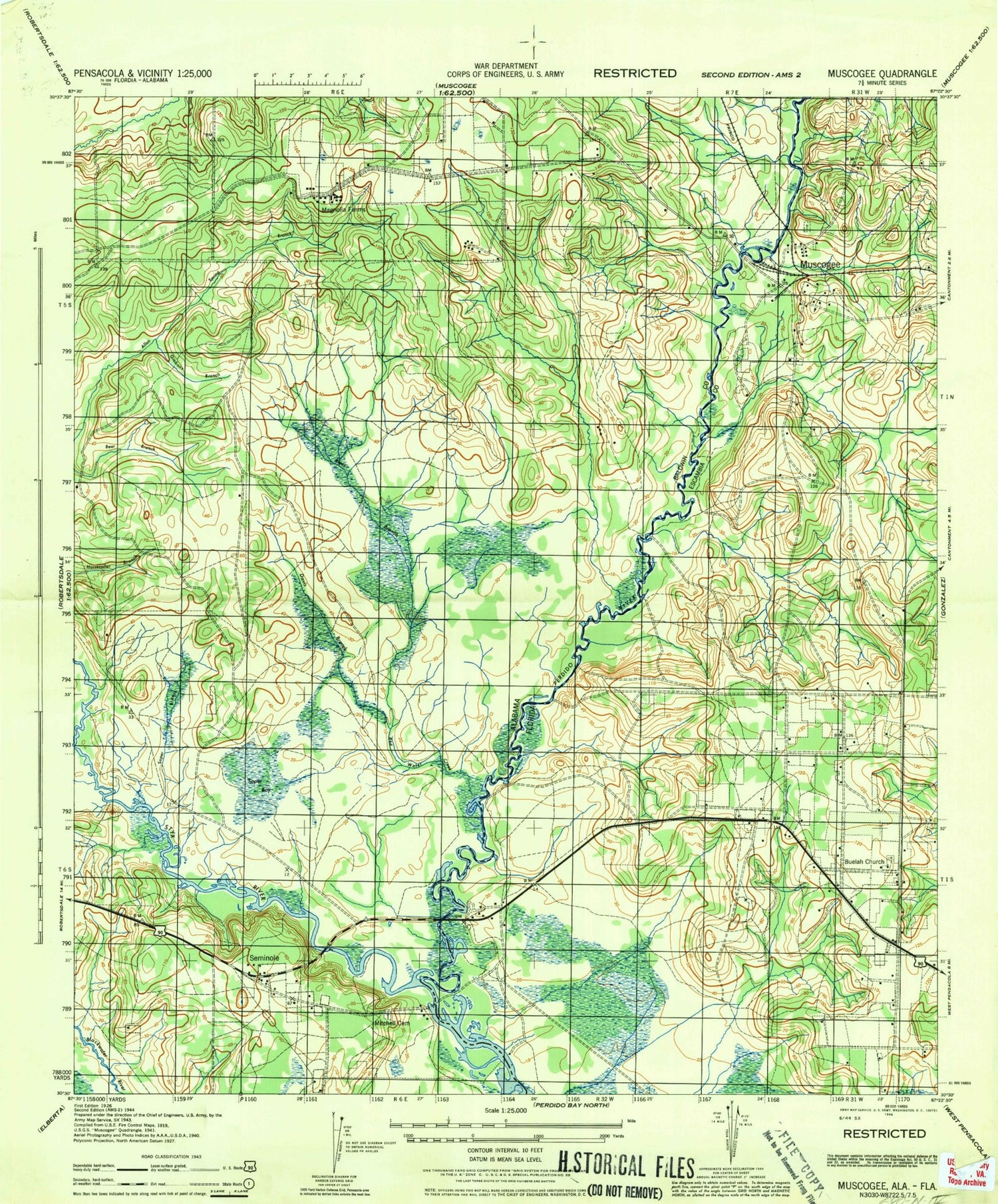
Historical USGS topographic quad map of Seminole in the states of Alabama, Florida. Typical map scale is 1:24,000, but may vary for certain years, if available. Print size: 24" x 27"
This quadrangle is in the following counties: Baldwin, Escambia.
The map contains contour lines, roads, rivers, towns, and lakes. Printed on high-quality waterproof paper with UV fade-resistant inks, and shipped rolled.
Contains the following named places: Allen Cemetery, Davis Branch, Gibbons Branch, Mitchell Cemetery, Seminole, Soper Bay, Soper Branch, Styx River, Nunez Ferry (historical), Seminole Church, Rices Branch, Browns Landing, Alabama Department of Transportation Interstate 10 Welcome Center Lagoon, Vaughn Airport, Seminole Volunteer Fire Department Station 1, Seminole Volunteer Fire Department Station 2, Beulah Church, Beulah Academy of Science, Mobile Highway Church, Old Muscogee Cemetery, Beulah, Muscogee, Beulah Volunteer Fire Department, Coastal Airport (historical)