MyTopo
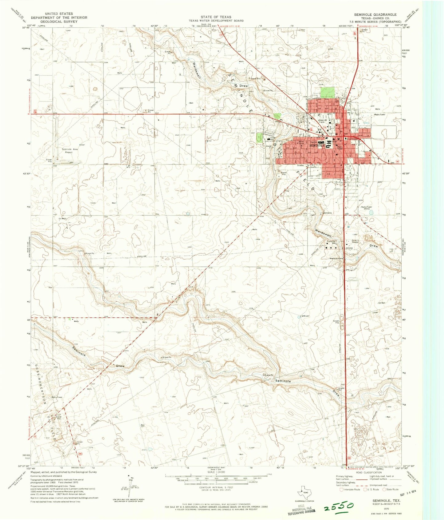
Classic USGS Seminole Texas 7.5'x7.5' Topo Map
Couldn't load pickup availability
Historical USGS topographic quad map of Seminole in the state of Texas. Map scale may vary for some years, but is generally around 1:24,000. Print size is approximately 24" x 27"
This quadrangle is in the following counties: Gaines.
The map contains contour lines, roads, rivers, towns, and lakes. Printed on high-quality waterproof paper with UV fade-resistant inks, and shipped rolled.
Contains the following named places: Church of Christ, City of Seminole, First Baptist Church, First Presbyterian Church, Gaines County, Gaines County Airport, Gaines County Cemetery, Gaines County Constable's Office Precinct 1, Gaines County Courthouse, Gaines County Jail, Gaines County Sheriff's Office, KIKZ-AM (Seminole), KSEM-FM (Seminole), Memorial Hospital, Seminole, Seminole City Hall, Seminole Division, Seminole Elementary School, Seminole Emergency Medical Service, Seminole High School, Seminole Junior High School, Seminole Police Department, Seminole Post Office, Seminole Primary School, Seminole Spraying Service Airport, Seminole Success Center, Seminole Volunteer Fire Department, Temple Baptist Church, Trinity Baptist Church, Young Elementary School, Young School, ZIP Code: 79360