MyTopo
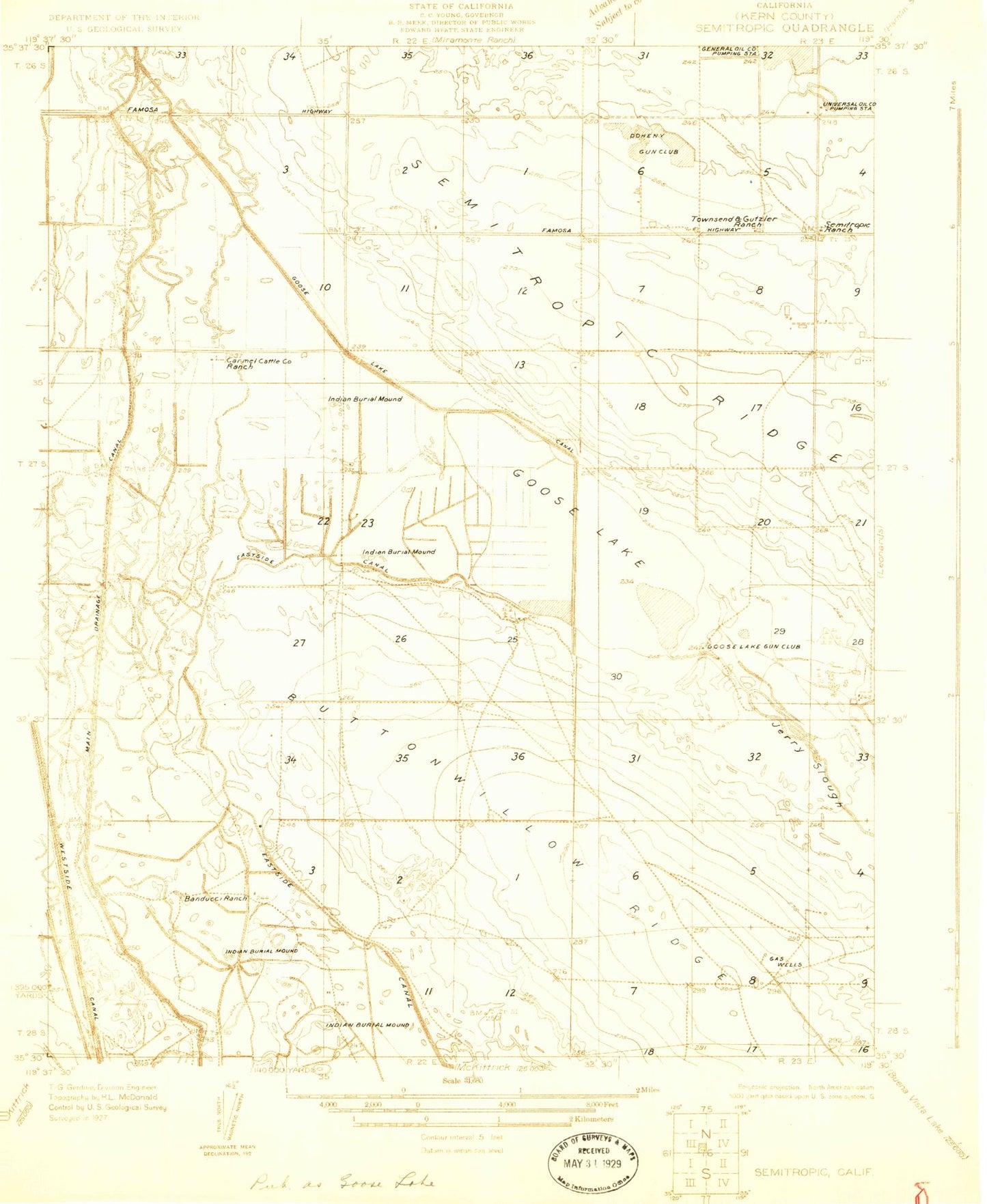
Classic USGS Semitropic California 7.5'x7.5' Topo Map
Regular price
$16.95
Regular price
Sale price
$16.95
Unit price
per
Couldn't load pickup availability
Historical USGS topographic quad map of Semitropic in the state of California. Map scale may vary for some years, but is generally around 1:24,000. Print size is approximately 24" x 27"
This quadrangle is in the following counties: Kern.
The map contains contour lines, roads, rivers, towns, and lakes. Printed on high-quality waterproof paper with UV fade-resistant inks, and shipped rolled.
Contains the following named places: Banducci Ranch, Blue Moon Ranch, Buttonwillow Gas Field, Carmel Ranch, Doheny Gun Club, Douglas Ranch, Dudley Ranch, Estrada Ranch, Goose Lake Bed, Goose Lake Gun Club, Gutzier Ranch, Jerry Slough, Milham Farm, Myer Ranch, Semitropic, Semitropic Ridge, Semitropic School, Spicer City