MyTopo
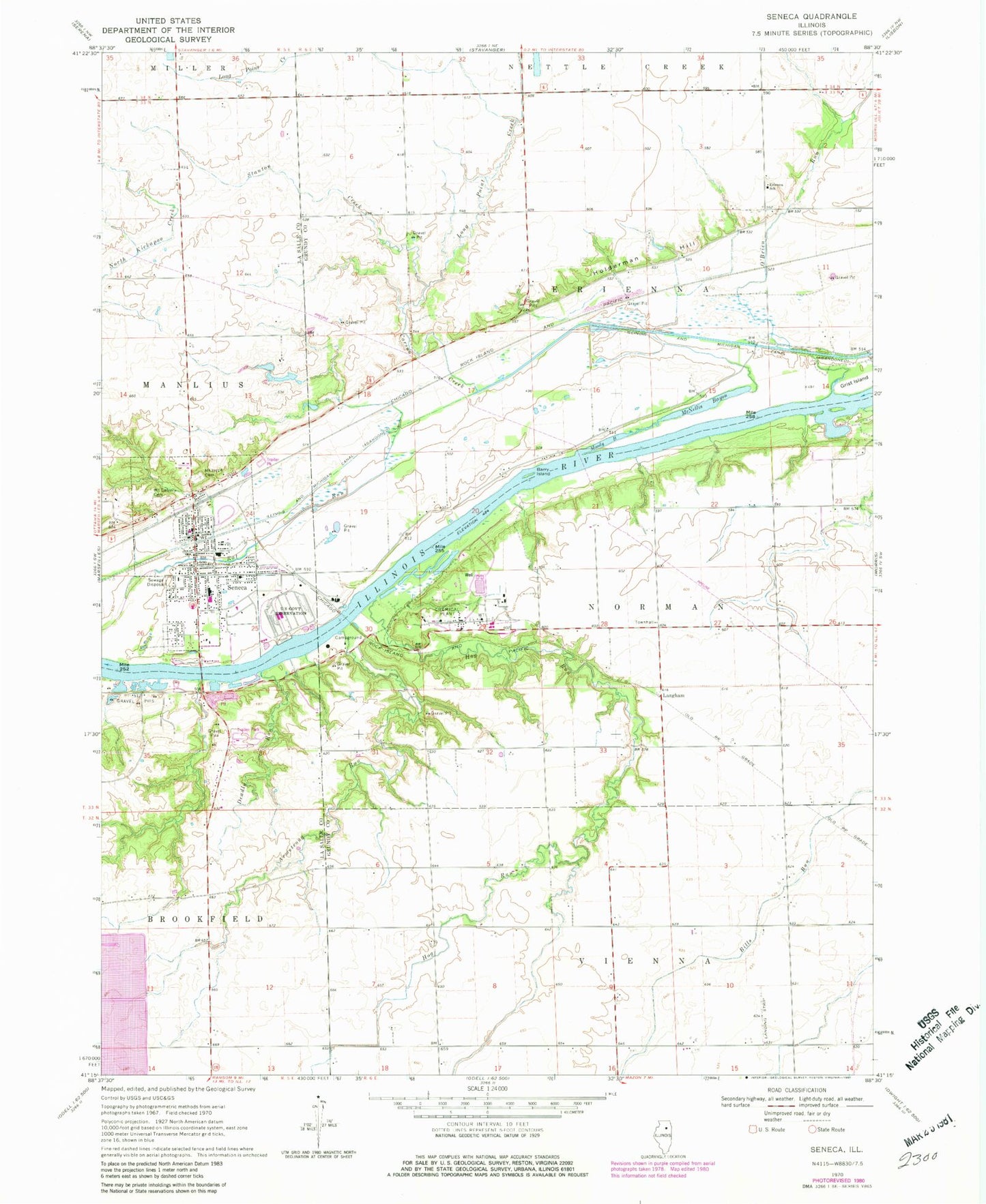
Classic USGS Seneca Illinois 7.5'x7.5' Topo Map
Couldn't load pickup availability
Historical USGS topographic quad map of Seneca in the state of Illinois. Map scale may vary for some years, but is generally around 1:24,000. Print size is approximately 24" x 27"
This quadrangle is in the following counties: Grundy, LaSalle.
The map contains contour lines, roads, rivers, towns, and lakes. Printed on high-quality waterproof paper with UV fade-resistant inks, and shipped rolled.
Contains the following named places: Armstrong Run, Barry Island, Barry School, Boondox Field, Brick School, Carson Creek, Crotty Creek, Deadly Run, Erienna Elementary School, First United Methodist Church, Grist Island, Higgins School, Hog Run, Holderman Hill, Holiness Methodist Church, Hull School, Langham, Long Point School, McNellis Bayou, Moody Bayou, Mount Calvary Cemetery, Mount Hope Cemetery, Norman Town Hall, O'Brien Run, O'Malley School, Our Saviours Lutheran Church, Raymond School, Saint Patricks Catholic Church, Seneca, Seneca Ambulance Service, Seneca Elementary School, Seneca Fire Protection and Ambulance District, Seneca High School, Seneca Police Department, Seneca Post Office, Stanton Creek, Township of Erienna, Township of Norman, Village of Seneca, Woodbury School, Young School, ZIP Code: 61360