MyTopo
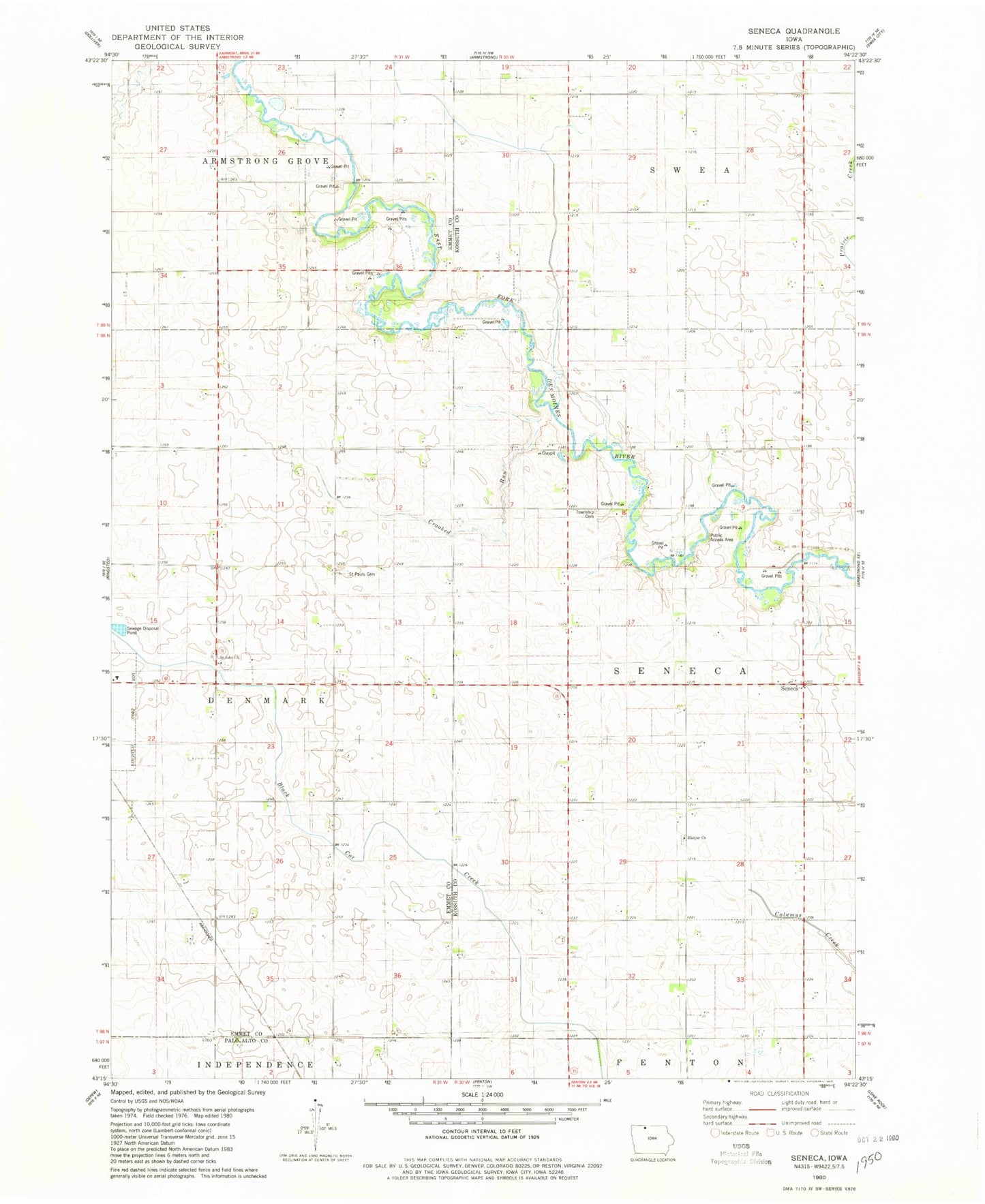
Classic USGS Seneca Iowa 7.5'x7.5' Topo Map
Couldn't load pickup availability
Historical USGS topographic quad map of Seneca in the state of Iowa. Map scale may vary for some years, but is generally around 1:24,000. Print size is approximately 24" x 27"
This quadrangle is in the following counties: Emmet, Kossuth, Palo Alto.
The map contains contour lines, roads, rivers, towns, and lakes. Printed on high-quality waterproof paper with UV fade-resistant inks, and shipped rolled.
Contains the following named places: Armstrong Grove Post Office, Bacon Maker Farm, Blackjar Lutheran Cemetery, Blackjer Church, Crooked Run, Des Moines River Bridge, East Des Moines Access Public Hunting Area, Forsyth, Forsyth Post Office, Memorial Cemetery, Saint John Church, Saint John Lutheran Cemetery, Saint Pauls Lutheran Cemetery, Seneca, Seneca Access, Seneca Access Public Hunting Area, Seneca Post Office, Seneca Township Cemetery, Township of Seneca