MyTopo
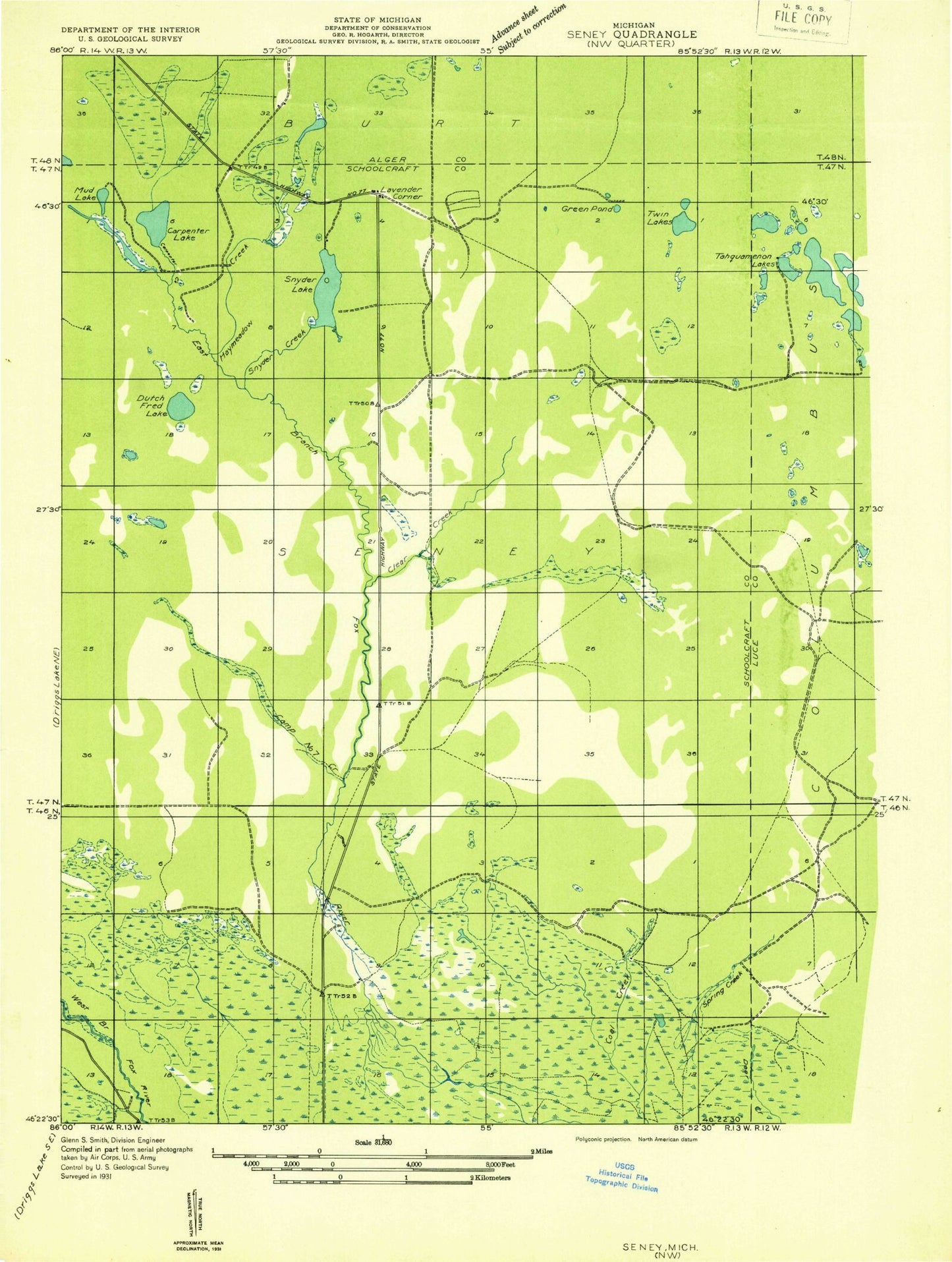
Classic USGS Seney NW Michigan 7.5'x7.5' Topo Map
Regular price
$16.95
Regular price
Sale price
$16.95
Unit price
per
Couldn't load pickup availability
Historical USGS topographic quad map of Seney NW in the state of Michigan. Map scale may vary for some years, but is generally around 1:24,000. Print size is approximately 24" x 27"
This quadrangle is in the following counties: Schoolcraft.
The map contains contour lines, roads, rivers, towns, and lakes. Printed on high-quality waterproof paper with UV fade-resistant inks, and shipped rolled.
Contains the following named places: Camp Seven Creek, Carpenter Lake, Clear Creek, Clear Creek Trout Pond, Dutch Fred Lake, East Branch Fox River State Forest Campground, Green Pond, Gronden Creek, Haymeadow Creek, Kings Pond, Snyder Creek, Snyder Lake, Spring Creek, The Reservoir, Twin Lakes