MyTopo
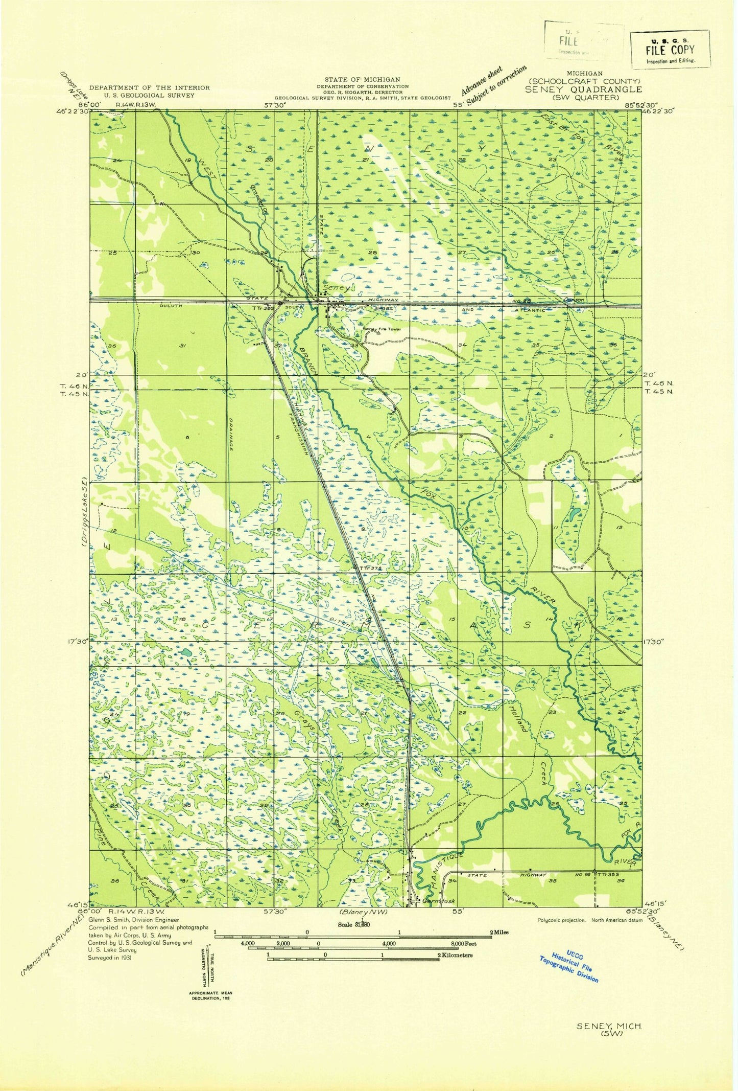
Classic USGS Seney Michigan 7.5'x7.5' Topo Map
Couldn't load pickup availability
Historical USGS topographic quad map of Seney in the state of Michigan. Map scale may vary for some years, but is generally around 1:24,000. Print size is approximately 24" x 27"
This quadrangle is in the following counties: Schoolcraft.
The map contains contour lines, roads, rivers, towns, and lakes. Printed on high-quality waterproof paper with UV fade-resistant inks, and shipped rolled.
Contains the following named places: B Pool, Blue Mountains, Boot Hill Cemetery, C Pool, Clarks Ditch, Cold Creek, D Pool, Dead Creek, E Pool, F Pool, Fox River, G Pool, Germfask Volunteer Fire Department, Gronden Creek, H Pool, Harcourt Lake, Holland Creek, Holland Ditch, I Pool, J Pool, Michigan Department of Natural Resources Seney Field Office, Seney, Seney Post Office, Seney Station, Seney Township Fire Department, The Spreads, Township Campground, Wigwam Picnic Area