
MyTopo
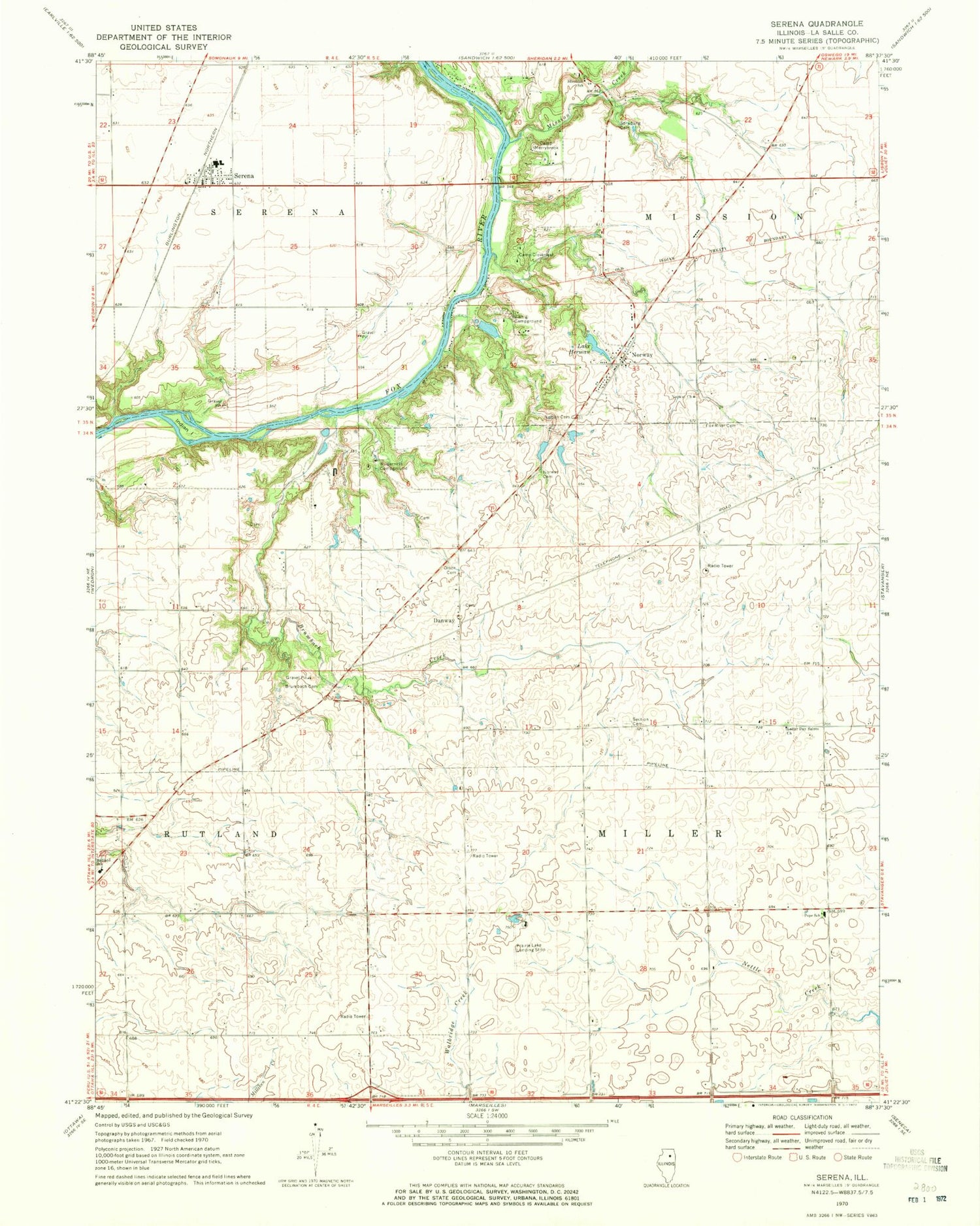
Classic USGS Serena Illinois 7.5'x7.5' Topo Map
Couldn't load pickup availability
Historical USGS topographic quad map of Serena in the state of Illinois. Map scale may vary for some years, but is generally around 1:24,000. Print size is approximately 24" x 27"
This quadrangle is in the following counties: LaSalle.
The map contains contour lines, roads, rivers, towns, and lakes. Printed on high-quality waterproof paper with UV fade-resistant inks, and shipped rolled.
Contains the following named places: Armson School, Barber School, Brumbach Cemetery, Brumbach Creek, Camp Cloverleaf, Camp Merrybrook, Classon School, Danway, David Strawn Cemetery, Fox River Cemetery, Fox River Lutheran Church, Friends Field, Grove School, Hall School, Indian Island, Jim Wehrli Memorial Airport, Lake Herman, Lake Herman Dam, Lang School, Latter Day Saints Church, Longview Airport, Lower Fox River - Blakes Landing Nature Preserve, Milton Pope Elementary School, Mission Creek, Nelson Cemetery, Norway, Norway Cemetery, Norwegian Settlers State Memorial, Olson Cemetery, Osmundson Cemetery, Prairie Lake Hunt Club Airport, Rosedale School, Rutland Elementary School, Section Cemetery, Section School, Serena, Serena Census Designated Place, Serena Community Fire Protection District Main Station, Serena Elementary School, Serena Fire Protection District Norway Station 2, Serena High School, Serena Post Office, Serena United Methodist Church, Sheridan School, Spradling Cemetery, Township of Miller, Township of Rutland, Viking Campground, Wilderness Campground


