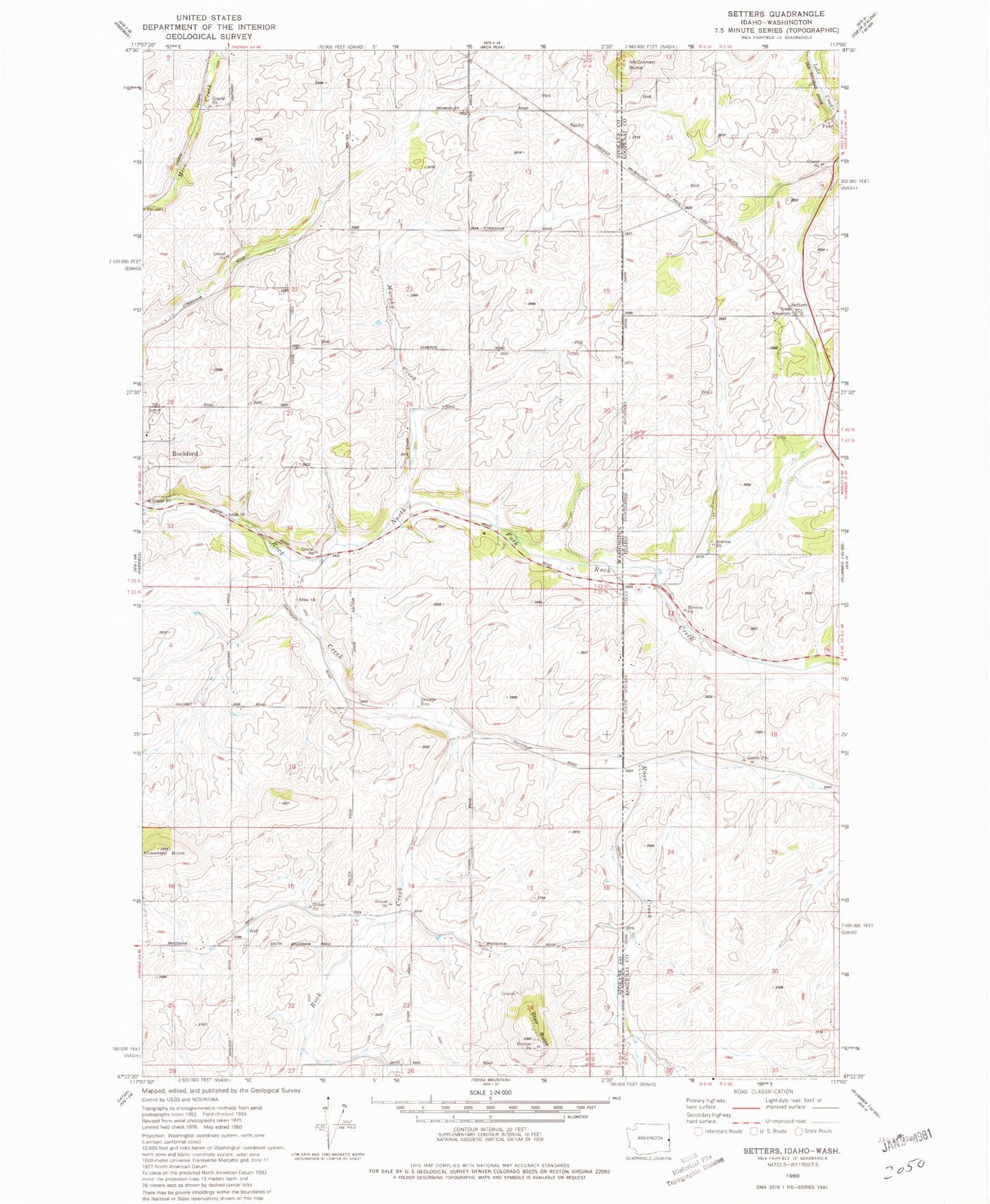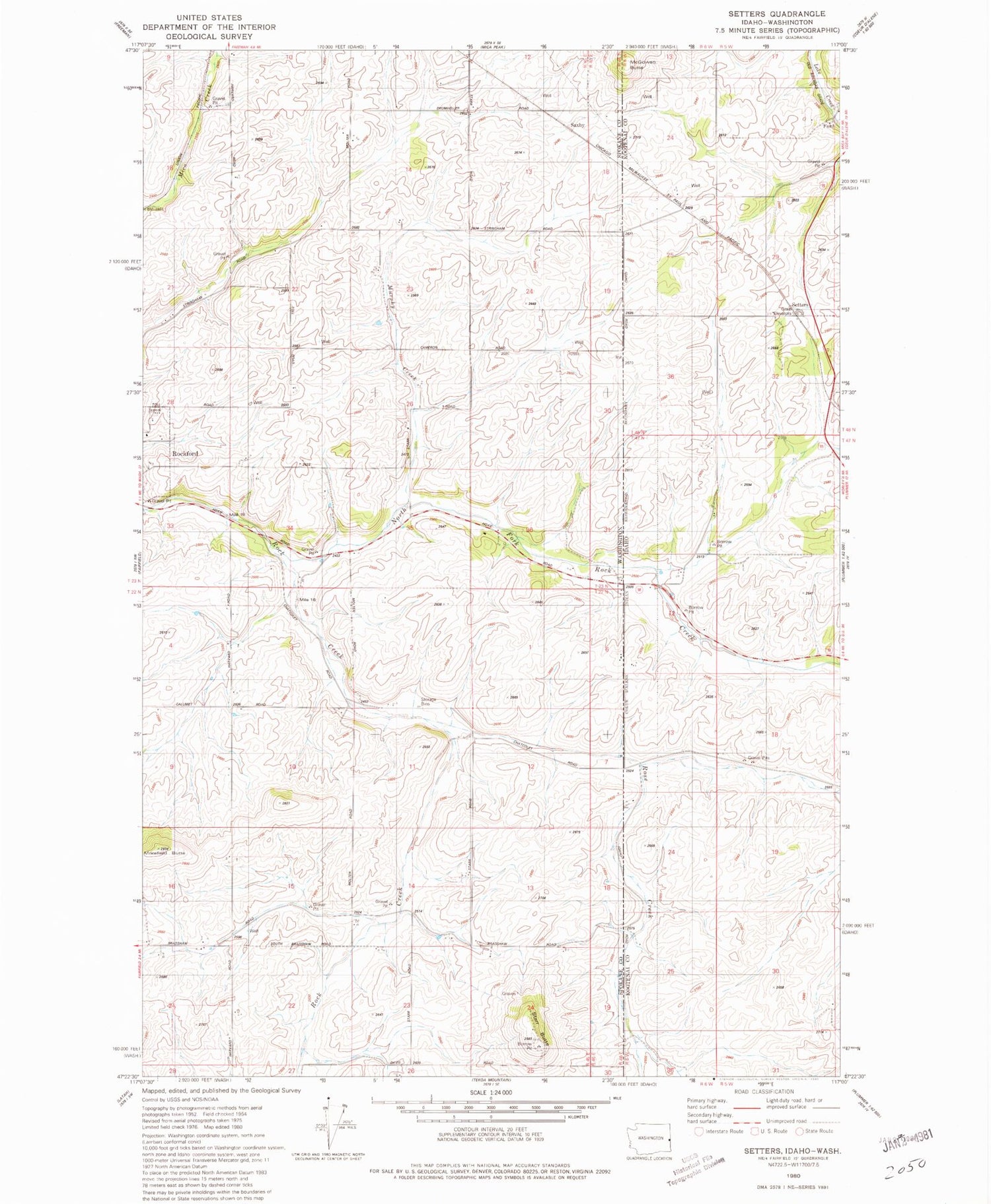
MyTopo
Classic USGS Setters Idaho 7.5'x7.5' Topo Map
Regular price
$16.95
Regular price
Sale price
$16.95
Unit price
per
Couldn't load pickup availability
Historical USGS topographic quad map of Setters in the states of Idaho, Washington. Map scale may vary for some years, but is generally around 1:24,000. Print size is approximately 24" x 27"
This quadrangle is in the following counties: Kootenai, Spokane.
The map contains contour lines, roads, rivers, towns, and lakes. Printed on high-quality waterproof paper with UV fade-resistant inks, and shipped rolled.
Contains the following named places: Coey, Ford, Ford School, La Shaw School, McGowan Butte, McIntosh Grange, Murphy Creek, North Fork Rock Creek, Rock Creek Gun Club, Rose Creek, Saxby, Setters, South Fork Rock Creek, Starr Butte, ZIP Code: 99030