MyTopo
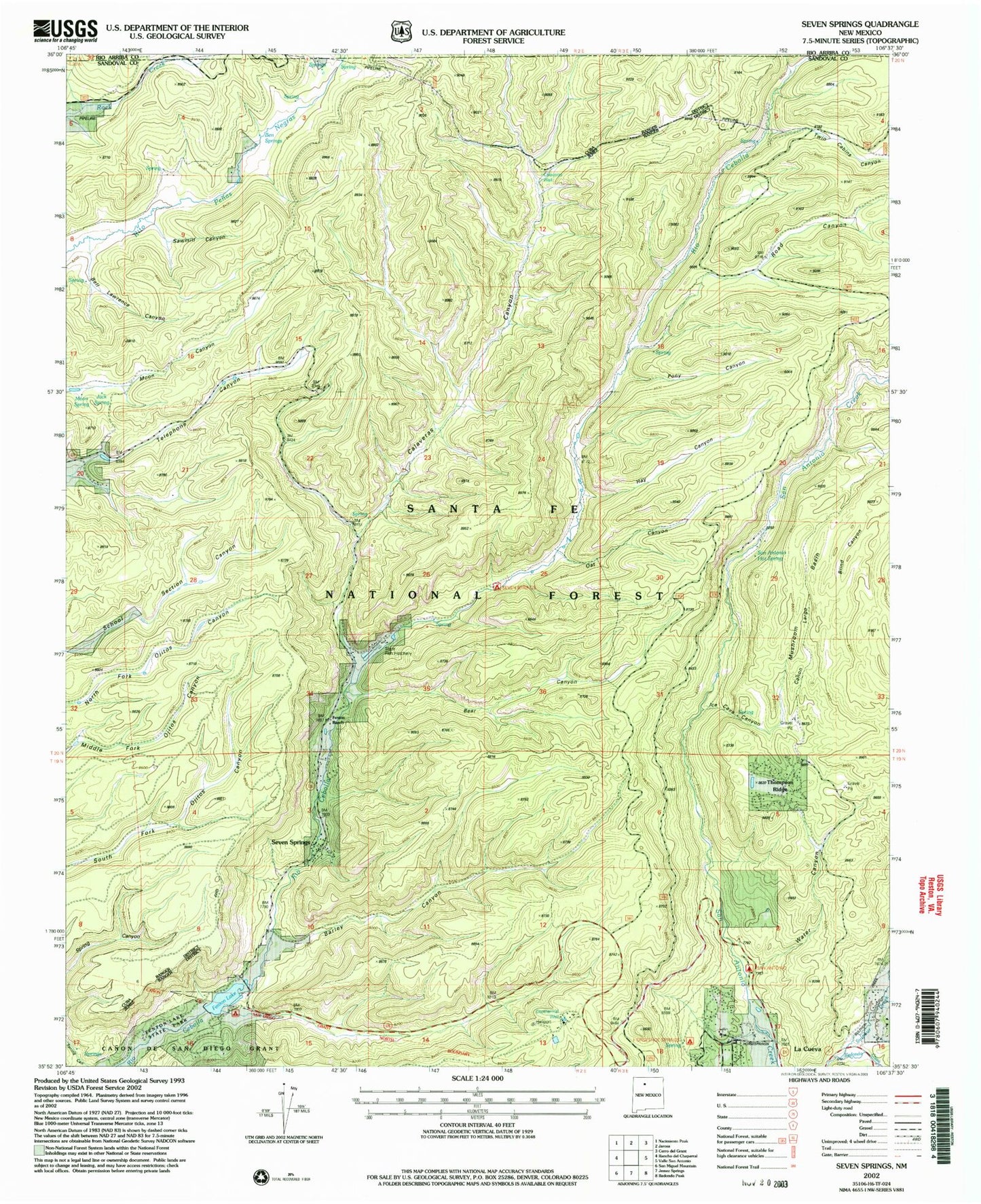
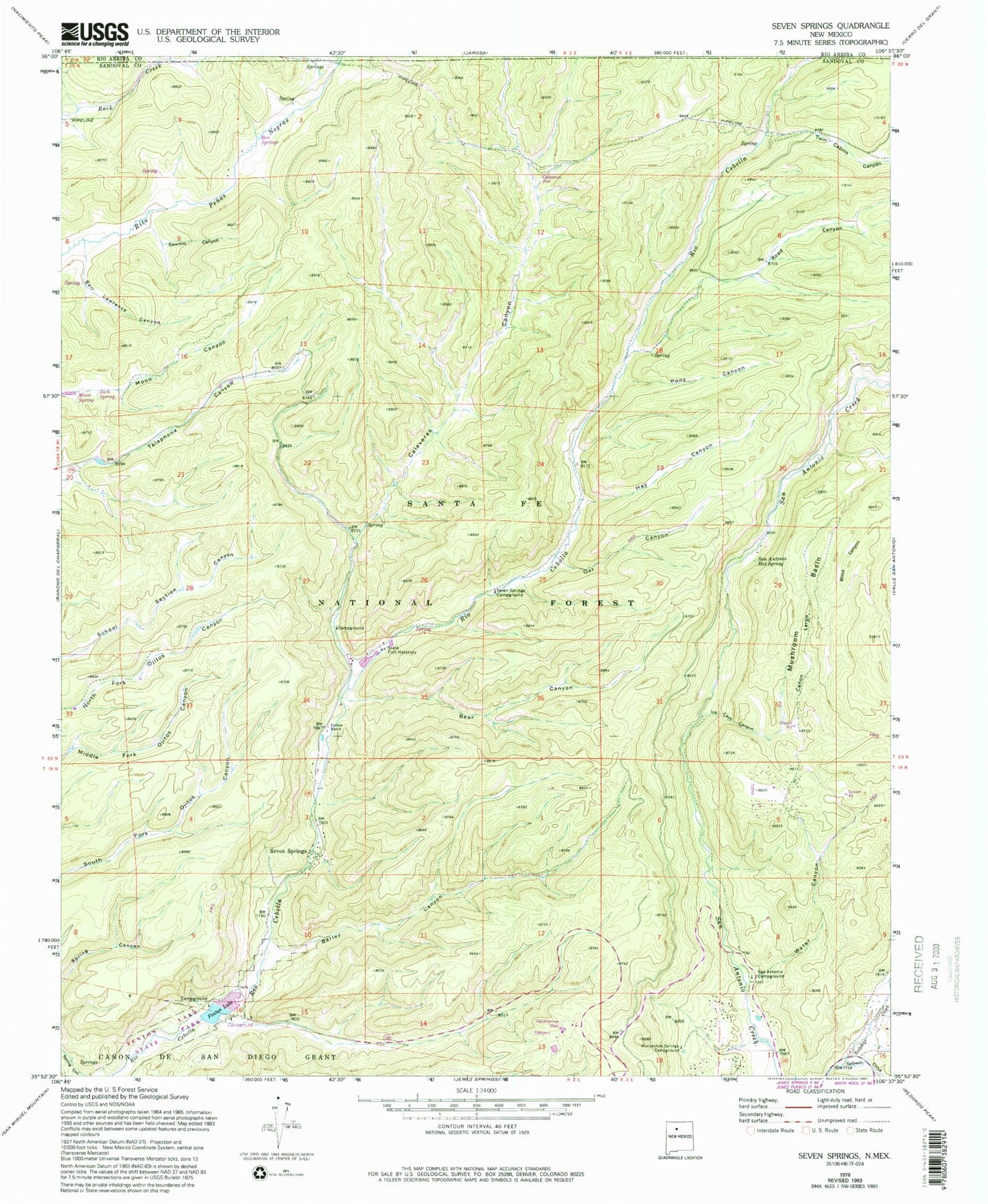
Classic USGS Seven Springs New Mexico 7.5'x7.5' Topo Map
Couldn't load pickup availability
Historical USGS topographic quad map of Seven Springs in the state of New Mexico. Typical map scale is 1:24,000, but may vary for certain years, if available. Print size: 24" x 27"
This quadrangle is in the following counties: Rio Arriba, Sandoval.
The map contains contour lines, roads, rivers, towns, and lakes. Printed on high-quality waterproof paper with UV fade-resistant inks, and shipped rolled.
Contains the following named places: Fenton Lake State Park, Barley Canyon, Bear Canyon, Bell Lawrence Canyon, Blind Canyon, Fenton Lake, Hay Canyon, Horseshoe Springs Campground, Ice Cave Canyon, Oat Canyon, Pony Canyon, San Antonio Campground, San Antonio Hot Spring, Sawmill Canyon, Seven Springs Campground, Twin Cabins Canyon, Water Canyon, Seven Springs, Fenton Hill GT-2 and EE-1, Ben Springs, Calaveras Well, Jack Spring, Moon Spring, Minerals and Chemicals Group, Fenton Hill, Calaveras Canyon, Canon Largo, Fenton Ranch, Mushroom Basin, Penas Negras Cabin (historical), Redondo Creek, Road Canyon, Seven Springs, Seven Springs Guard Station (historical), Fenton Lake Dam, Calaveras Well, Fenton Lake State Park, Calaveras Campground, La Cueva Fire District Seven Springs, La Cueva Fire District Thompson Ridge