MyTopo
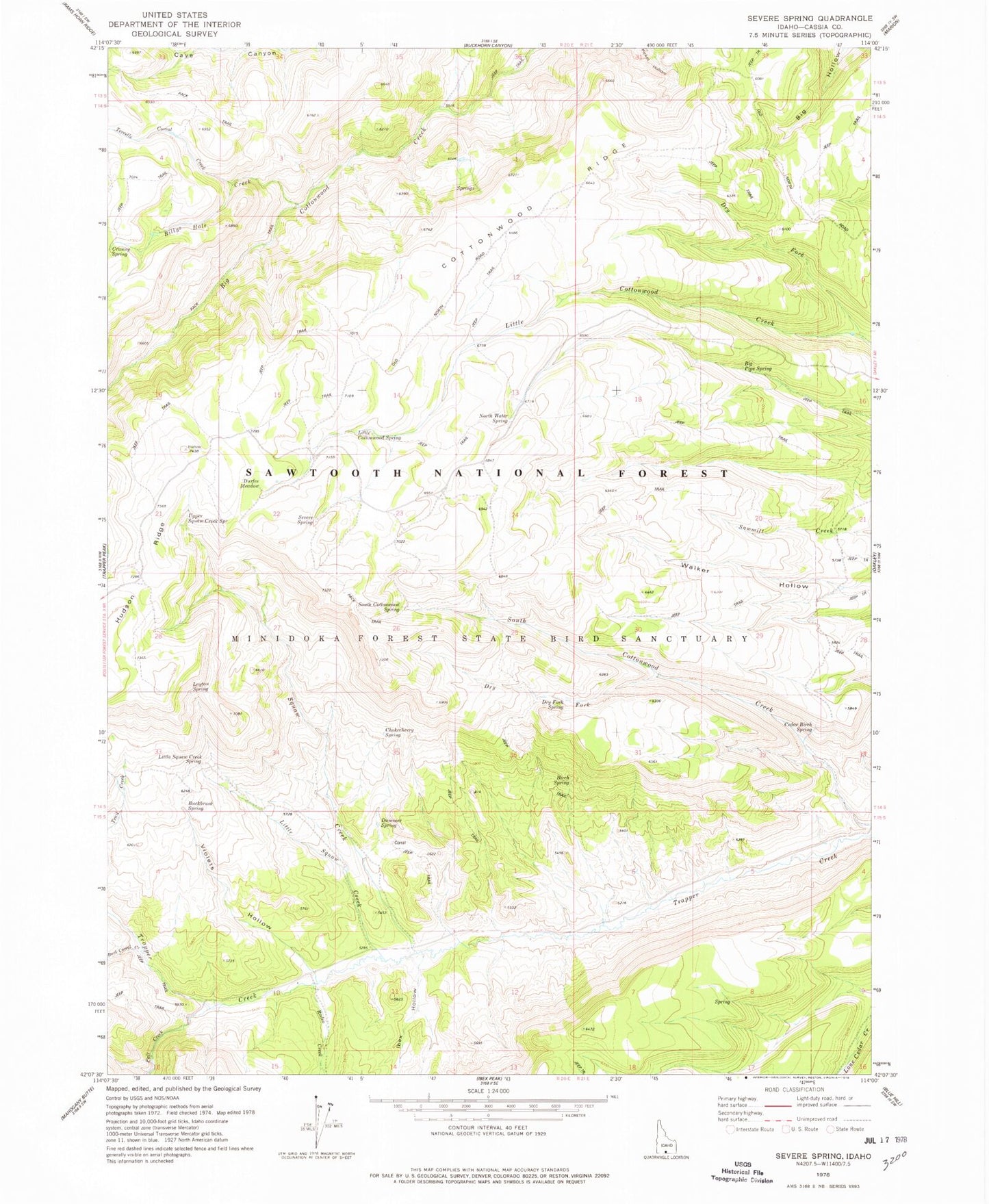
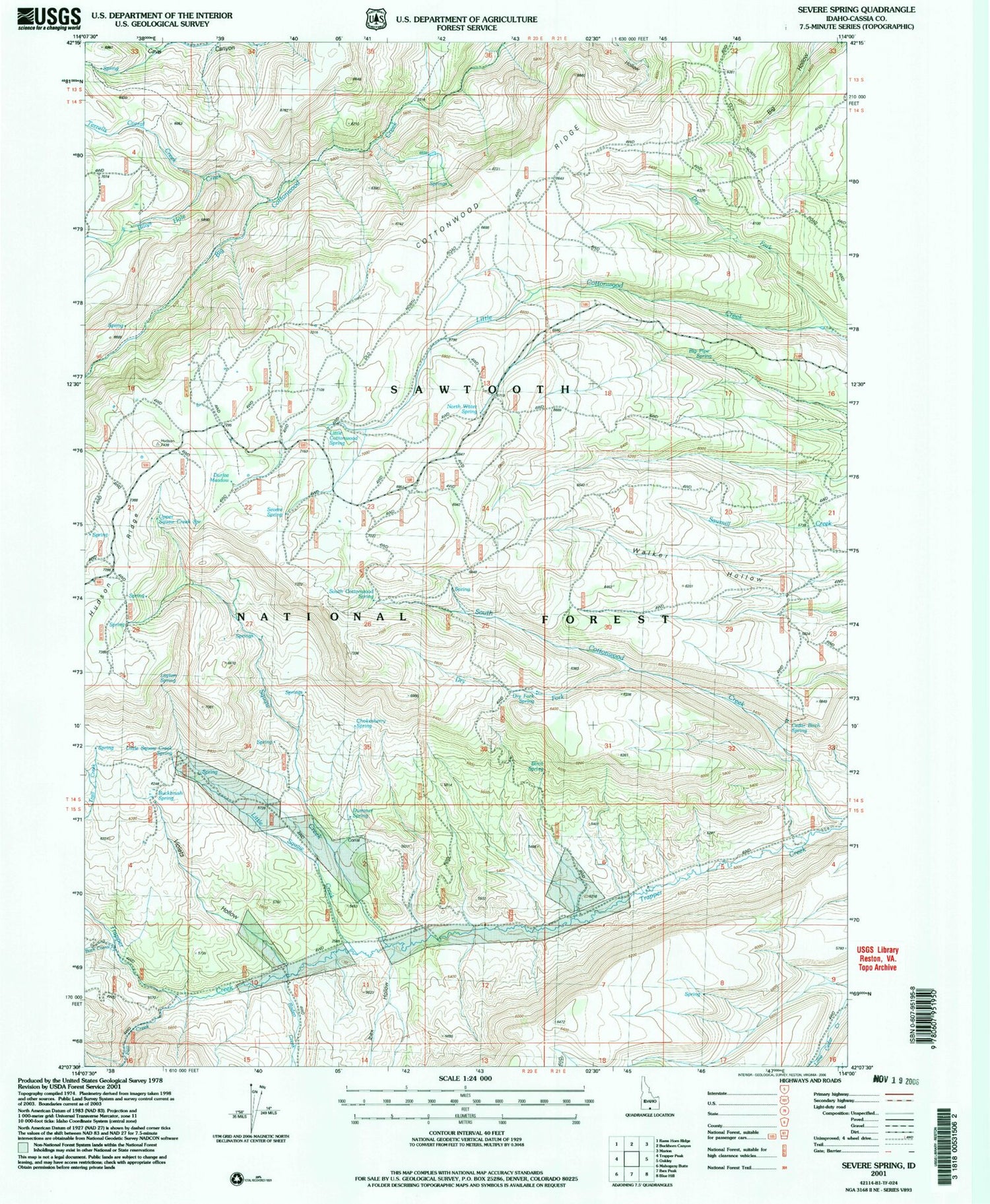
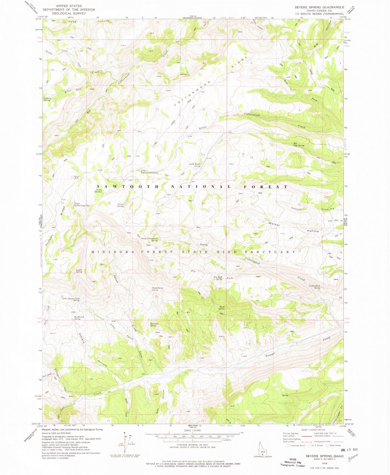
Classic USGS Severe Spring Idaho 7.5'x7.5' Topo Map
Couldn't load pickup availability
Historical USGS topographic quad map of Severe Spring in the state of Idaho. Map scale may vary for some years, but is generally around 1:24,000. Print size is approximately 24" x 27"
This quadrangle is in the following counties: Cassia.
The map contains contour lines, roads, rivers, towns, and lakes. Printed on high-quality waterproof paper with UV fade-resistant inks, and shipped rolled.
Contains the following named places: Aspen Spring, Big Pipe Spring, Billys Hole Creek, Birch Spring, Buck Corral Creek, Buckbrush Spring, Cedar Birch Spring, Chokecherry Spring, Cottonwood Ridge, Dry Fork, Dry Fork Little Cottonwood Creek, Dry Fork Spring, Dummer Spring, Durfee Meadow, Fall Creek, Ibex Hollow, Layton Spring, Little Cottonwood Spring, Little Squaw Creek, Little Squaw Creek Spring, North Water Spring, Oakley Division, Rodeo Creek, Severe Spring, South Cottonwood Spring, Squaw Creek, Terrells Corral Creek, Upper Squaw Creek Spring, Violets Hollow