MyTopo
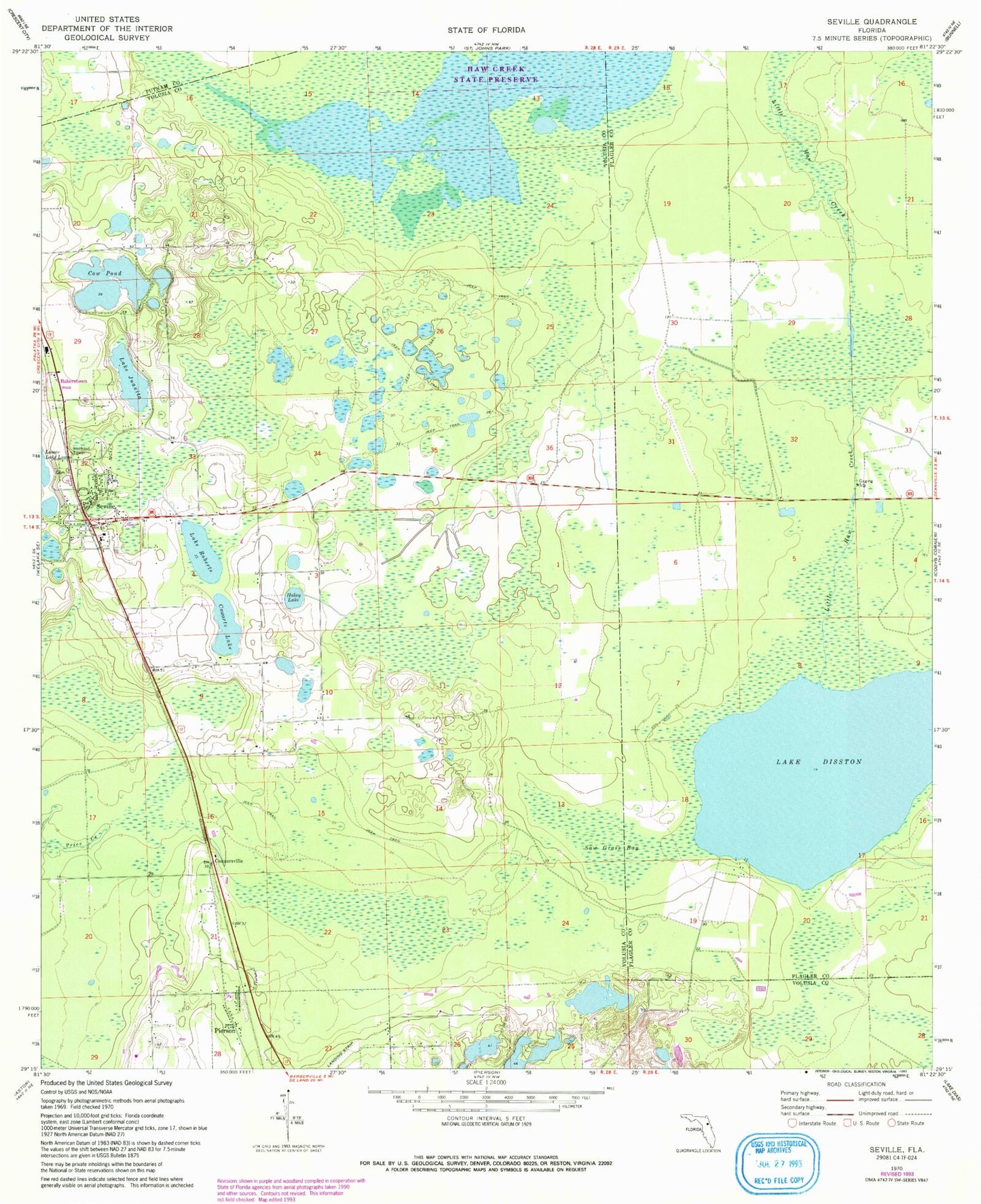
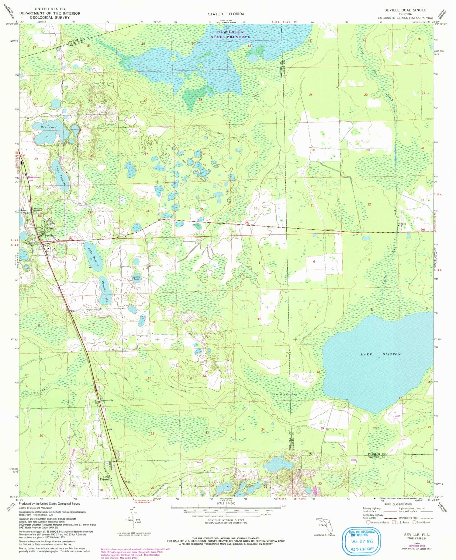
Classic USGS Seville Florida 7.5'x7.5' Topo Map
Couldn't load pickup availability
Historical USGS topographic quad map of Seville in the state of Florida. Map scale may vary for some years, but is generally around 1:24,000. Print size is approximately 24" x 27"
This quadrangle is in the following counties: Flagler, Putnam, Volusia.
The map contains contour lines, roads, rivers, towns, and lakes. Printed on high-quality waterproof paper with UV fade-resistant inks, and shipped rolled.
Contains the following named places: Anchor Baptist Church, Bakerstown, Budd Darling Heliport, Causey Family Cemetery, Cone Cemetery, Connersville, Cow Pond, Cowarts Lake, Harris Cemetery, Haw Creek Preserve State Park, Hokey Lake, Lake Disston, Lake Juanita, Lake Roberts, Pentecostal Church of Pierson, Piney Grove Free Will Baptist Church, Roberts Cemetery, Salt Springs Island, Saw Grass Bay, Senyah, Seville, Seville Cemetery, Seville Lookout Tower, Seville Post Office, Seville Public School, Seville Trinity United Methodist Church, Sunny Sands Resort Mobile Home Park, Volusia County Fire Services Station 43 Seville, Ward Chapel African Methodist Episcopal Church, WAYQ-TV (Daytona Beach), ZIP Code: 32190