MyTopo
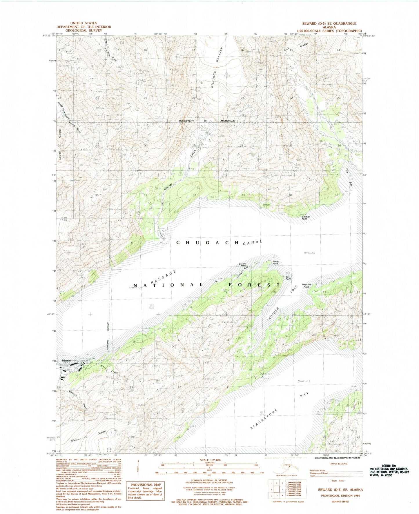
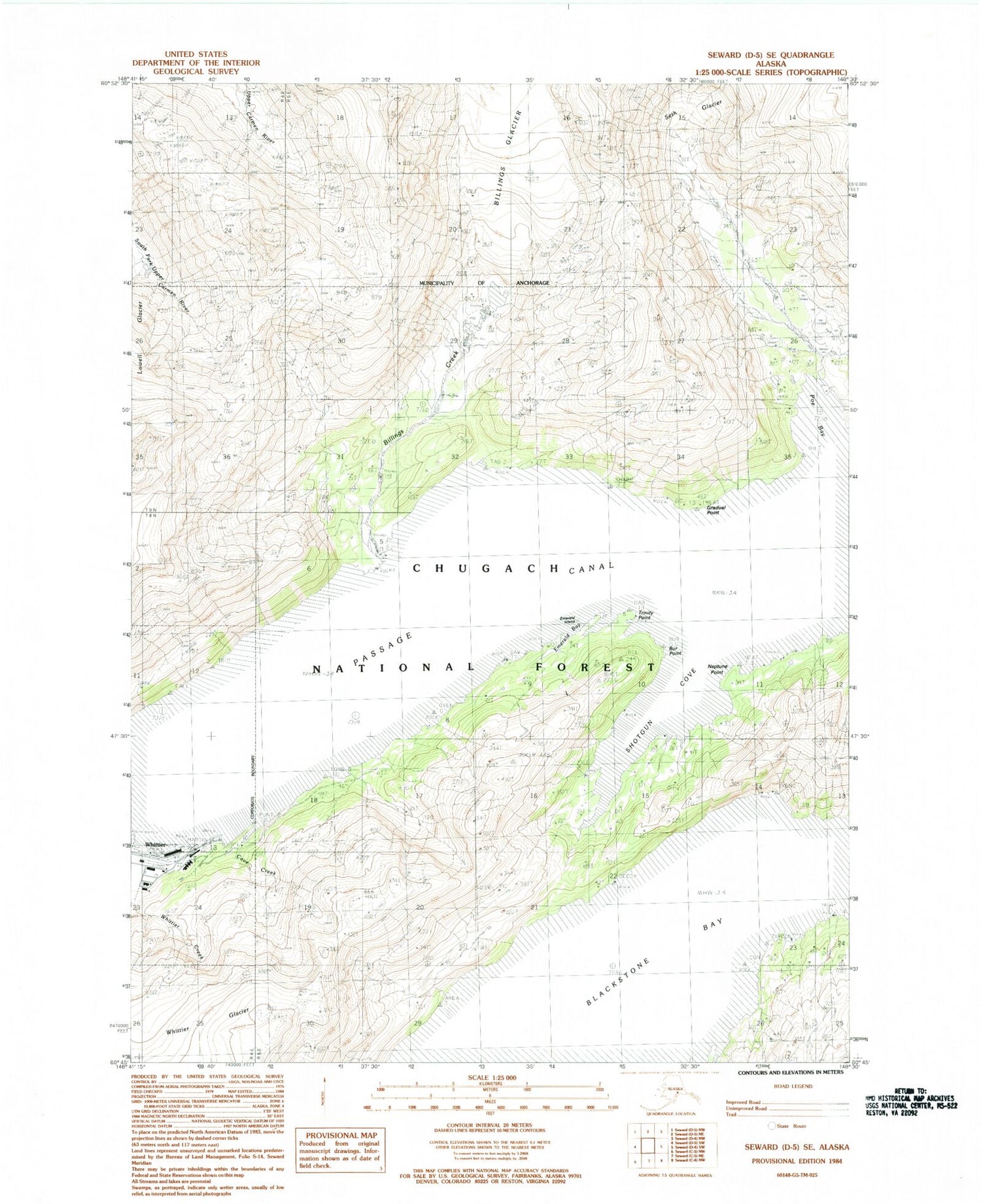
Classic USGS Seward D-5 SE Alaska 7.5'x7.5' Topo Map
Couldn't load pickup availability
Historical USGS topographic quad map of Seward D-5 SE in the state of Alaska. Typical map scale is 1:24,000, but may vary for certain years, if available. Print size: 24" x 27"
This quadrangle is in the following counties: Anchorage, Valdez-Cordova (CA).
The map contains contour lines, roads, rivers, towns, and lakes. Printed on high-quality waterproof paper with UV fade-resistant inks, and shipped rolled.
Contains the following named places: Shotgun Cove, Trinity Point, Whittier, Whittier Breakwater Light, Billings Creek, Blackstone Bay, Bur Point, Cove Creek, Emerald Bay, Emerald Island, Gradual Point, Neptune Point, Passage Canal, Poe Bay, Portage Mine, City of Whittier, Whittier Volunteer Fire Department, Eastern Aleutian Tribes Whittier Community Health Center, Whittier Contract Postal Unit, Whittier Police Department