
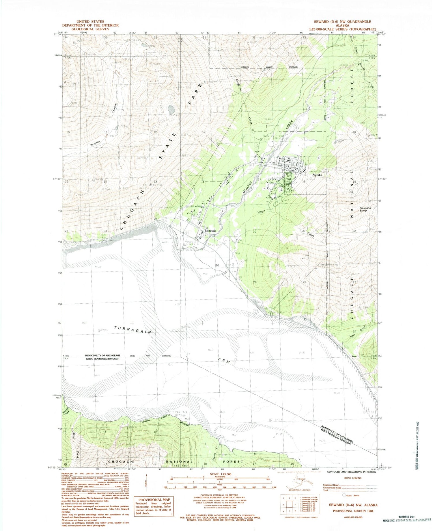
MyTopo
Classic USGS Seward D-6 NW Alaska 7.5'x7.5' Topo Map
Couldn't load pickup availability
Historical USGS topographic quad map of Seward D-6 NW in the state of Alaska. Typical map scale is 1:24,000, but may vary for certain years, if available. Print size: 24" x 27"
This quadrangle is in the following counties: Anchorage, Kenai Peninsula.
The map contains contour lines, roads, rivers, towns, and lakes. Printed on high-quality waterproof paper with UV fade-resistant inks, and shipped rolled.
Contains the following named places: Sawmill Creek, Seattle Creek, Slate Creek, Virgin Creek, Winner Creek, Girdwood Airport, Alyeska, Baumann Bump, California Creek, Crow Creek, Girdwood, Glacier Creek, Kern, Kern Creek, Alyeska Winter Sports Area (historical), Girdwood Fire and Rescue, Girdwood Clinic, Girdwood Post Office, Alaska State Troopers Girdwood


