MyTopo
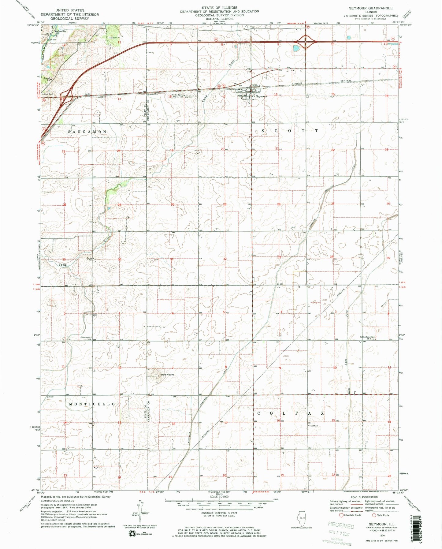
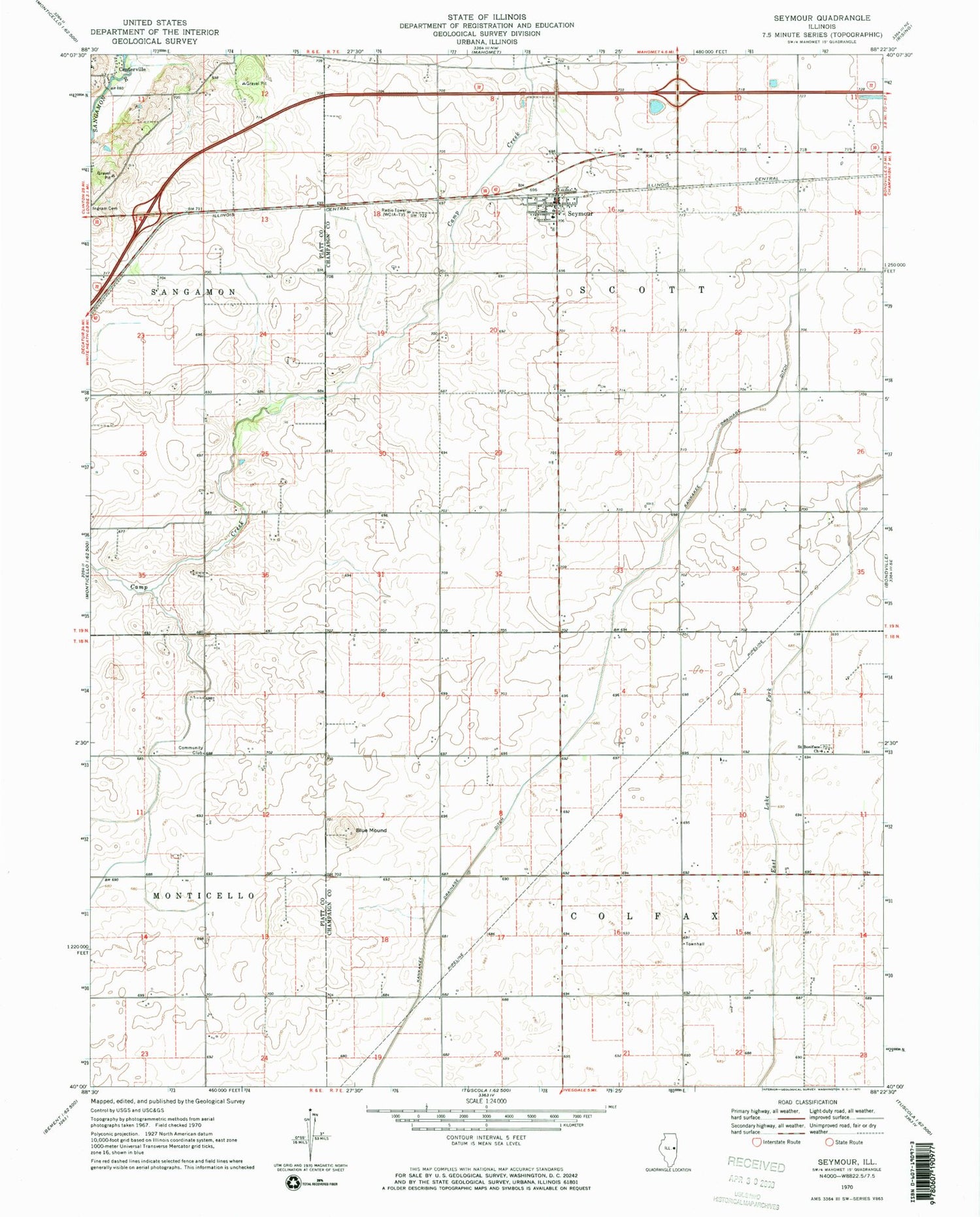
Classic USGS Seymour Illinois 7.5'x7.5' Topo Map
Couldn't load pickup availability
Historical USGS topographic quad map of Seymour in the state of Illinois. Map scale may vary for some years, but is generally around 1:24,000. Print size is approximately 24" x 27"
This quadrangle is in the following counties: Champaign, Piatt.
The map contains contour lines, roads, rivers, towns, and lakes. Printed on high-quality waterproof paper with UV fade-resistant inks, and shipped rolled.
Contains the following named places: Blue Mound, Centerville, Colfax Townhall, Giblin, Igoe Heliport, Kankakee Drainage Ditch, Litchfield RLA Airport, Saint Boniface Cemetery, Saint Boniface Church, Seymour, Seymour Census Designated Place, Seymour Post Office, Seymour Village Fire Department, Township of Colfax, Township of Scott, WCIA-TV (Champaign), ZIP Codes: 61815, 61875, 61884