MyTopo
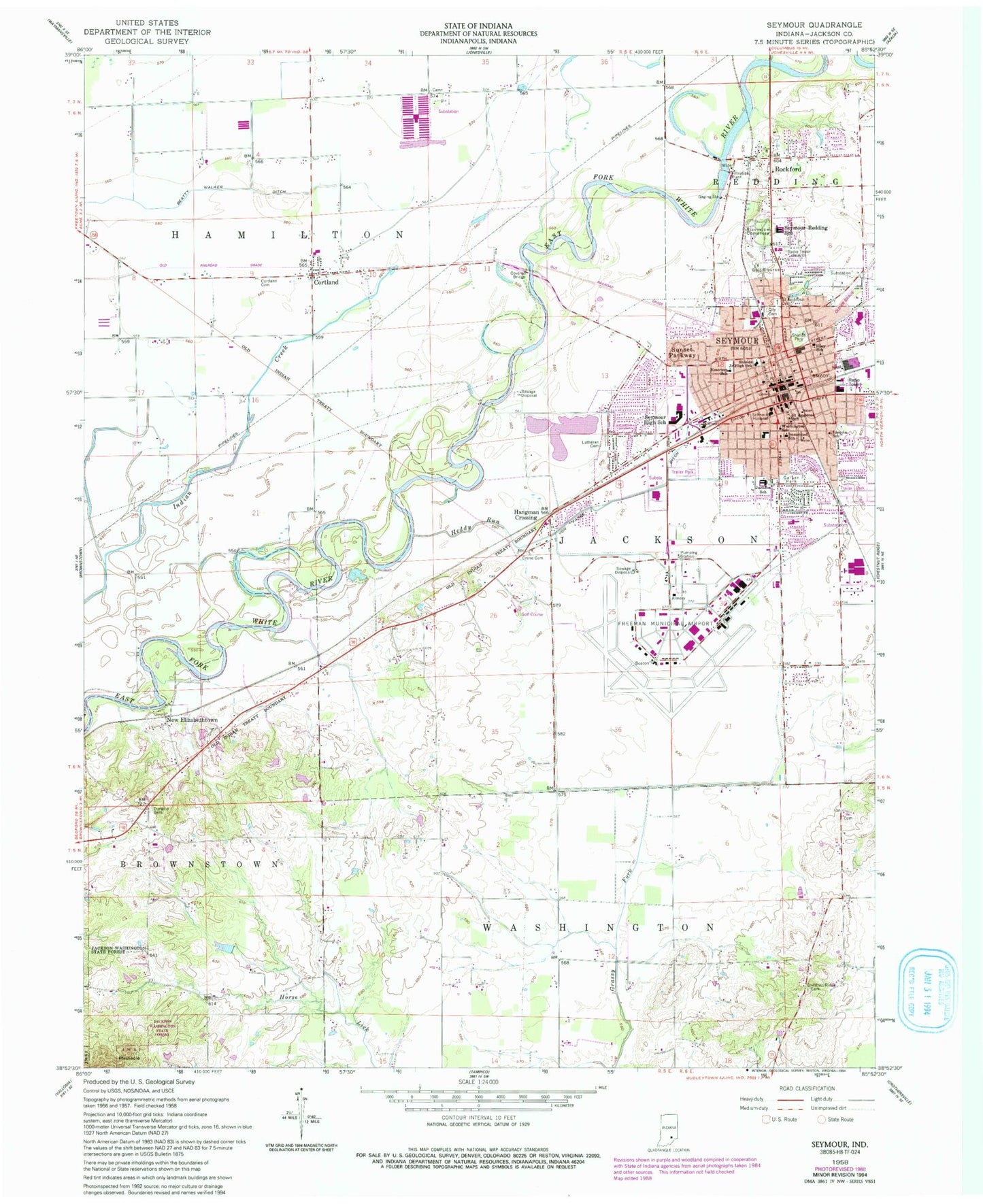
Classic USGS Seymour Indiana 7.5'x7.5' Topo Map
Couldn't load pickup availability
Historical USGS topographic quad map of Seymour in the state of Indiana. Map scale may vary for some years, but is generally around 1:24,000. Print size is approximately 24" x 27"
This quadrangle is in the following counties: Jackson.
The map contains contour lines, roads, rivers, towns, and lakes. Printed on high-quality waterproof paper with UV fade-resistant inks, and shipped rolled.
Contains the following named places: Chestnut Ridge Cemetery, City of Seymour, Cortland, Cortland Cemetery, Cortland Elementary School, Cortland Post Office, Crane Cemetery, Durland Cemetery, Emerson Elementary School, Freeman Army Air Field, Freeman Municipal Airport, Gaiser Park, Hamilton Township Volunteer Fire Department, Hangman Crossing, Heddy Run, Immanuel-Lutheran School, Jackson - Washington Fire Department - Hangman Crossing, Jackson - Washington Fire Department - Kriete Corner, Jackson County Emergency Medical Services, Lincoln School, Lutheran Cemetery, New Elizabethtown, Pinnacle, Riley School, Riverview Cemetery, Rockford, Saint Ambrose Catholic Cemetery, Saint Ambrose School, Schneck Medical Center, Seymour, Seymour Fire Department Station 1, Seymour Fire Department Station 2, Seymour Police Department, Seymour Post Office, Seymour Senior High School, Seymour-Jackson Elementary School, Seymour-Redding Elementary School, Shields Junior High School, Shields Park, Sunset Parkway, Thompson Slough, Township of Hamilton, Township of Jackson, Von Fange Ditch, Washington School, WJCD-AM (Seymour), WJCD-FM (Seymour), ZIP Code: 47274