
MyTopo
Classic USGS Shabbona Grove Illinois 7.5'x7.5' Topo Map
Couldn't load pickup availability
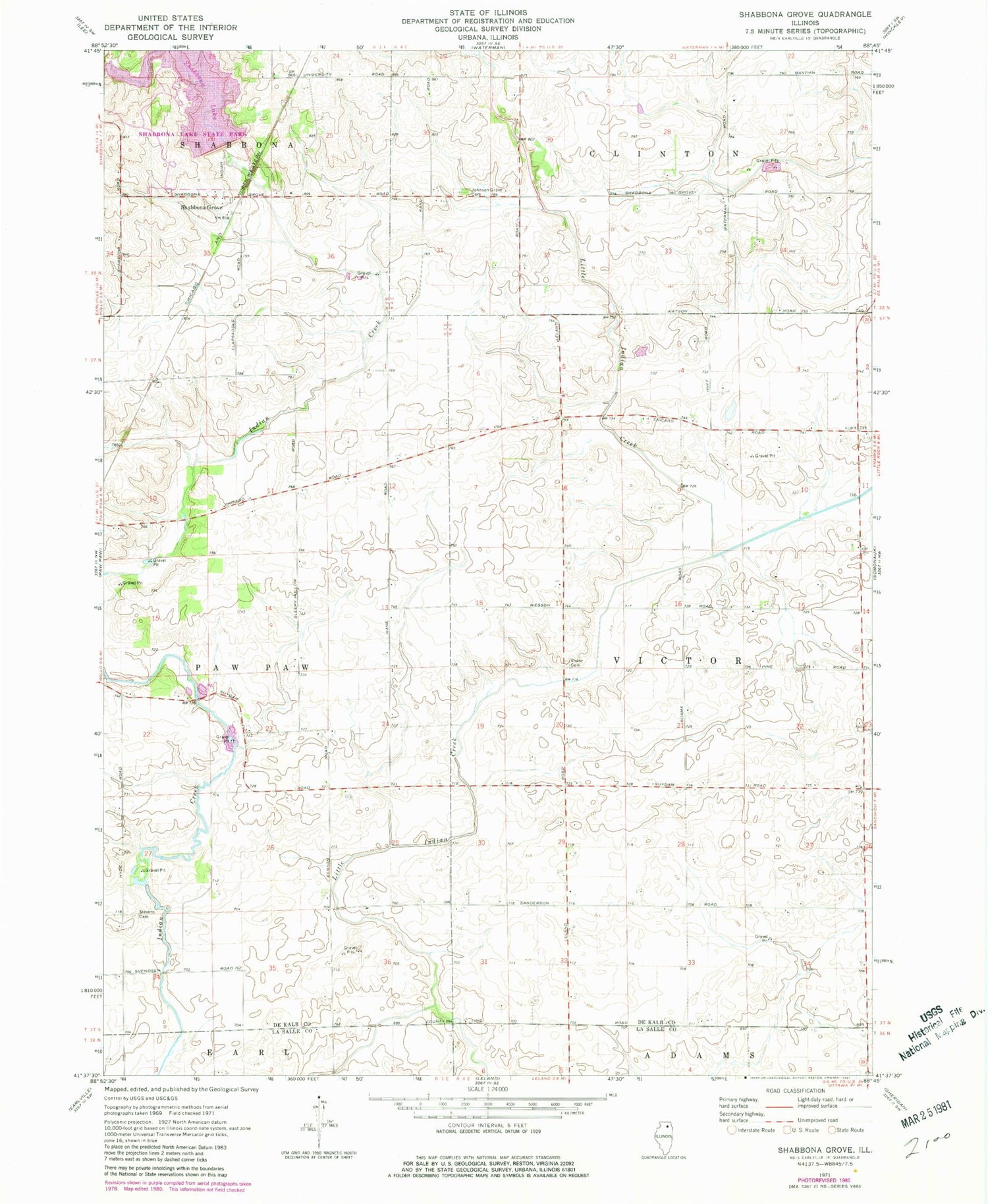
Historical USGS topographic quad map of Shabbona Grove in the state of Illinois. Typical map scale is 1:24,000, but may vary for certain years, if available. Print size: 24" x 27"
This quadrangle is in the following counties: DeKalb, LaSalle.
The map contains contour lines, roads, rivers, towns, and lakes. Printed on high-quality waterproof paper with UV fade-resistant inks, and shipped rolled.
Contains the following named places: Johnson Grove Cemetery, Shabbona Grove, Stevens Cemetery, Victor Cemetery, Shabbona Lake, Shabbona Lake State Recreational Area, Dewey Airport (historical), Township of Victor, Shabbona Lake Dam, Suydam School (historical), Prichards Grove, Ross Grove, Ross Grove Post Office (historical), Shabbona Grove Picnic Area, Sommonauk Point Picnic Area, Three Fires Picnic Area, Touch the Earth Trail, Van Buren Post Office (historical), Timber Edge Farm, Johnson Farm


