MyTopo
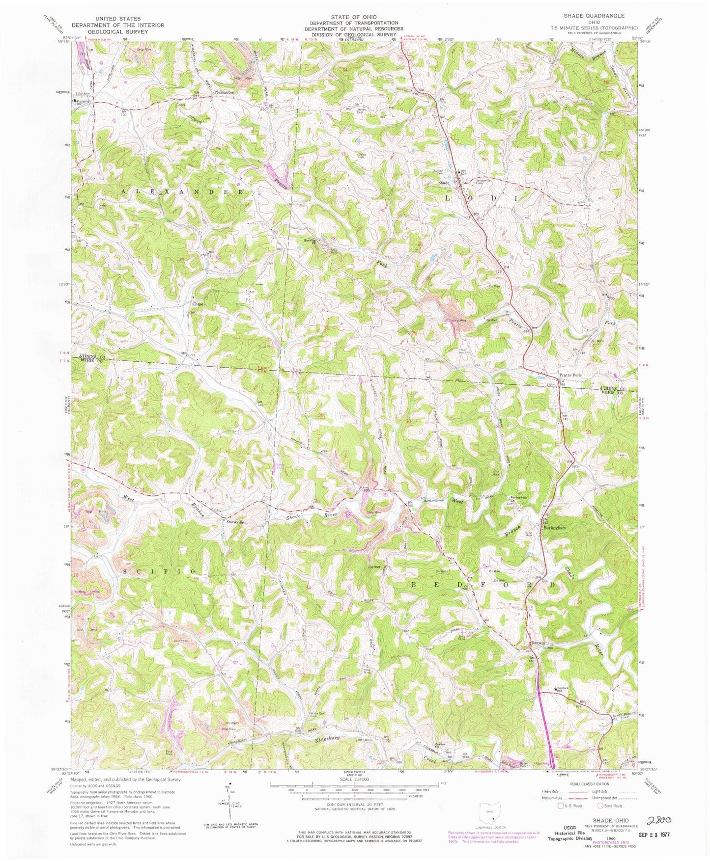
Classic USGS Shade Ohio 7.5'x7.5' Topo Map
Couldn't load pickup availability
Historical USGS topographic quad map of Shade in the state of Ohio. Map scale may vary for some years, but is generally around 1:24,000. Print size is approximately 24" x 27"
This quadrangle is in the following counties: Athens, Meigs.
The map contains contour lines, roads, rivers, towns, and lakes. Printed on high-quality waterproof paper with UV fade-resistant inks, and shipped rolled.
Contains the following named places: Alexander Junior High School, Baker Cemetery, Bedford Church, Bedford Elementary School, Burlingham, Burlingham Church, Burlingham Post Office, Burlington Cemetery, Burson Cemetery, Carlton Cemetery, Carlton Church, Chase, Chase Cemetery, Chase Church, Darwin, Darwin Post Office, Duck Run, Free Will Baptist Church, Gates Cemetery, Hanning Church, Jeffers Cemetery, Jerseyville Cemetery, Pleasant Hill Cemetery, Pleasant Hill Church, Pleasanton, Pleasanton Post Office, Pratts Fork, Pratts Fork Cemetery, Pratts Fork Church, Pratts Fork Post Office, Rainbow Lake, Rainbow Lake Dam, Saint James Episcopal Church, Shade, Shade Post Office, Snowville, Snowville Post Office, Township of Bedford, Township of Lodi, White Oak Cemetery, White Oak Methodist Protestant Church, ZIP Code: 45776