MyTopo
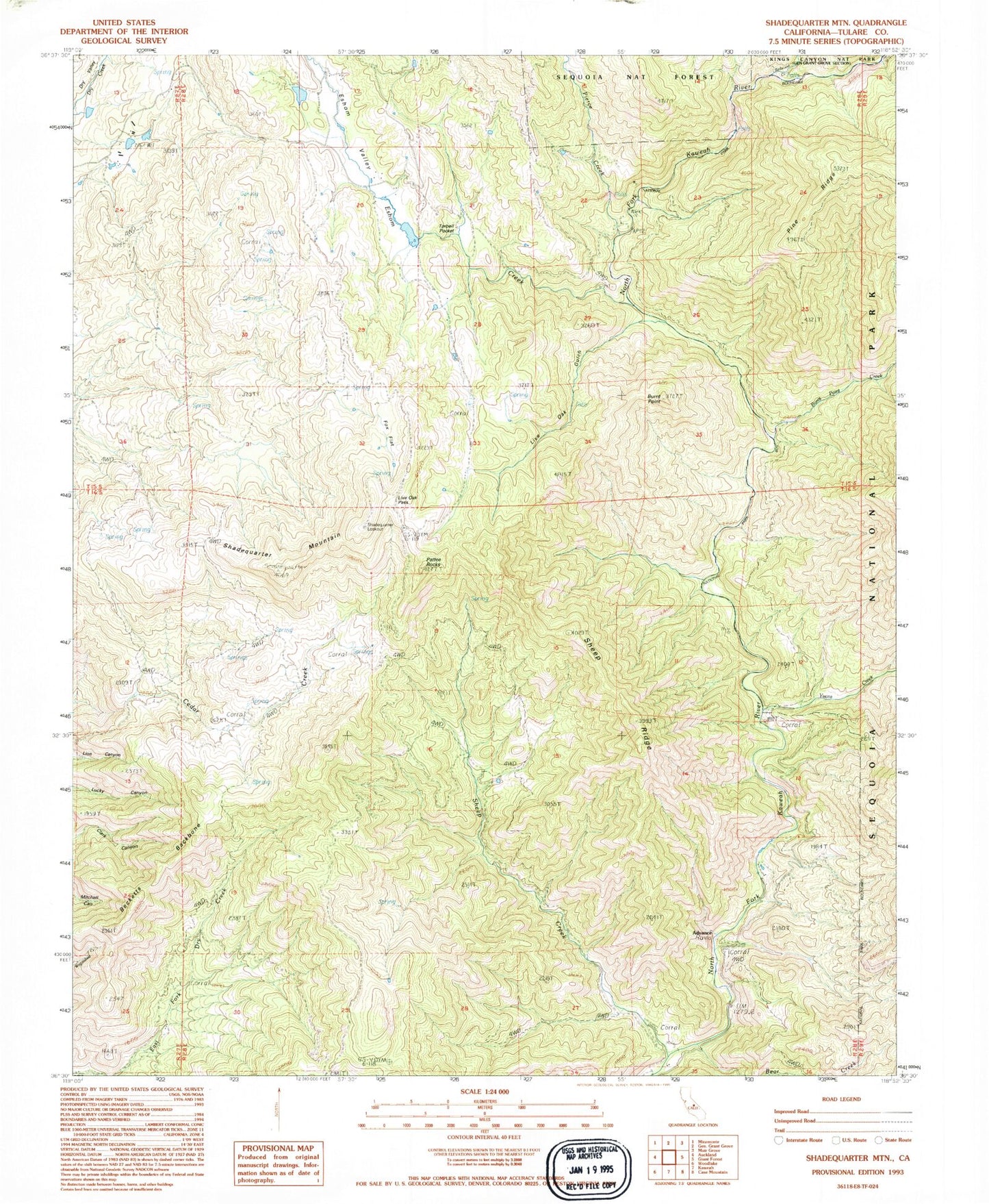
Classic USGS Shadequarter Mountain California 7.5'x7.5' Topo Map
Couldn't load pickup availability
Historical USGS topographic quad map of Shadequarter Mountain in the state of California. Map scale may vary for some years, but is generally around 1:24,000. Print size is approximately 24" x 27"
This quadrangle is in the following counties: Tulare.
The map contains contour lines, roads, rivers, towns, and lakes. Printed on high-quality waterproof paper with UV fade-resistant inks, and shipped rolled.
Contains the following named places: Advance, Bear Creek, Becketts Backbone, Burnt Point, Burnt Point Creek, Eshom Creek, Eshom Valley, Live Oak Gulch, Live Oak Pass, Pattee Rocks, Pierce Creek, Redwood Canyon, Redwood Creek, Shadequarter Lookout, Shadequarter Mountain, Sheep Creek, Sheep Ridge, Tarbell Pocket, Yucca Creek, ZIP Code: 93603