MyTopo
Classic USGS Shadow Mountains California 7.5'x7.5' Topo Map
Regular price
$16.95
Regular price
Sale price
$16.95
Unit price
per
Couldn't load pickup availability
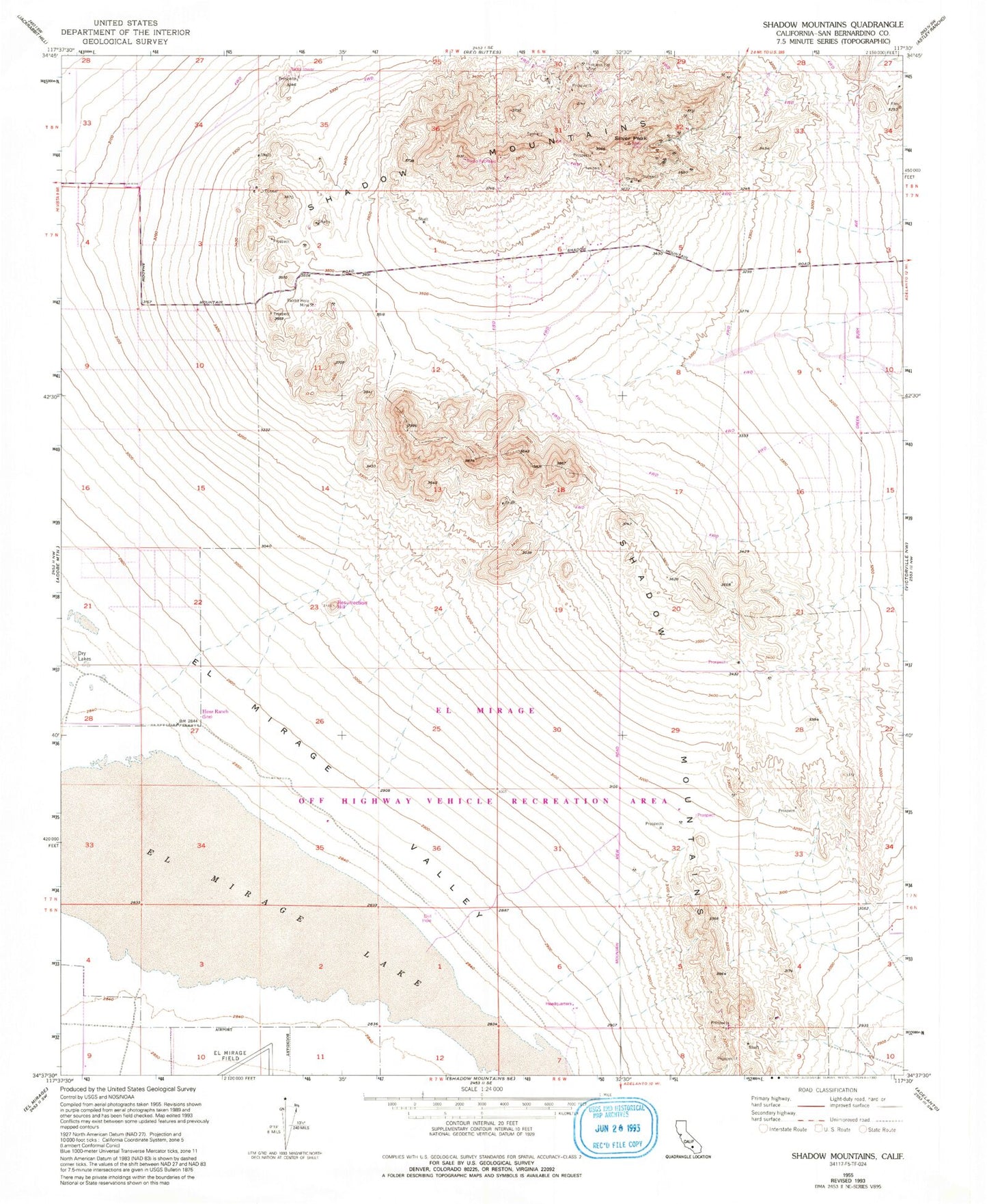
Historical USGS topographic quad map of Shadow Mountains in the state of California. Map scale may vary for some years, but is generally around 1:24,000. Print size is approximately 24" x 27"
This quadrangle is in the following counties: San Bernardino.
The map contains contour lines, roads, rivers, towns, and lakes. Printed on high-quality waterproof paper with UV fade-resistant inks, and shipped rolled.
Contains the following named places: Airway Beacon Number 7, El Mirage Lake, El Mirage Off Highway Vehicle Recreation Area, Gerrish Ranch, Hess Ranch, Martin Ranch, Princess Pat Mine, Rabbit Hole Mine, Resurrection Hill, Shadow Mountains, Silver Peak