MyTopo
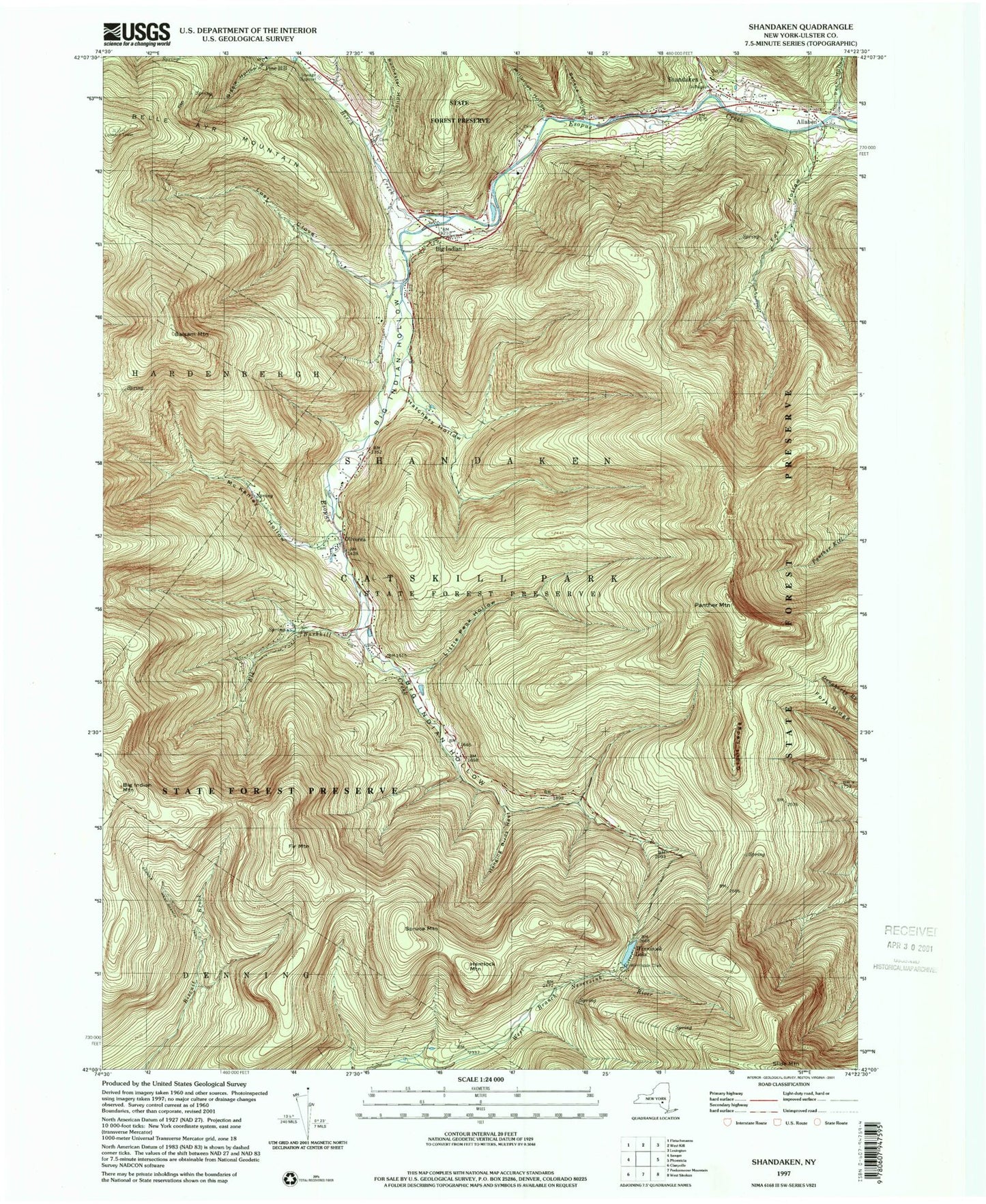
USGS Classic Shandaken New York 7.5'x7.5' Topo Map
Couldn't load pickup availability
Historical USGS topographic quad map of Shandaken in the state of New York. Scale: 1:24000. Print size: 24" x 27"
This quadrangle is in the following counties: Ulster.
The map contains contour lines, roads, rivers, towns, lakes, and grids including latitude / longitude and UTM / MGRS. Printed on high-quality waterproof paper with UV fade-resistant inks.
Contains the following named places: Balsam Mountain, Big Indian, Big Indian Hollow, Big Indian Mountain, Birch Creek, Elk Bushkill, Fir Mountain, Fox Hollow, Giant Ledge, Giggle Hollow, Hanging Birds Nest, Hatchery Hollow, Hemlock Mountain, Little Peck Hollow, Lost Clove, McKenley Hollow, Millbrook Hollow, Oliverea, Panther Mountain, Peck Hollow, Rochester Hollow, Seager West Branch Trail, Seneca Hollow, Shandaken, Spruce Mountain, Belle Ayr Mountain, Bushnellsville Creek, Winnisook Club, Winnisook Lake, Catskill State Park, Town of Shandaken, Giant Ledge Stream, School Number 2 (historical), School Number 4 (historical), Big Indian Post Office, Shandaken - Allaben Hose Company, Shandaken Ambulance Service, Big Indian and Oliverea Fire District, Phoenicia Volunteer Fire Company Shandaken - Allaben Hose Company 2, Shandaken Post Office