MyTopo
Classic USGS Shandon California 7.5'x7.5' Topo Map
Couldn't load pickup availability
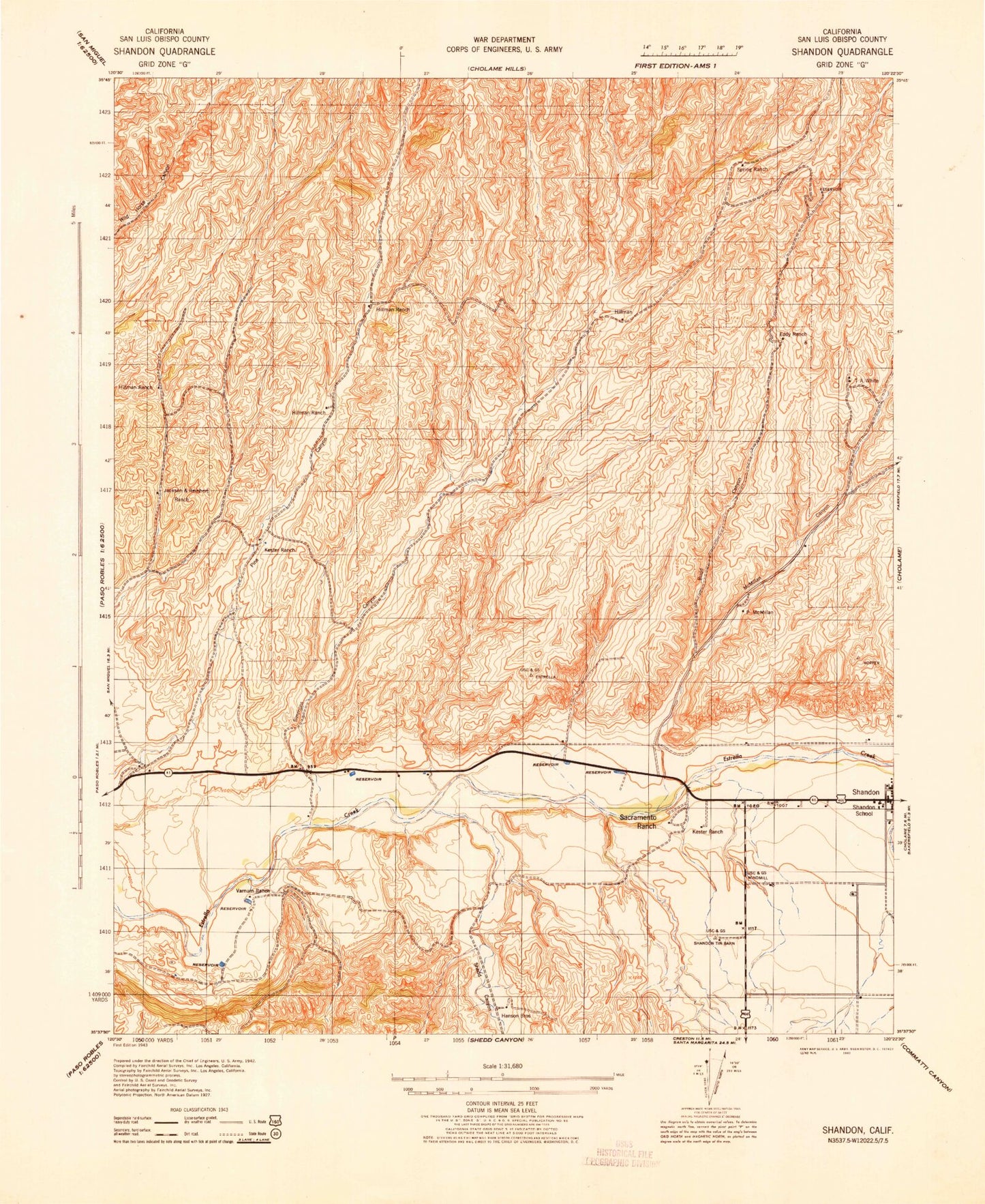
Historical USGS topographic quad map of Shandon in the state of California. Map scale may vary for some years, but is generally around 1:24,000. Print size is approximately 24" x 27"
This quadrangle is in the following counties: San Luis Obispo.
The map contains contour lines, roads, rivers, towns, and lakes. Printed on high-quality waterproof paper with UV fade-resistant inks, and shipped rolled.
Contains the following named places: Bud Canyon, California Department of Forestry and Fire Protection Station 31 Shandon, Clark Memorial Park, Crawford W Clarke Memorial Park, East Tuley Springs, Eddy Ranch, Gruenhagen Flat, Hillman Ranch, Indian Creek, Jackson and Reinhert Ranch, Kester Ranch, Lyon Spring, Manzanita Canyon, McMillan Canyon, Middle Canyon, Morgenson Springs, Murphy Hill, Pear Spring, Pine Canyon, Sacramento Ranch, Shandon, Shandon Assembly of God Church, Shandon Census Designated Place, Shandon Elementary School, Shandon Flat, Shandon High School, Shandon Middle School, Shandon Post Office, Shandon United Methodist Church, Shedd Canyon, Shimmin Canyon, Spring Ranch, Taylor Canyon, Varnum Ranch, West Tuley Springs, Wolf Canyon, Wood Canyon, Yokum Bend