MyTopo
Classic USGS Shannon Butte California 7.5'x7.5' Topo Map
Couldn't load pickup availability
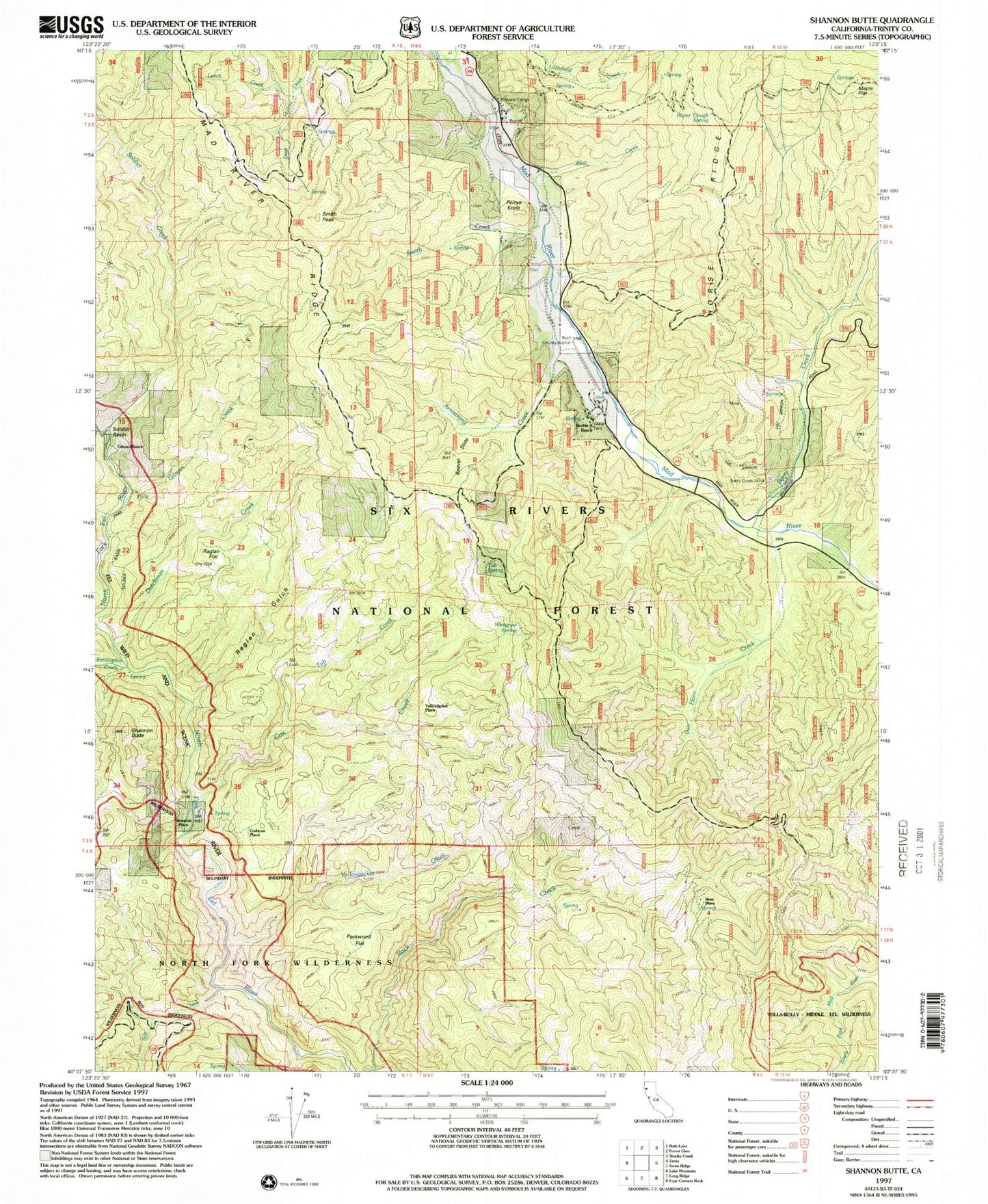
Historical USGS topographic quad map of Shannon Butte in the state of California. Map scale may vary for some years, but is generally around 1:24,000. Print size is approximately 24" x 27"
This quadrangle is in the following counties: Trinity.
The map contains contour lines, roads, rivers, towns, and lakes. Printed on high-quality waterproof paper with UV fade-resistant inks, and shipped rolled.
Contains the following named places: Armstrong Creek, Barry Creek, Barry Creek Mine, Barry Creek Trail, Beaver Slide, Ben Arthur Trail, Blair Creek, Browns Camp, Cox Creek, Crabtree Place, Double A Ranch, Dutchman Creek, Gilman Creek, Gilman Ranch, Kettenpom Creek, Littlefield Creek, Lynch Creek, Mad River Division, Maple Flat, Maple Spring, Packwood Flat, Perrys Knob, Raglan Flat, Raglan Gulch, Russ Place, Ruth Airport, Salt Creek, Shannon Butte, Shannon Place, Smith Creek, Smith Peak, Soldier Basin, Soldier Basin Trail, Soldier Creek, Surveyor Spring, Tub Creek, Tub Spring, Van Horn Creek, Water Trough Spring, Wiregrass Spring, Yellowjacket Creek, Yellowjacket Place