MyTopo
Classic USGS Shannondale Indiana 7.5'x7.5' Topo Map
Regular price
$16.95
Regular price
Sale price
$16.95
Unit price
per
Couldn't load pickup availability
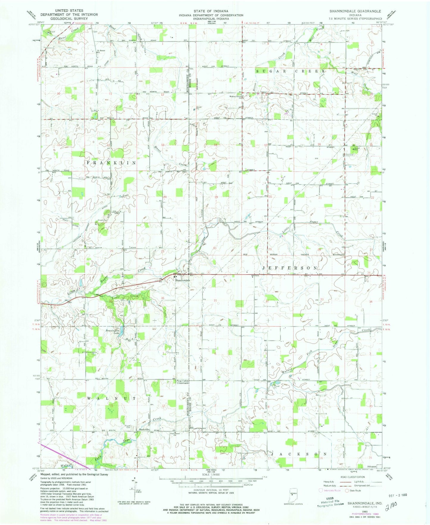
Historical USGS topographic quad map of Shannondale in the state of Indiana. Map scale may vary for some years, but is generally around 1:24,000. Print size is approximately 24" x 27"
This quadrangle is in the following counties: Boone, Montgomery.
The map contains contour lines, roads, rivers, towns, and lakes. Printed on high-quality waterproof paper with UV fade-resistant inks, and shipped rolled.
Contains the following named places: Beckville, Cox Cemetery, Cross Ditch, Dixon Creek, Gray Ditch, Little Creek, Log Cabin Crossroads, Needham Booher Ditch, Pennington Lake, Pisgah Cemetery, Providence Church, Saint James Church, Shannondale, Walnut Grove Church, ZIP Code: 47940