MyTopo
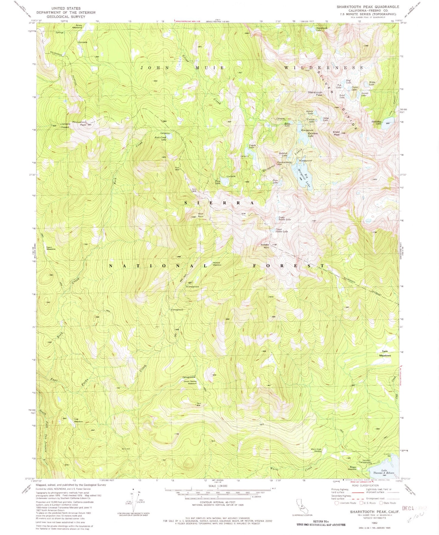
Classic USGS Sharktooth Peak California 7.5'x7.5' Topo Map
Couldn't load pickup availability
Historical USGS topographic quad map of Sharktooth Peak in the state of California. Typical map scale is 1:24,000, but may vary for certain years, if available. Print size: 24" x 27"
This quadrangle is in the following counties: Fresno.
The map contains contour lines, roads, rivers, towns, and lakes. Printed on high-quality waterproof paper with UV fade-resistant inks, and shipped rolled.
Contains the following named places: Arch Rock, Baby Lake, Bathtub Lake, Beetlebug Lake, Big Margaret Lake, Cockscomb Lakes, Cold Creek, Coyote Lake, Fawn Meadow, Fern Lake, Four Forks Creek, Frog Lake, Hedrick Meadow, Margaret Lakes, Midge Lake, Onion Spring Meadow, Pincushion Peak, Pocket Lake, Rainbow Lake, Reef Lake, Rock Creek Lake, Saddle Mountain, Sand Lake, Scarab Lake, Sharktooth Lake, Shorty Lake, Silver Peak, String Meadows, Tule Meadow, Twin Meadows, Warm Creek Meadow, Cockscomb, Sedge Lake, High Sierra Edison Pack Station, Vermillion Valley Resort, Sharktooth Peak, Boggy Meadow, Lower Saddle Lake, Tub Lake, Upper Saddle Lake, Useless Lake, Vermilion Campground