MyTopo
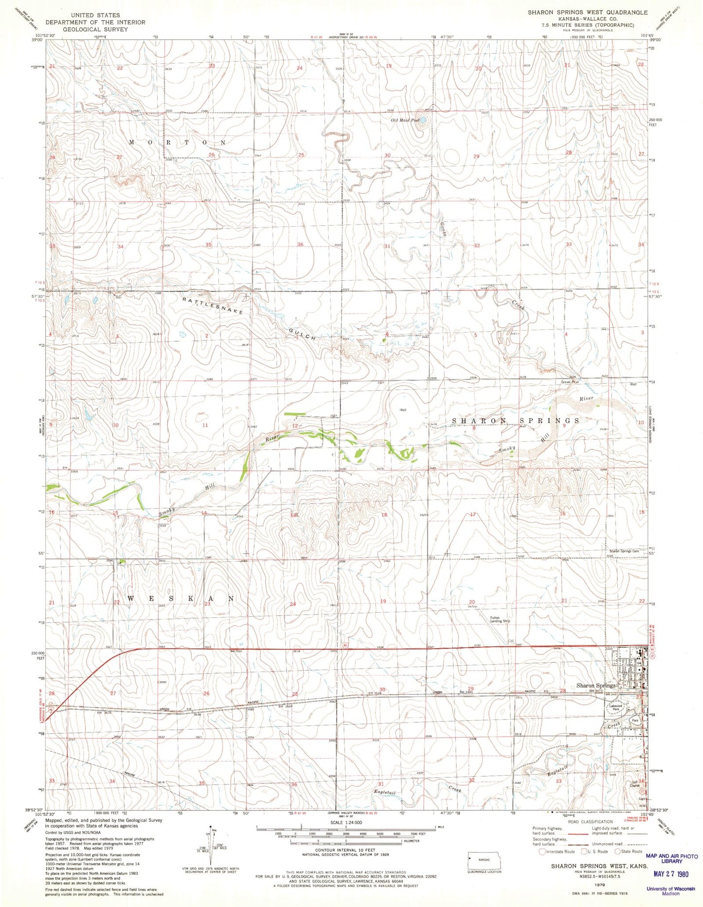
Classic USGS Sharon Springs West Kansas 7.5'x7.5' Topo Map
Couldn't load pickup availability
Historical USGS topographic quad map of Sharon Springs West in the state of Kansas. Map scale may vary for some years, but is generally around 1:24,000. Print size is approximately 24" x 27"
This quadrangle is in the following counties: Wallace.
The map contains contour lines, roads, rivers, towns, and lakes. Printed on high-quality waterproof paper with UV fade-resistant inks, and shipped rolled.
Contains the following named places: Bussen Airport, City of Sharon Springs, Goose Creek, Hi - Plains Baptist Church, Holy Ghost Catholic Church, Lakeview Park, Old Maid Pool, Rattle Snake Gulch, Sharon Lutheran Church, Sharon Springs, Sharon Springs Cemetery, Sharon Springs Elementary / Middle School, Sharon Springs Fire Department, Sharon Springs Golf Course, Sharon Springs Municipal Power Plant, Sharon Springs Post Office, Sharon Springs Public Library, Sharon Springs United Methodist Church, Sunland, Township of Sharon Springs, Wallace County, Wallace County Courthouse, Wallace County Fairgrounds, Wallace County Health Department, Wallace County High School, Wallace County Jail, Wallace County Rural Fire Department 2, Wallace County Sheriff's Office, Wesleyan Church