MyTopo
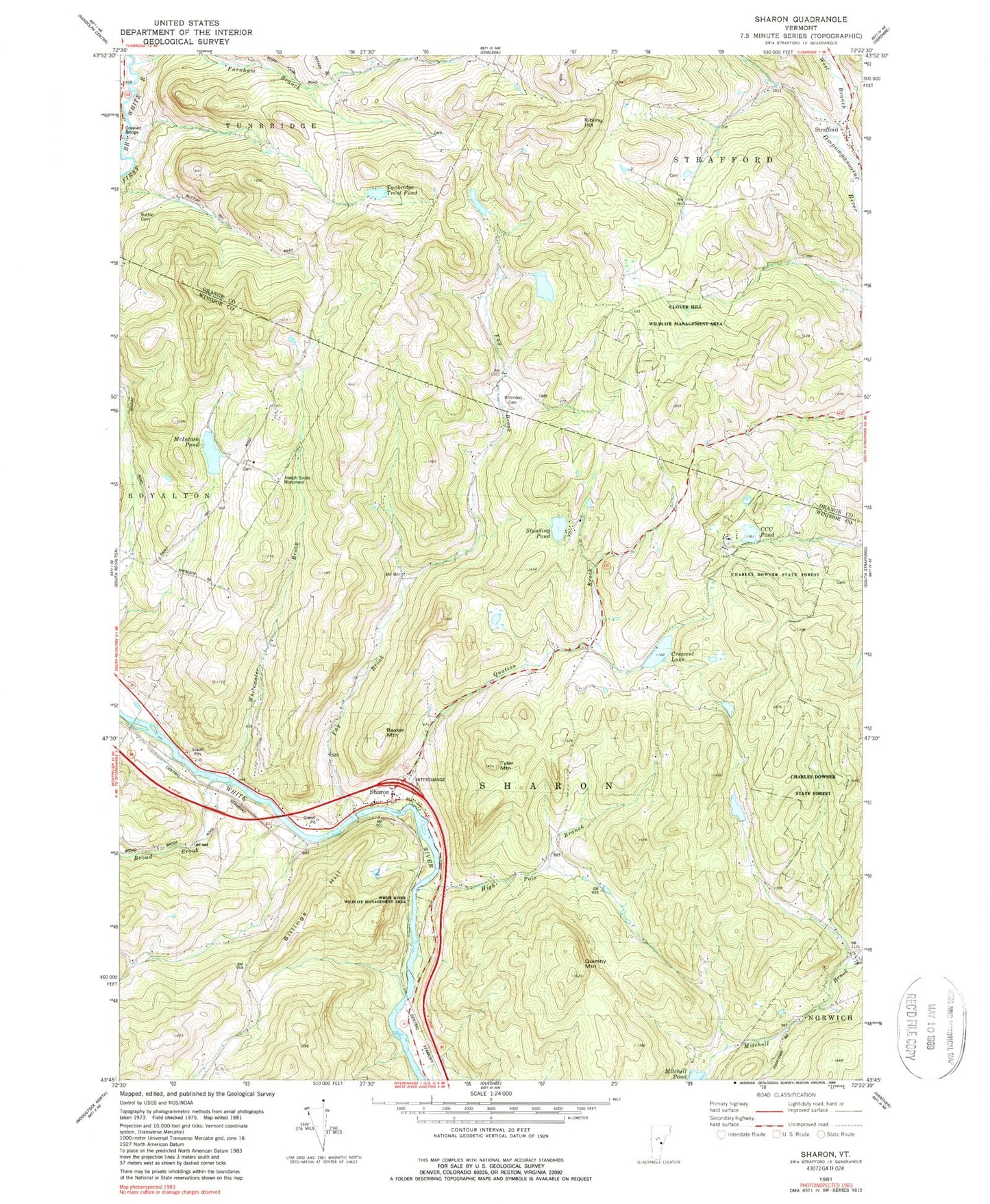
Classic USGS Sharon Vermont 7.5'x7.5' Topo Map
Couldn't load pickup availability
Historical USGS topographic quad map of Sharon in the state of Vermont. Map scale may vary for some years, but is generally around 1:24,000. Print size is approximately 24" x 27"
This quadrangle is in the following counties: Orange, Windsor.
The map contains contour lines, roads, rivers, towns, and lakes. Printed on high-quality waterproof paper with UV fade-resistant inks, and shipped rolled.
Contains the following named places: Baxter Mountain, Belnap Pond Dam, Billings Hill, Broad Brook, Broad Brook Cemetery, Button Cemetery, C C C Pond, C C C Pond Dam, Charles Downer State Forest, Clover Hill Wildlife Management Area, Crescent Lake, Crescent Lake Dam, Dairy Hill School, Day School, Dewey Cemetery, Downer 4-H Camp, Elmers Brook, Farnham Branch, Fay Brook, High Pole Branch, Howe Covered Bridge, Howe Hill School, Joseph Smith Monument, Kibling Hill, McIntosh Pond, McIntosh Pond Dam, Morrill Memorial and Harris Library, Mount Pleasant Cemetery, Ordway Cemetery, Quation Brook, Quimby Mountain, Robinson Cemetery, Robinson School, School Number 3, Sharon, Sharon Academy High School, Sharon Academy Middle School, Sharon Broad Brook School, Sharon Congregational Church, Sharon Elementary School, Sharon Post Office, Sharon Volunteer Fire Department, Standing Pond, Strafford, Strafford Cemetery, Strafford Fire Station, Strafford Meeting House, Strafford Post Office, Strafford Village Historic District, Town of Sharon, Tunbridge Trout Pond, Tyler Mountain, Village - Pine Hill Cemetery, White River Wildlife Management Area, Whitewater Brook, ZIP Code: 05065