MyTopo
Classic USGS Sharp Lake Montana 7.5'x7.5' Topo Map
Regular price
$16.95
Regular price
Sale price
$16.95
Unit price
per
Couldn't load pickup availability
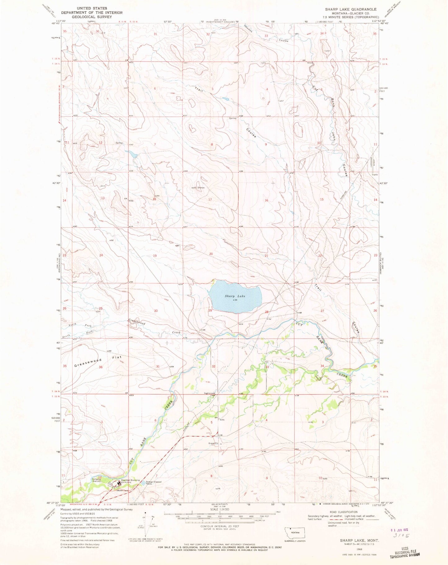
Historical USGS topographic quad map of Sharp Lake in the state of Montana. Map scale may vary for some years, but is generally around 1:24,000. Print size is approximately 24" x 27"
This quadrangle is in the following counties: Glacier.
The map contains contour lines, roads, rivers, towns, and lakes. Printed on high-quality waterproof paper with UV fade-resistant inks, and shipped rolled.
Contains the following named places: Blackfeet Boarding Dormitory, Blackfeet Reservation Division, Glacier County, Greasewood Creek, Hoodoo Coulee, Nightshoot Cemetery, North Fork Greasewood Creek, Sharp Lake, South Fork Greasewood Creek, Trail Coulee, Vigor Dam