
MyTopo
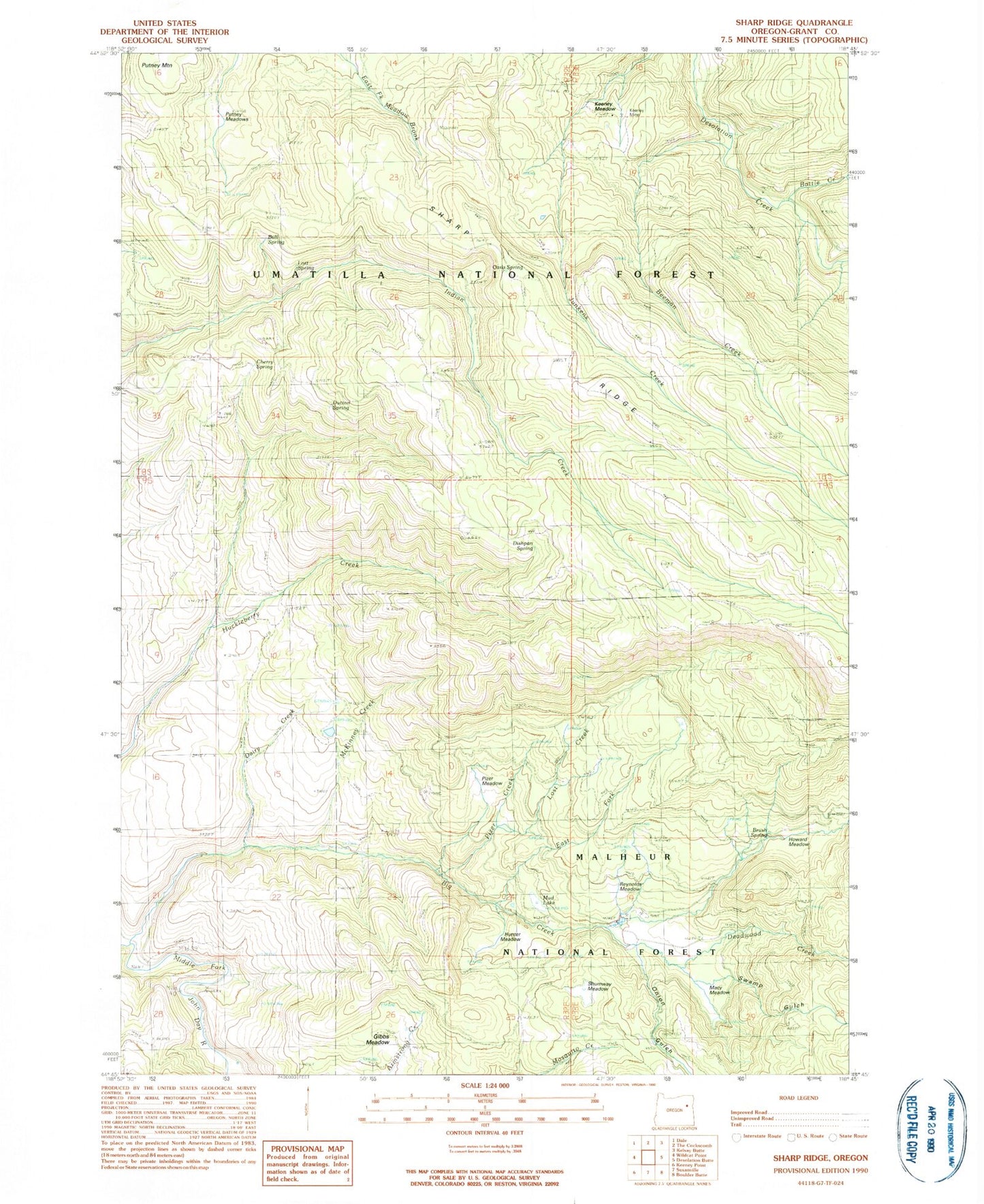
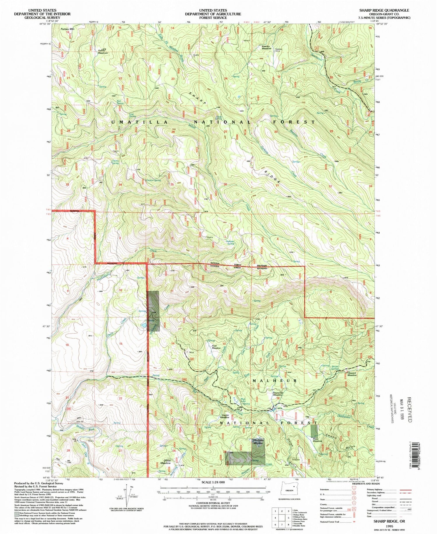
Classic USGS Sharp Ridge Oregon 7.5'x7.5' Topo Map
Couldn't load pickup availability
Historical USGS topographic quad map of Sharp Ridge in the state of Oregon. Typical map scale is 1:24,000, but may vary for certain years, if available. Print size: 24" x 27"
This quadrangle is in the following counties: Grant.
The map contains contour lines, roads, rivers, towns, and lakes. Printed on high-quality waterproof paper with UV fade-resistant inks, and shipped rolled.
Contains the following named places: Howard Meadow, Howard Meadow Camp, Brush Spring, Mud Lake, Keeney Meadow, Battle Creek, Bear Camp (historical), Bear Camp Trail (historical), Beeman Creek, Beeman Junkens Trail (historical), Big Creek, Bull Spring, Cherry Spring, Dairy Creek, Deadwood Creek, Dishpan Spring, Dutton Spring, East Fork Big Creek, Keeney Camp (historical), Keeney Mine, Lost Creek, Lost Spring, McKinney Creek, Mulkey Spring (historical), Oasis Spring, Onion Gulch, Pizer Creek, Putney Meadows, Putney Mountain, Swamp Gulch, Macy Meadow, Rock Creek, Onion Gulch Meadow, Hunter Meadow, Shumway Meadow, Reynolds Meadow, Pizer Meadow, Mud Springs, Lost Meadow, Gibbs Meadow