MyTopo
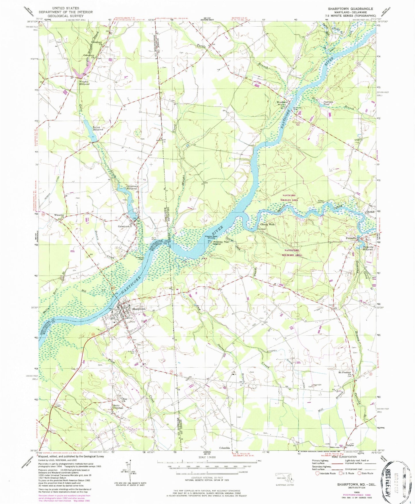
Classic USGS Sharptown Maryland 7.5'x7.5' Topo Map
Couldn't load pickup availability
Historical USGS topographic quad map of Sharptown in the states of Maryland, Delaware. Typical map scale is 1:24,000, but may vary for certain years, if available. Print size: 24" x 27"
This quadrangle is in the following counties: Dorchester, Sussex, Wicomico.
The map contains contour lines, roads, rivers, towns, and lakes. Printed on high-quality waterproof paper with UV fade-resistant inks, and shipped rolled.
Contains the following named places: Cokesbury Church, Dennis Creek, Gales Creek, Galestown Millpond, Hurts Wharf, Irving Millpond, Messick Ditch, Mill Creek, Molly Horn Branch, Plum Creek, Redman Cemetery, Wheatley Church, Wheatleys Wharf, Wrights Millpond, Wrights Millpond Branch, Zion Church, Galestown United Methodist Church, Cherry Park, Cokesbury Church (historical), Galestown, Santo Domingo, Sharptown, Galestown Millpond Dam, Cokesbury Cemetery, Cokesbury Cemetery, Cokesbury School (historical), Millpond Acres, Nanticoke Boy Scout Reservation, Wheatley School (historical), WMDT-TV (Salisbury), Asbury United Methodist Church, Cooper Mill, Matyiko Manor, Mount Vernon Church, Riverton Acres, Sharptown Elementary School, Sharptown Post Office, Zion Methodist Cemetery, District 10 Sharptown, Sharptown Volunteer Fire Department Station 14, Town of Galestown, Town of Sharptown, Beaver Dam Branch, Broad Creek, Butler Mill Branch, Chapel Branch, Cherry Walk, Cod Creek, Ellis Wharf, Gum Branch, Hawks Nest Shoals, Kinniken Evans Ditch, Lewes Creek, Mill Branch, Owens Branch, Patricks Pond, Portsville Millpond, Prickley Pear Island, Turkey Branch, Turtle Branch, Tussocky Branch, Woodland Cemetery, Woodland Ferry, Wright Creek, WDPB-TV (Seaford), Tussock Pond, Portsville Church, River-view Acres, Phillips Landing Recreation Area, Patty Cannon Estates, Old Mill Acres, Baileys Landing, Portsville, Ralphs, Woodland, Mount Pleasant United Methodist Church, Upcounty Mobile Home Park, White River Estates, Nanticoke Park Wildlife Area, Portsville United Methodist Church, Woodland United Methodist Church, Tulls School (historical), Barnes Woods Nature Preserve (historical), Pevey Airport